![](/images/other/stat-length.png)
![Trail Walking Fournels - ATPC Fournels_Les Thermes_Fournels 2019-08-25 - Photo](https://media.geolcdn.com/t/1900/400/ext.pjpeg?maxdim=2&url=https%3A%2F%2Fstatic1.geolcdn.com%2Fsiteimages%2Fupload%2Ffiles%2F1553511878bg_sport_marche.png)
ATPC Fournels_Les Thermes_Fournels 2019-08-25
raymondfn
User
![Length](/images/other/stat-length.png)
Length
11.9 km
![Max alt](https://static1.geolcdn.com/siteimages/upload/files/1508320355ic_sort_altitude_max_24dp.png)
Max alt
1197 m
![Uphill gradient](https://static1.geolcdn.com/siteimages/upload/files/1508320355ic_sort_den_pos_24dp.png)
Uphill gradient
332 m
![Km-Effort](/images/other/stat-length.png)
Km-Effort
16.4 km
![Min alt](https://static1.geolcdn.com/siteimages/upload/files/1508320355ic_sort_altitude_min_24dp.png)
Min alt
957 m
![Downhill gradient](https://static1.geolcdn.com/siteimages/upload/files/1508320355ic_sort_den_neg_24dp.png)
Downhill gradient
332 m
![Boucle](https://static1.geolcdn.com/siteimages/upload/files/16400158638029165_repeat_loop_refresh_sync_direction_icon.png)
Boucle
Yes
Creation date :
2024-04-26 16:50:07.402
Updated on :
2024-05-26 12:33:10.392
![Walking](https://static1.geolcdn.com/sitytour/trail-icons/101.png)
3h42
Difficulty : Difficult
![Scan this QR Code to open this trail in the SityTrail application](https://capi.geolives.com/qq0zvz2zws4bq2lad0pu/sitytour/trails/4030746/qr.png?size=200)
FREE GPS app for hiking
About
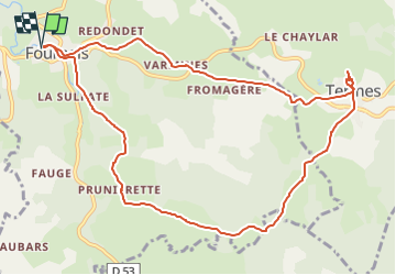
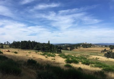
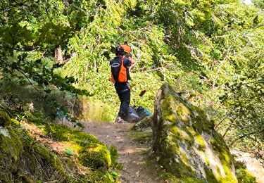
Trail Walking of 11.9 km to be discovered at Occitania, Lozère, Fournels. This trail is proposed by raymondfn.
Description
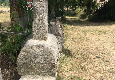
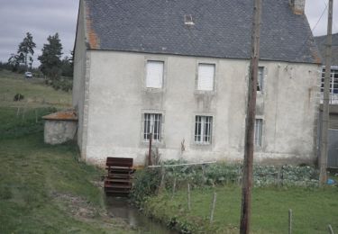
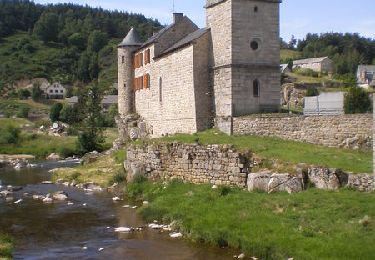
Passer devant l'Eglise et gagner le GR de Pays du Tour des monts d'Aubrac et aller jusqu'à Pruniérette. Rester sur ce GR jusqu'à Termes. A Termes, revenir vers le calvaire et prendre le PR à droite en direction de Varennes, puis le Mazet et enfin Fournels.
Positioning
Country:
France
Region :
Occitania
Department/Province :
Lozère
Municipality :
Fournels
Location:
Unknown
Start:(Dec)
Start:(UTM)
509329 ; 4962732 (31T) N.
Comments
Trails nearby
![Trail On foot Chauchailles - 2022-05-31_19h34m27_gpx-trace - Photo](https://media.geolcdn.com/t/375/260/ext.jpg?maxdim=2&url=https%3A%2F%2Fstatic1.geolcdn.com%2Fsiteimages%2Fupload%2Ffiles%2F1545311037marcheuse_200dpi.jpg)
![On foot On foot](https://static1.geolcdn.com/sitytour/trail-icons/100.png)
2022-05-31_19h34m27_gpx-trace
On foot
Difficult
(1)
Chauchailles,
Occitania,
Lozère,
France
![](/images/other/stat-length.png)
22 km | 31 km-effort
7h 7min
![](https://static1.geolcdn.com/siteimages/upload/files/16400158638029165_repeat_loop_refresh_sync_direction_icon.png)
Yes
![Trail Walking Chauchailles - sentier des espagnols - Photo](https://media.geolcdn.com/t/375/260/3a0f3874-78ce-48ea-a436-24dea33476d2.jpg&format=jpg&maxdim=2)
![Walking Walking](https://static1.geolcdn.com/sitytour/trail-icons/101.png)
sentier des espagnols
Walking
Difficult
Chauchailles,
Occitania,
Lozère,
France
![](/images/other/stat-length.png)
22 km | 32 km-effort
6h 48min
![](https://static1.geolcdn.com/siteimages/upload/files/16400158638029165_repeat_loop_refresh_sync_direction_icon.png)
Yes
![Trail Walking Chauchailles - Gorges du Bèz sentier des espagnols - Photo](https://media.geolcdn.com/t/375/260/9def8888-645c-4270-a3bb-b3f990eb7ef3.jpg&format=jpg&maxdim=2)
![Walking Walking](https://static1.geolcdn.com/sitytour/trail-icons/101.png)
Gorges du Bèz sentier des espagnols
Walking
Very difficult
Chauchailles,
Occitania,
Lozère,
France
![](/images/other/stat-length.png)
22 km | 31 km-effort
7h 34min
![](https://static1.geolcdn.com/siteimages/upload/files/16400158638029165_repeat_loop_refresh_sync_direction_icon.png)
Yes
![Trail Walking Termes - Termes Aumont aubrac - Photo](https://media.geolcdn.com/t/375/260/f87d16b1-1f73-4a88-8df5-61d0347ec4b8.jpg&format=jpg&maxdim=2)
![Walking Walking](https://static1.geolcdn.com/sitytour/trail-icons/101.png)
Termes Aumont aubrac
Walking
Medium
Termes,
Occitania,
Lozère,
France
![](/images/other/stat-length.png)
19.1 km | 23 km-effort
7h 22min
![](https://static1.geolcdn.com/siteimages/upload/files/16400158638029165_repeat_loop_refresh_sync_direction_icon.png)
No
![Trail Walking Termes - TERMES 48 - autour de la Rau de la FAGE - Photo](https://media.geolcdn.com/t/375/260/ext.jpg?maxdim=2&url=https%3A%2F%2Fservices.sitytrail.com%2FGeolivesWS%2FDownloadMedia.ashx%3FTrailID%3D445928%26Media%3D20150715150322.jpg)
![Walking Walking](https://static1.geolcdn.com/sitytour/trail-icons/101.png)
TERMES 48 - autour de la Rau de la FAGE
Walking
Medium
Termes,
Occitania,
Lozère,
France
![](/images/other/stat-length.png)
12.2 km | 15.4 km-effort
2h 36min
![](https://static1.geolcdn.com/siteimages/upload/files/16400158638029165_repeat_loop_refresh_sync_direction_icon.png)
Yes
![Trail Walking Termes - TERMES 48 - petit circuit - Photo](https://media.geolcdn.com/t/375/260/ext.jpg?maxdim=2&url=https%3A%2F%2Fservices.sitytrail.com%2FGeolivesWS%2FDownloadMedia.ashx%3FTrailID%3D445926%26Media%3D20150712174806.jpg)
![Walking Walking](https://static1.geolcdn.com/sitytour/trail-icons/101.png)
TERMES 48 - petit circuit
Walking
Easy
(1)
Termes,
Occitania,
Lozère,
France
![](/images/other/stat-length.png)
7.3 km | 8.8 km-effort
1h 46min
![](https://static1.geolcdn.com/siteimages/upload/files/16400158638029165_repeat_loop_refresh_sync_direction_icon.png)
Yes
![Trail Walking Fournels - De Fournels à St-Chély-d'Apcher - Photo](https://media.geolcdn.com/t/375/260/ext.jpg?maxdim=2&url=https%3A%2F%2Fservices.sitytrail.com%2FGeolivesWS%2FDownloadMedia.ashx%3FTrailID%3D172923%26Media%3D14391_4.jpg)
![Walking Walking](https://static1.geolcdn.com/sitytour/trail-icons/101.png)
De Fournels à St-Chély-d'Apcher
Walking
Difficult
Fournels,
Occitania,
Lozère,
France
![](/images/other/stat-length.png)
17.7 km | 23 km-effort
4h 10min
![](https://static1.geolcdn.com/siteimages/upload/files/16400158638029165_repeat_loop_refresh_sync_direction_icon.png)
No
![Trail Walking Chauchailles - Les Gorges du Bes - Photo](https://media.geolcdn.com/t/375/260/ext.jpg?maxdim=2&url=https%3A%2F%2Fservices.sitytrail.com%2FGeolivesWS%2FDownloadMedia.ashx%3FTrailID%3D103575%26Media%3D5887_6.jpg)
![Walking Walking](https://static1.geolcdn.com/sitytour/trail-icons/101.png)
Les Gorges du Bes
Walking
Difficult
(1)
Chauchailles,
Occitania,
Lozère,
France
![](/images/other/stat-length.png)
21 km | 30 km-effort
7h 0min
![](https://static1.geolcdn.com/siteimages/upload/files/16400158638029165_repeat_loop_refresh_sync_direction_icon.png)
Yes
![Trail Walking Chauchailles - les Gorges du Bes - Photo](https://media.geolcdn.com/t/375/260/c987b7ea-518c-4395-9a06-f2e4d18857b3.jpg&format=jpg&maxdim=2)
![Walking Walking](https://static1.geolcdn.com/sitytour/trail-icons/101.png)
les Gorges du Bes
Walking
Medium
Chauchailles,
Occitania,
Lozère,
France
![](/images/other/stat-length.png)
15.3 km | 21 km-effort
7h 7min
![](https://static1.geolcdn.com/siteimages/upload/files/16400158638029165_repeat_loop_refresh_sync_direction_icon.png)
Yes