![](/images/other/stat-length.png)
![Trail Walking Gières - Boucle Mûrier - Venon depuis Gières - Photo](https://media.geolcdn.com/t/1900/400/c6968e08-c2d2-4d10-9d70-51d89710f0b1.jpg&format=pjpeg&maxdim=2)
Boucle Mûrier - Venon depuis Gières
flip38
User
![Length](/images/other/stat-length.png)
Length
17.9 km
![Max alt](https://static1.geolcdn.com/siteimages/upload/files/1508320355ic_sort_altitude_max_24dp.png)
Max alt
701 m
![Uphill gradient](https://static1.geolcdn.com/siteimages/upload/files/1508320355ic_sort_den_pos_24dp.png)
Uphill gradient
822 m
![Km-Effort](/images/other/stat-length.png)
Km-Effort
29 km
![Min alt](https://static1.geolcdn.com/siteimages/upload/files/1508320355ic_sort_altitude_min_24dp.png)
Min alt
229 m
![Downhill gradient](https://static1.geolcdn.com/siteimages/upload/files/1508320355ic_sort_den_neg_24dp.png)
Downhill gradient
822 m
![Boucle](https://static1.geolcdn.com/siteimages/upload/files/16400158638029165_repeat_loop_refresh_sync_direction_icon.png)
Boucle
Yes
Creation date :
2024-04-21 10:13:25.319
Updated on :
2024-04-21 21:06:03.302
![Walking](https://static1.geolcdn.com/sitytour/trail-icons/101.png)
4h10
Difficulty : Medium
![Scan this QR Code to open this trail in the SityTrail application](https://capi.geolives.com/qq0zvz2zws4bq2lad0pu/sitytour/trails/4024578/qr.png?size=200)
FREE GPS app for hiking
About
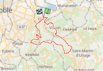
Trail Walking of 17.9 km to be discovered at Auvergne-Rhône-Alpes, Isère, Gières. This trail is proposed by flip38.
Description
Boucle assez longue mais qui relie les deux versants de la combe de Gières.
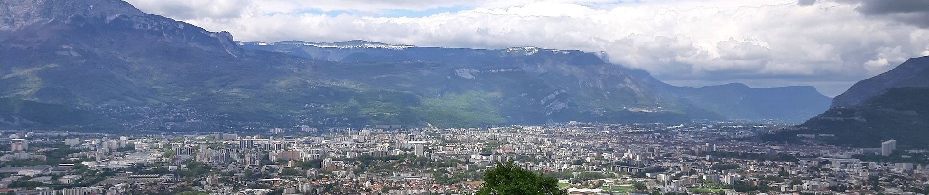
Chemins ou sentiers souvent en forêt, quelques parties en bitume mais pas très longues. De beaux points de vue sur le bassin grenoblois.
On passera aussi par certaines fortifications du Mûrier.
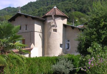
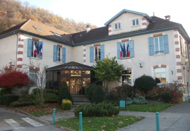
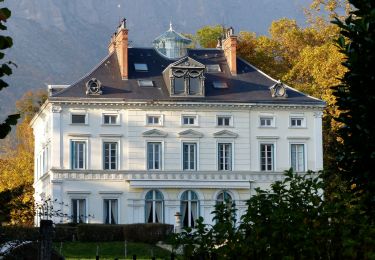
Positioning
Country:
France
Region :
Auvergne-Rhône-Alpes
Department/Province :
Isère
Municipality :
Gières
Location:
Unknown
Start:(Dec)
Start:(UTM)
719267 ; 5006820 (31T) N.
Comments
Trails nearby
![Trail On foot Saint-Martin-d'Uriage - Circuit des Curistes - Photo](https://media.geolcdn.com/t/375/260/884736af-6d5e-4498-9816-404871d42486.jpeg&format=jpg&maxdim=2)
![On foot On foot](https://static1.geolcdn.com/sitytour/trail-icons/100.png)
Circuit des Curistes
On foot
Easy
Saint-Martin-d'Uriage,
Auvergne-Rhône-Alpes,
Isère,
France
![](/images/other/stat-length.png)
5.9 km | 7.8 km-effort
1h 46min
![](https://static1.geolcdn.com/siteimages/upload/files/16400158638029165_repeat_loop_refresh_sync_direction_icon.png)
Yes
![Trail On foot Saint-Martin-d'Uriage - Circuit des Crêtes - Photo](https://media.geolcdn.com/t/375/260/a077f9fa-48e4-483f-a273-f9f858afd6d0.jpeg&format=jpg&maxdim=2)
![On foot On foot](https://static1.geolcdn.com/sitytour/trail-icons/100.png)
Circuit des Crêtes
On foot
Easy
Saint-Martin-d'Uriage,
Auvergne-Rhône-Alpes,
Isère,
France
![](/images/other/stat-length.png)
9.5 km | 13.6 km-effort
3h 5min
![](https://static1.geolcdn.com/siteimages/upload/files/16400158638029165_repeat_loop_refresh_sync_direction_icon.png)
Yes
![Trail On foot Saint-Martin-d'Uriage - Circuit du Bit - Photo](https://media.geolcdn.com/t/375/260/2fa5dbdf-0fcb-48b8-a2a0-bdb0f129de25.jpeg&format=jpg&maxdim=2)
![On foot On foot](https://static1.geolcdn.com/sitytour/trail-icons/100.png)
Circuit du Bit
On foot
Easy
Saint-Martin-d'Uriage,
Auvergne-Rhône-Alpes,
Isère,
France
![](/images/other/stat-length.png)
9.1 km | 16.3 km-effort
3h 41min
![](https://static1.geolcdn.com/siteimages/upload/files/16400158638029165_repeat_loop_refresh_sync_direction_icon.png)
Yes
![Trail On foot Saint-Martin-d'Uriage - Balcon de Combeloup - Photo](https://media.geolcdn.com/t/375/260/67f211a9-4659-4ac8-8551-19ac88e52f68.jpeg&format=jpg&maxdim=2)
![On foot On foot](https://static1.geolcdn.com/sitytour/trail-icons/100.png)
Balcon de Combeloup
On foot
Easy
Saint-Martin-d'Uriage,
Auvergne-Rhône-Alpes,
Isère,
France
![](/images/other/stat-length.png)
9.4 km | 15.1 km-effort
3h 25min
![](https://static1.geolcdn.com/siteimages/upload/files/16400158638029165_repeat_loop_refresh_sync_direction_icon.png)
Yes
![Trail On foot Domène - Domène à Murianette, par les rives de l'Isère - Photo](https://media.geolcdn.com/t/375/260/f00f3b3d-abcc-47f4-9cc6-e5ee52a8ddd2.jpeg&format=jpg&maxdim=2)
![On foot On foot](https://static1.geolcdn.com/sitytour/trail-icons/100.png)
Domène à Murianette, par les rives de l'Isère
On foot
Easy
Domène,
Auvergne-Rhône-Alpes,
Isère,
France
![](/images/other/stat-length.png)
6.4 km | 7 km-effort
1h 35min
![](https://static1.geolcdn.com/siteimages/upload/files/16400158638029165_repeat_loop_refresh_sync_direction_icon.png)
No
![Trail On foot Domène - Circuit de Beauregard - Photo](https://media.geolcdn.com/t/375/260/c0d86b6a-ec41-4f3c-879d-1fb6f4151878.jpeg&format=jpg&maxdim=2)
![On foot On foot](https://static1.geolcdn.com/sitytour/trail-icons/100.png)
Circuit de Beauregard
On foot
Easy
Domène,
Auvergne-Rhône-Alpes,
Isère,
France
![](/images/other/stat-length.png)
3.6 km | 7 km-effort
1h 35min
![](https://static1.geolcdn.com/siteimages/upload/files/16400158638029165_repeat_loop_refresh_sync_direction_icon.png)
Yes
![Trail On foot Domène - Circuit de la Monta - Photo](https://media.geolcdn.com/t/375/260/8f502881-e98d-4929-b19b-6c8e9cb279e5.jpeg&format=jpg&maxdim=2)
![On foot On foot](https://static1.geolcdn.com/sitytour/trail-icons/100.png)
Circuit de la Monta
On foot
Easy
Domène,
Auvergne-Rhône-Alpes,
Isère,
France
![](/images/other/stat-length.png)
9.9 km | 15.4 km-effort
3h 29min
![](https://static1.geolcdn.com/siteimages/upload/files/16400158638029165_repeat_loop_refresh_sync_direction_icon.png)
Yes
![Trail On foot Gières - De Gières au col du Gourlu - Photo](https://media.geolcdn.com/t/375/260/b782ea79-2f14-452c-9af6-76dad2fec664.jpeg&format=jpg&maxdim=2)
![On foot On foot](https://static1.geolcdn.com/sitytour/trail-icons/100.png)
De Gières au col du Gourlu
On foot
Easy
Gières,
Auvergne-Rhône-Alpes,
Isère,
France
![](/images/other/stat-length.png)
6.2 km | 10.5 km-effort
2h 22min
![](https://static1.geolcdn.com/siteimages/upload/files/16400158638029165_repeat_loop_refresh_sync_direction_icon.png)
No
![Trail On foot La Tronche - Grande Traverse de Meylan - Photo](https://media.geolcdn.com/t/375/260/07dafc4a-0388-404d-b349-5b51404ed80b.jpeg&format=jpg&maxdim=2)
![On foot On foot](https://static1.geolcdn.com/sitytour/trail-icons/100.png)
Grande Traverse de Meylan
On foot
Easy
La Tronche,
Auvergne-Rhône-Alpes,
Isère,
France
![](/images/other/stat-length.png)
5.6 km | 6.5 km-effort
1h 28min
![](https://static1.geolcdn.com/siteimages/upload/files/16400158638029165_repeat_loop_refresh_sync_direction_icon.png)
No