


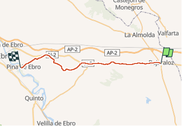
BUJARALOS-PINA DEL EBRO

PHILIPPONjeanpaul
User

Length
37 km

Max alt
367 m

Uphill gradient
191 m
Km-Effort
40 km

Min alt
157 m

Downhill gradient
360 m
Boucle
No
Creation date :
2024-04-18 04:26:07.0
Updated on :
2024-04-18 10:52:43.136
6h02
Difficulty : Very difficult

FREE GPS app for hiking
 SityTrail
IGN / Geographical institutes
SityTrail World
The world is yours!
About
Trail Walking of 37 km to be discovered at Aragon, Zaragoza, Bujaraloz. This trail is proposed by PHILIPPONjeanpaul.
Photos

Positioning
Country:
Spain
Region :
Aragon
Department/Province :
Zaragoza
Municipality :
Bujaraloz
Location:
Unknown
Start:(Dec)
Start:(UTM)
737679 ; 4597706 (30T) N.
Comments
Trails nearby