Trail Walking Saint-Pierre-de-Genebroz - 2024-04-16_11h07m53_SityTrail - 4017426 - mont-grelle - Photo

2024-04-16_11h07m53_SityTrail - 4017426 - mont-grelle

© OpenStreetMap contributors
Length
Length
16.8 km
Max alt
Max alt
1434 m
Uphill gradient
Uphill gradient
919 m
Km-Effort
Km-Effort  
29 km
Min alt
Min alt
881 m
Downhill gradient
Downhill gradient
906 m
Boucle
Boucle
Yes
Creation date :
2024-04-16 09:07:53.873
Updated on :
2024-04-18 08:34:53.546

(0 Reviews)

Walking
Walking
6h35
Difficulty : Medium

Scan this QR Code to open this trail in the SityTrail application

FREE GPS app for hiking

Logo SityTrail SityTrail

IGN / Geographical institutes

Download SityTrail from the App Store Download SityTrail from Google Play

Logo SityTrail SityTrail World

The world is yours!

Download SityTrail from the App Store Download SityTrail from Google Play Download SityTrail on Huawei AppGallery

About

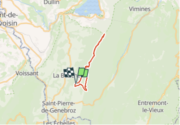
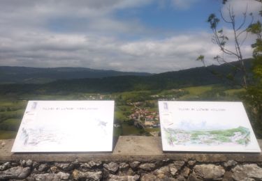
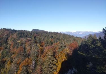
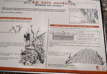
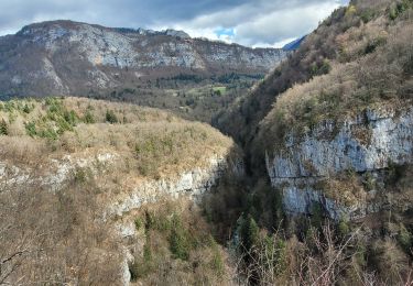
Trail Walking of 16.8 km to be discovered at Auvergne-Rhône-Alpes, Savoy, Saint-Pierre-de-Genebroz. This trail is proposed by Bernard Rodriguez.

Description

3333 OT
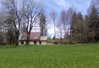
Départ Ferme Riondet.
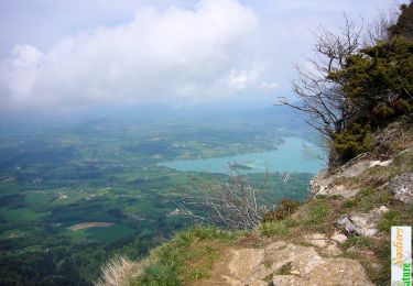
Arrivée Mont Grelle (face au las d'Aiguebelette

Elevation profile

Positioning

Country:
France
Region :
Auvergne-Rhône-Alpes
Department/Province :
Savoy
Municipality :
Saint-Pierre-de-Genebroz
Location:
Unknown
Start:(UTM)
717115 ; 5039335 (31T) N.

Trails nearby

Trail Walking Attignat-Oncin - Le Mont Grelle 1425m, depuis Attignat - Oncin - Photo
Walking
tracegps

Walking

Medium
(3)
Attignat-Oncin, Auvergne-Rhône-Alpes, Savoy, France
9.6 km | 17.6 km-effort
4h 30min
Yes
Trail Road bike Corbel - Entreront  - Photo
Road bike
Geneviève Robardey

Road bike

Very difficult
(1)
Corbel, Auvergne-Rhône-Alpes, Savoy, France
34 km | 49 km-effort
2h 53min
Yes
Trail Walking Saint-Christophe - 38 st Christophe sur guiers grottes guiers vif - Photo
Walking
GUIDE
randodyssée

Walking

Medium
Saint-Christophe, Auvergne-Rhône-Alpes, Savoy, France
7.3 km | 12.7 km-effort
3h 24min
Yes
Trail Walking La Bauche - Ballade vers la Bauche - Photo
Walking
GUIDE
nadd73

Walking

Easy
La Bauche, Auvergne-Rhône-Alpes, Savoy, France
11.7 km | 23 km-effort
6h 19min
Yes
Trail sport Saint-Christophe - La grotte - Photo
sport
Biquette73

sport

Very easy
Saint-Christophe, Auvergne-Rhône-Alpes, Savoy, France
8.9 km | 14.1 km-effort
Unknown
No
Trail Trail Saint-Christophe - au dessus de la grotte des échelles  - Photo
Trail
GUIDE
nadd73

Trail

Very easy
Saint-Christophe, Auvergne-Rhône-Alpes, Savoy, France
8 km | 11.8 km-effort
1h 11min
Yes
Trail Trail La Bauche - Mont Beauvoir  - Photo
Trail
GUIDE
nadd73

Trail

Easy
La Bauche, Auvergne-Rhône-Alpes, Savoy, France
9.2 km | 18.7 km-effort
1h 47min
Yes
Trail Walking Saint-Christophe - la voie SARDE / tunnel des l'Echelles /st Christophe sur Guiers - Photo
Walking
okfred26

Walking

Very difficult
Saint-Christophe, Auvergne-Rhône-Alpes, Savoy, France
15.1 km | 23 km-effort
5h 12min
Yes
Trail Walking Saint-Christophe - 190323 Boucle voie Sarde - Photo
Walking
mzonzon05

Walking

Difficult
Saint-Christophe, Auvergne-Rhône-Alpes, Savoy, France
9.7 km | 15.6 km-effort
3h 50min
Yes


Close
My subscriptions