


11.8 km | 12.9 km-effort


User


FREE GPS app for hiking
 SityTrail
IGN / Geographical institutes
SityTrail World
The world is yours!
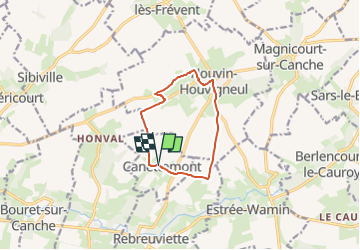
Trail Walking of 8.2 km to be discovered at Hauts-de-France, Pas-de-Calais, Canettemont. This trail is proposed by temmichel.
Randonnée au départ de l'église de CANETTEMONT pour rejoindre par le chemin de Saint Pol la commune d'HOUVIN HOUVIGNEUL, Descendre vers la vallée de la Canche pour retrouver le point de départ
Bonne randonnée
Jean-Michel
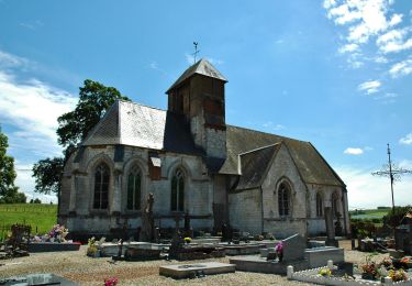
 Le chemin de Saint Pol - Photo 1")

Walking

Walking
Walking

Walking

Walking
Walking
Walking
Walking
Walking