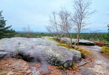
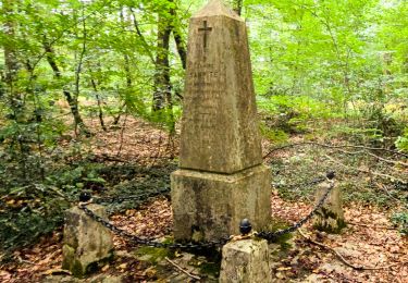
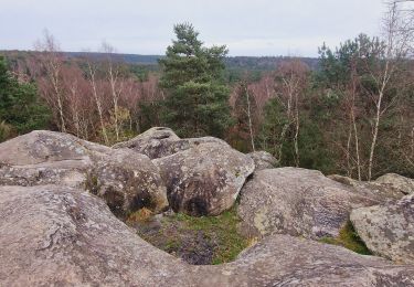
Trail Walking Fontainebleau - 77F2-18 Fontainebleau Table du roi - 21 km -  Par Bernard V IBP 52 - Photo

77F2-18 Fontainebleau Table du roi - 21 km - Par Bernard V IBP 52

 jeanmarcMasson
jeanmarcMasson

User GUIDE

© OpenStreetMap contributors
Length
Length
19 km
Max alt
Max alt
152 m
Uphill gradient
Uphill gradient
265 m
Km-Effort
Km-Effort  
23 km
Min alt
Min alt
81 m
Downhill gradient
Downhill gradient
264 m
Boucle
Boucle
Yes
Creation date :
2024-03-31 13:11:04.052
Updated on :
2024-03-31 14:44:18.055

(1 Reviews)

Walking
Walking
5h07
Difficulty : Very difficult

Scan this QR Code to open this trail in the SityTrail application

FREE GPS app for hiking

Logo SityTrail SityTrail

IGN / Geographical institutes

Download SityTrail from the App Store Download SityTrail from Google Play

Logo SityTrail SityTrail World

The world is yours!

Download SityTrail from the App Store Download SityTrail from Google Play Download SityTrail on Huawei AppGallery

About

Trail Walking of 19 km to be discovered at Ile-de-France, Seine-et-Marne, Fontainebleau. This trail is proposed by jeanmarcMasson.

Description

[img]https://4.bp.blogspot.com/-CBUmrUw11Uo/Wtr_c5QVTSI/AAAAAAAAPL4/18f8zkojvuQ3yH17tt2Md3CAeGiWpXpOQCLcBGAs/s1600/RONG-ConvertImage.icoo[/img]   [b]Rando Club Yerrois[/b]

[img]https://4.bp.blogspot.com/-CBUmrUw11Uo/Wtr_c5QVTSI/AAAAAAAAPL4/18f8zkojvuQ3yH17tt2Md3CAeGiWpXpOQCLcBGAs/s1600/RONG-ConvertImage.icoo[/img]   [b]Rando Club Yerrois[/b]

[b]Date[/b] :  Mercredi 24 Janvier 2018
[b]Animateur[/b] : Bernard V
[b]Groupe[/b] : 18-22
[b]Effectif[/b] : 20aine
[b]Vidéo relive[/b] :[url]https://youtu.be/wVzmHyJh1UU[/url]

[b]Remarque particulière[/b] : Pas de difficultés particulières - Possibilité de déjeuner avec tables et chaises

[b]Avertissement[/b] Toutes les randonnées répertoriées dans la randothèque du [b]R[/b]ando [b]C[/b]lub [b]Y[/b]errois ont été tracées par l'un de nos animateurs, puis reconnues et enfin effectuées avec un groupe. Pour votre sécurité, regardez toujours la date à laquelle la sortie a été effectuée - Nous tachons de mentionner des conditions météos particulières ou les difficultés éventuelles. N'oubliez jamais les consignes élémentaires de sécurité.

Elevation profile

Positioning

Country:
France
Region :
Ile-de-France
Department/Province :
Seine-et-Marne
Municipality :
Fontainebleau
Location:
Unknown
Start:(Dec)
Start:(UTM)
475309 ; 5370021 (31U) N.

Comments

Please log in to post a review or rate the element


Trails nearby

Trail Walking Barbizon - Sentier des peintres - Photo
Walking
onftest

Walking

Medium
(11)
Barbizon, Ile-de-France, Seine-et-Marne, France
7.5 km | 8.2 km-effort
1h 25min
Yes
Trail Walking Fontainebleau - Sur les traces de Césaire Sempité - Fontainebleau rocher canon - Photo
Walking
GUIDE
chessyca

Walking

Easy
(1)
Fontainebleau, Ile-de-France, Seine-et-Marne, France
17.3 km | 21 km-effort
4h 8min
Yes
Trail Walking Bois-le-Roi - 170822 - RECO BoisLeRoi-Cmcas - Photo
Walking
MarcheEtReve

Walking

Very easy
(1)
Bois-le-Roi, Ile-de-France, Seine-et-Marne, France
8.7 km | 10 km-effort
2h 41min
Yes
Trail Walking Fontainebleau - 131204-GLM - CxToulouse-StLouis - Photo
Walking
randodan

Walking

Easy
(3)
Fontainebleau, Ile-de-France, Seine-et-Marne, France
9 km | 10.7 km-effort
3h 0min
Yes
Trail On foot Fontainebleau - Fontainebleau les monts de Fay - Photo
On foot
GUIDE
chessyca

On foot

Medium
Fontainebleau, Ile-de-France, Seine-et-Marne, France
22 km | 27 km-effort
6h 12min
Yes
Trail Walking Fontainebleau - SityTrail - JC 71 Fontainebleau Rocher Cassepot, Tour Denecourt - Photo
Walking

Walking

Difficult
(1)
Fontainebleau, Ile-de-France, Seine-et-Marne, France
16.9 km | 22 km-effort
4h 55min
Yes
Trail Walking Fontainebleau - Boucle Fontainebleau - Photo
Walking
GUIDE
chessyca

Walking

Medium
Fontainebleau, Ile-de-France, Seine-et-Marne, France
29 km | 34 km-effort
5h 49min
Yes
Trail Walking Fontainebleau - Boucle Fontainebleau 19 km au départ de la Croix de Toulouse - Photo
Walking
GUIDE
chessyca

Walking

Very difficult
Fontainebleau, Ile-de-France, Seine-et-Marne, France
19.1 km | 23 km-effort
4h 26min
Yes
Trail Walking Barbizon - Le tour du Grand Paris via le GR1 etape 14 Barbizon- Malesherbes - Photo
Walking
GUIDE
chessyca

Walking

Very difficult
Barbizon, Ile-de-France, Seine-et-Marne, France
35 km | 41 km-effort
6h 11min
No


Close
My subscriptions