![](/images/other/stat-length.png)
![Trail Walking Matringhem - Matringhem (62) - Les Monts - Photo](https://media.geolcdn.com/t/1900/400/22879fc7-fb44-4afb-af78-f9201e3fab8c.jpg&format=pjpeg&maxdim=2)
Matringhem (62) - Les Monts
temmichel
User
![Length](/images/other/stat-length.png)
Length
12.3 km
![Max alt](https://static1.geolcdn.com/siteimages/upload/files/1508320355ic_sort_altitude_max_24dp.png)
Max alt
188 m
![Uphill gradient](https://static1.geolcdn.com/siteimages/upload/files/1508320355ic_sort_den_pos_24dp.png)
Uphill gradient
192 m
![Km-Effort](/images/other/stat-length.png)
Km-Effort
14.8 km
![Min alt](https://static1.geolcdn.com/siteimages/upload/files/1508320355ic_sort_altitude_min_24dp.png)
Min alt
76 m
![Downhill gradient](https://static1.geolcdn.com/siteimages/upload/files/1508320355ic_sort_den_neg_24dp.png)
Downhill gradient
184 m
![Boucle](https://static1.geolcdn.com/siteimages/upload/files/16400158638029165_repeat_loop_refresh_sync_direction_icon.png)
Boucle
Yes
Creation date :
2024-03-28 10:16:23.324
Updated on :
2024-03-28 10:25:17.939
![Walking](https://static1.geolcdn.com/sitytour/trail-icons/101.png)
3h22
Difficulty : Difficult
![Scan this QR Code to open this trail in the SityTrail application](https://capi.geolives.com/qq0zvz2zws4bq2lad0pu/sitytour/trails/3996424/qr.png?size=200)
FREE GPS app for hiking
About
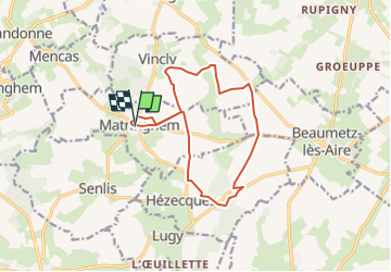
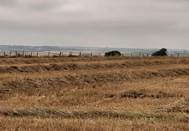
Trail Walking of 12.3 km to be discovered at Hauts-de-France, Pas-de-Calais, Matringhem. This trail is proposed by temmichel.
Description
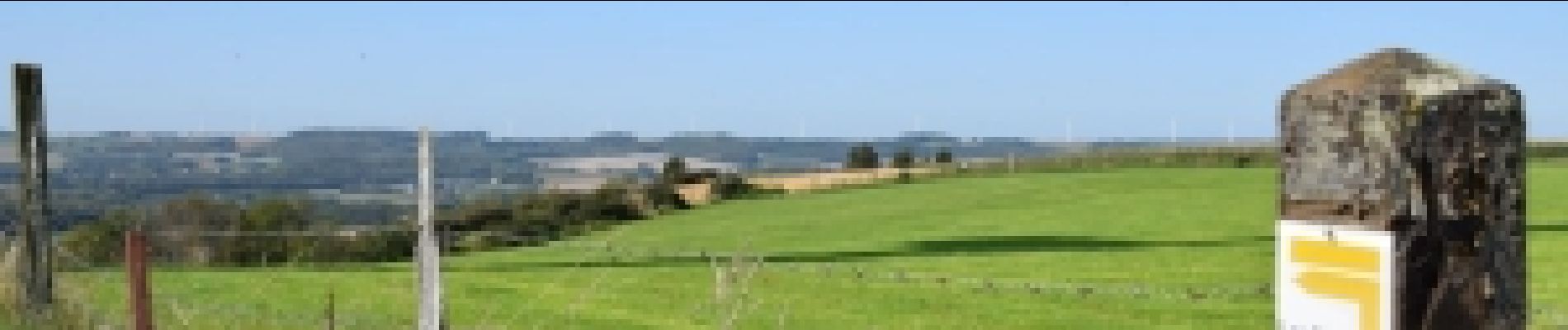
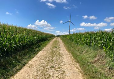
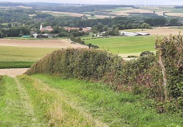
Cette randonnée vous fera découvrir le Mont Hézecques, le Mont d'Anguilbert, le Mont Grave et le Mont Fontaine premières collines artésiennes de la vallée de la Lys
Bonne randonnée
Jean-Michel
Positioning
Country:
France
Region :
Hauts-de-France
Department/Province :
Pas-de-Calais
Municipality :
Matringhem
Location:
Unknown
Start:(Dec)
Start:(UTM)
440785 ; 5599628 (31U) N.
Comments
Trails nearby
![Trail Walking Fruges - Fruges les 7 clocher - Photo](https://media.geolcdn.com/t/375/260/ext.jpg?maxdim=2&url=https%3A%2F%2Fstatic1.geolcdn.com%2Fsiteimages%2Fupload%2Ffiles%2F1553511878bg_sport_marche.png)
![Walking Walking](https://static1.geolcdn.com/sitytour/trail-icons/101.png)
Fruges les 7 clocher
Walking
Very easy
(1)
Fruges,
Hauts-de-France,
Pas-de-Calais,
France
![](/images/other/stat-length.png)
11.2 km | 13.9 km-effort
2h 29min
![](https://static1.geolcdn.com/siteimages/upload/files/16400158638029165_repeat_loop_refresh_sync_direction_icon.png)
Yes
![Trail Walking Coupelle-Vieille - Coupelle Vieille - Photo](https://media.geolcdn.com/t/375/260/0494ace5-e380-4b27-a17c-ea2bcb453c2c.jpg&format=jpg&maxdim=2)
![Walking Walking](https://static1.geolcdn.com/sitytour/trail-icons/101.png)
Coupelle Vieille
Walking
Medium
Coupelle-Vieille,
Hauts-de-France,
Pas-de-Calais,
France
![](/images/other/stat-length.png)
18.6 km | 21 km-effort
4h 33min
![](https://static1.geolcdn.com/siteimages/upload/files/16400158638029165_repeat_loop_refresh_sync_direction_icon.png)
Yes
![Trail Walking Reclinghem - Les hauts de RECLINGHEM - Photo](https://media.geolcdn.com/t/375/260/20fb6d25-f84e-4a0d-88c2-6113522a2109.jpg&format=jpg&maxdim=2)
![Walking Walking](https://static1.geolcdn.com/sitytour/trail-icons/101.png)
Les hauts de RECLINGHEM
Walking
Easy
Reclinghem,
Hauts-de-France,
Pas-de-Calais,
France
![](/images/other/stat-length.png)
4.6 km | 6 km-effort
1h 15min
![](https://static1.geolcdn.com/siteimages/upload/files/16400158638029165_repeat_loop_refresh_sync_direction_icon.png)
Yes
![Trail Walking Vincly - Les hauts de VINCLY - Photo](https://media.geolcdn.com/t/375/260/68ad05c8-0165-41ee-a2c5-d09dff4e8587.jpg&format=jpg&maxdim=2)
![Walking Walking](https://static1.geolcdn.com/sitytour/trail-icons/101.png)
Les hauts de VINCLY
Walking
Difficult
Vincly,
Hauts-de-France,
Pas-de-Calais,
France
![](/images/other/stat-length.png)
10 km | 12.2 km-effort
2h 26min
![](https://static1.geolcdn.com/siteimages/upload/files/16400158638029165_repeat_loop_refresh_sync_direction_icon.png)
Yes
![Trail Mountain bike Dennebrœucq - de bellefontaine à Hezecques - Photo](https://media.geolcdn.com/t/375/260/ext.jpg?maxdim=2&url=https%3A%2F%2Fstatic1.geolcdn.com%2Fsiteimages%2Fupload%2Ffiles%2F1524743154velo.jpg)
![Mountain bike Mountain bike](https://static1.geolcdn.com/sitytour/trail-icons/202.png)
de bellefontaine à Hezecques
Mountain bike
Medium
Dennebrœucq,
Hauts-de-France,
Pas-de-Calais,
France
![](/images/other/stat-length.png)
22 km | 26 km-effort
2h 3min
![](https://static1.geolcdn.com/siteimages/upload/files/16400158638029165_repeat_loop_refresh_sync_direction_icon.png)
Yes
![Trail Walking Bomy - Bomy (3) 12.1Km Dén P 175m - Photo](https://media.geolcdn.com/t/375/260/ext.jpg?maxdim=2&url=https%3A%2F%2Fstatic1.geolcdn.com%2Fsiteimages%2Fupload%2Ffiles%2F1553511878bg_sport_marche.png)
![Walking Walking](https://static1.geolcdn.com/sitytour/trail-icons/101.png)
Bomy (3) 12.1Km Dén P 175m
Walking
Medium
Bomy,
Hauts-de-France,
Pas-de-Calais,
France
![](/images/other/stat-length.png)
12.1 km | 14.4 km-effort
3h 9min
![](https://static1.geolcdn.com/siteimages/upload/files/16400158638029165_repeat_loop_refresh_sync_direction_icon.png)
Yes
![Trail Walking Coupelle-Vieille - Coupelle-Vieille 13Km Dén P 135m - Photo](https://media.geolcdn.com/t/375/260/ext.jpg?maxdim=2&url=https%3A%2F%2Fstatic1.geolcdn.com%2Fsiteimages%2Fupload%2Ffiles%2F1553511878bg_sport_marche.png)
![Walking Walking](https://static1.geolcdn.com/sitytour/trail-icons/101.png)
Coupelle-Vieille 13Km Dén P 135m
Walking
Medium
Coupelle-Vieille,
Hauts-de-France,
Pas-de-Calais,
France
![](/images/other/stat-length.png)
13 km | 14.8 km-effort
2h 40min
![](https://static1.geolcdn.com/siteimages/upload/files/16400158638029165_repeat_loop_refresh_sync_direction_icon.png)
Yes
![Trail Walking Renty - éoliennes du mont des faucons par Saint Aubin - Photo](https://media.geolcdn.com/t/375/260/ext.jpg?maxdim=2&url=https%3A%2F%2Fstatic1.geolcdn.com%2Fsiteimages%2Fupload%2Ffiles%2F1553511878bg_sport_marche.png)
![Walking Walking](https://static1.geolcdn.com/sitytour/trail-icons/101.png)
éoliennes du mont des faucons par Saint Aubin
Walking
Medium
Renty,
Hauts-de-France,
Pas-de-Calais,
France
![](/images/other/stat-length.png)
10.6 km | 12.5 km-effort
2h 50min
![](https://static1.geolcdn.com/siteimages/upload/files/16400158638029165_repeat_loop_refresh_sync_direction_icon.png)
Yes
![Trail Walking Audincthun - menca - Photo](https://media.geolcdn.com/t/375/260/ext.jpg?maxdim=2&url=https%3A%2F%2Fstatic1.geolcdn.com%2Fsiteimages%2Fupload%2Ffiles%2F1553511878bg_sport_marche.png)
![Walking Walking](https://static1.geolcdn.com/sitytour/trail-icons/101.png)
menca
Walking
Very difficult
Audincthun,
Hauts-de-France,
Pas-de-Calais,
France
![](/images/other/stat-length.png)
25 km | 27 km-effort
4h 20min
![](https://static1.geolcdn.com/siteimages/upload/files/16400158638029165_repeat_loop_refresh_sync_direction_icon.png)
No