Trail Walking Nicole - ASPTT DU 21/03/2024 _ Boucle Ayet/Pech de Berre/Ayet - Photo

ASPTT DU 21/03/2024 _ Boucle Ayet/Pech de Berre/Ayet

 Elbe
Elbe

User

© OpenStreetMap contributors
Length
Length
11.1 km
Max alt
Max alt
172 m
Uphill gradient
Uphill gradient
316 m
Km-Effort
Km-Effort  
15.3 km
Min alt
Min alt
45 m
Downhill gradient
Downhill gradient
313 m
Boucle
Boucle
Yes
Creation date :
2024-03-21 13:08:34.969
Updated on :
2024-03-24 16:14:37.564

(0 Reviews)

Walking
Walking
3h28
Difficulty : Difficult

Scan this QR Code to open this trail in the SityTrail application

FREE GPS app for hiking

Logo SityTrail SityTrail

IGN / Geographical institutes

Download SityTrail from the App Store Download SityTrail from Google Play

Logo SityTrail SityTrail World

The world is yours!

Download SityTrail from the App Store Download SityTrail from Google Play Download SityTrail on Huawei AppGallery

About

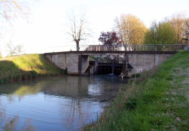
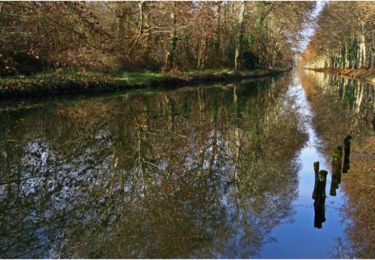
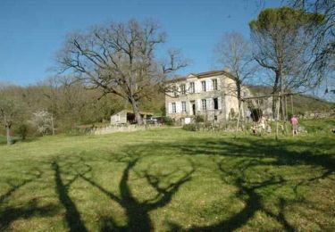
Trail Walking of 11.1 km to be discovered at New Aquitaine, Lot-et-Garonne, Nicole. This trail is proposed by Elbe.

Description

Cette balade qui offre de nombreux panoramas sur les deux vallées du confluent est une des variantes de la rando du Lot & Garonne.

Elevation profile

Positioning

Country:
France
Region :
New Aquitaine
Department/Province :
Lot-et-Garonne
Municipality :
Nicole
Location:
Unknown
Start:(UTM)
287378 ; 4913257 (31T) N.

Trails nearby

Trail Walking Tonneins - Unet, petite randonnée entre Garonne et Lot - Pays Val de Garonne - Gascogne - Photo
Walking
tracegps

Walking

Medium
(1)
Tonneins, New Aquitaine, Lot-et-Garonne, France
5.6 km | 7.8 km-effort
2h 0min
Yes
Trail On foot Puch-d'Agenais - Damazan, la Bastide du Canal de Garonne - 9,8km - Photo
On foot
PRO

On foot

Easy
Puch-d'Agenais, New Aquitaine, Lot-et-Garonne, France
3.6 km | 3.9 km-effort
52min
No
Trail On foot Monheurt - Monheurt, balade entre Garonne et canal - 7 km - Photo
On foot
PRO

On foot

Easy
Monheurt, New Aquitaine, Lot-et-Garonne, France
6.8 km | 7.5 km-effort
1h 41min
Yes
Trail Mountain bike Monheurt - Monheurt, balade entre Garonne et Canal  - Pays de la vallée du Lot  - Photo
Mountain bike
tracegps

Mountain bike

Medium
Monheurt, New Aquitaine, Lot-et-Garonne, France
9.1 km | 10.1 km-effort
34min
Yes
Trail Walking Monheurt - Monheurt, balade entre Garonne et Canal  - Pays de la vallée du Lot  - Photo
Walking
tracegps

Walking

Medium
Monheurt, New Aquitaine, Lot-et-Garonne, France
9.1 km | 10.1 km-effort
2h 30min
Yes
Trail Walking Clairac - Clairac, une boucle semi urbaine au bord du Lot - Pays de la vallée du Lot - Photo
Walking
tracegps

Walking

Easy
Clairac, New Aquitaine, Lot-et-Garonne, France
4.9 km | 5.5 km-effort
1h 40min
Yes
Trail Mountain bike Aiguillon - Aiguillon, bastide française au confluent du Lot et de la Garonne - Pays de la vallée du Lot - Photo
Mountain bike
tracegps

Mountain bike

Difficult
Aiguillon, New Aquitaine, Lot-et-Garonne, France
15 km | 19.2 km-effort
2h 0min
Yes
Trail Walking Aiguillon - Aiguillon, bastide française au confluent du Lot et de la Garonne - Pays de la vallée du Lot - Photo
Walking
tracegps

Walking

Difficult
Aiguillon, New Aquitaine, Lot-et-Garonne, France
15 km | 19.2 km-effort
4h 0min
Yes
Trail Mountain bike Tonneins - Unet, petite randonnée entre Garonne et Lot - Pays Val de Garonne - Gascogne - Photo
Mountain bike
tracegps

Mountain bike

Medium
Tonneins, New Aquitaine, Lot-et-Garonne, France
5.6 km | 7.8 km-effort
45min
Yes


Close
My subscriptions