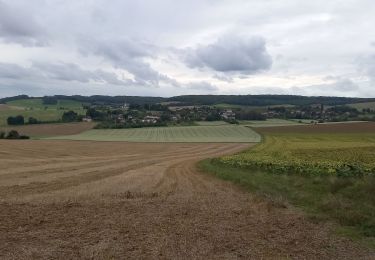
12 km | 14 km-effort
2024-04 Villeneuve
letzelter
User
Length
7.5 km
Max alt
278 m
Uphill gradient
153 m
Km-Effort
9.6 km
Min alt
151 m
Downhill gradient
159 m
Boucle
No
Creation date :
2024-03-20 12:29:08.405
Updated on :
2024-03-20 14:52:23.574
2h22
Difficulty : Medium
FREE GPS app for hiking
About
Trail Walking of 7.5 km to be discovered at Grand Est, Aube, Villeneuve-au-Chemin. This trail is proposed by letzelter.
Positioning
Country:
France
Region :
Grand Est
Department/Province :
Aube
Municipality :
Villeneuve-au-Chemin
Location:
Unknown
Start:(Dec)
Start:(UTM)
562469 ; 5325697 (31U) N.
Comments
Trails nearby
Circuit du Coursannais - Coursan-en-Othe
Walking
Medium
(1)
Coursan-en-Othe,
Grand Est,
Aube,
France
3h 0min
Yes
Circuit des trois Monts - Eaux-Puiseaux
Walking
Very difficult
Eaux-Puiseaux,
Grand Est,
Aube,
France
14.7 km | 19 km-effort
3h 45min
Yes
Eaux 12,5km GRBA le 11.09.2024
Walking
Medium
Eaux-Puiseaux,
Grand Est,
Aube,
France
12.5 km | 16.1 km-effort
3h 17min
Yes
Eaux puiseaux
Walking
Easy
Eaux-Puiseaux,
Grand Est,
Aube,
France
11.9 km | 14.8 km-effort
3h 4min
Yes
circuit au départ de Eaux-Puiseaux
Nordic walking
Easy
Eaux-Puiseaux,
Grand Est,
Aube,
France
7.3 km | 10 km-effort
1h 17min
Yes
COURSAN EN OTH
Walking
Very easy
Coursan-en-Othe,
Grand Est,
Aube,
France
20 km | 23 km-effort
5h 34min
Yes
Eaux 12,3km GRBA le 11.09.2023
Walking
Medium
Eaux-Puiseaux,
Grand Est,
Aube,
France
12.3 km | 14.8 km-effort
2h 39min
Yes
Eaux-Puiseaux 12km réel
Walking
Difficult
Eaux-Puiseaux,
Grand Est,
Aube,
France
11.5 km | 14.9 km-effort
3h 22min
Yes