![](/images/other/stat-length.png)
![Trail Walking Fraisans - fraisans - Photo](https://media.geolcdn.com/t/1900/400/f306cb95-b966-4d41-81f4-15fee8d1db5c.jpg&format=pjpeg&maxdim=2)
fraisans
eltonnermou
User
![Length](/images/other/stat-length.png)
![Max alt](https://static1.geolcdn.com/siteimages/upload/files/1508320355ic_sort_altitude_max_24dp.png)
![Uphill gradient](https://static1.geolcdn.com/siteimages/upload/files/1508320355ic_sort_den_pos_24dp.png)
![Km-Effort](/images/other/stat-length.png)
![Min alt](https://static1.geolcdn.com/siteimages/upload/files/1508320355ic_sort_altitude_min_24dp.png)
![Downhill gradient](https://static1.geolcdn.com/siteimages/upload/files/1508320355ic_sort_den_neg_24dp.png)
![Boucle](https://static1.geolcdn.com/siteimages/upload/files/16400158638029165_repeat_loop_refresh_sync_direction_icon.png)
![Walking](https://static1.geolcdn.com/sitytour/trail-icons/101.png)
5h06
Difficulty : Difficult
![Scan this QR Code to open this trail in the SityTrail application](https://capi.geolives.com/qq0zvz2zws4bq2lad0pu/sitytour/trails/3977307/qr.png?size=200)
FREE GPS app for hiking
About
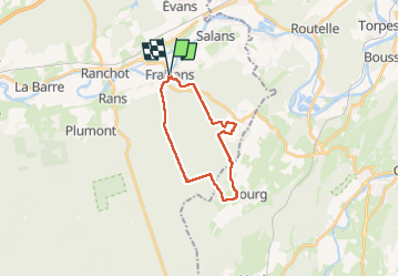
Trail Walking of 19.1 km to be discovered at Bourgogne-Franche-Comté, Jura, Fraisans. This trail is proposed by eltonnermou.
Description
Cette belle randonnée pédestre vous entrainera à travers la forêt de Chaux, avec quelques montées et donc descentes "délicates" (raidillons). Les bâtons sont conseillés. Le départ sur la route peu vite être remplacé par le chemin forestier qui la longe à main gauche, avec la vigilance de rejoindre le tracé au moment opportun (environ 3,5 km après le départ).
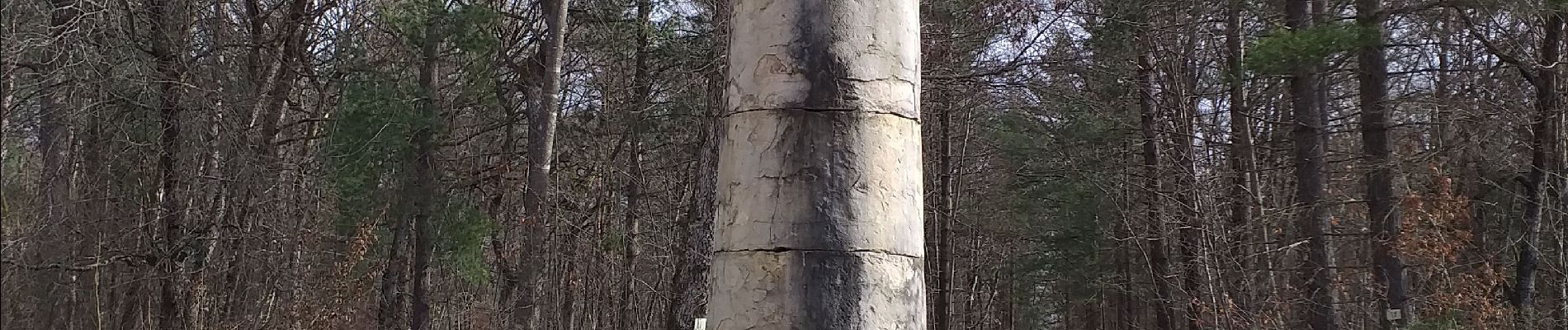
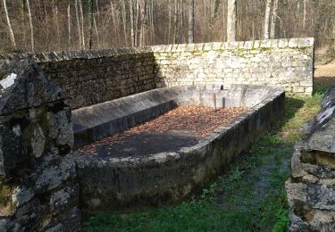
La 8ième colonne mérite l'observation.
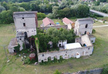
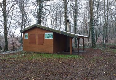
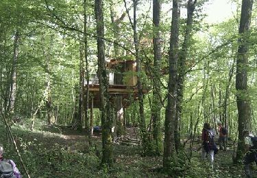
Avant l'arrivée à Fourg, vous traversez un village de maisons en bois qui offre un lieu de repas idéal.
Par temps humides (à plus forte raison en cas de pluie) les sentiers se transforment très vite en bailloux, prenez vos précautions.
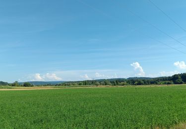
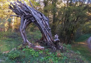
Avec un peu de chance, vous surprendrez des chevreuils. Vous pourrez apprécier la diversité de la flore et profiter d'un parcours ombragé et très agréable,
Positioning
Comments
Trails nearby
![Trail On foot Rans - Sentier du Doubs - Photo](https://media.geolcdn.com/t/375/260/2f023412-4b4b-4930-9895-3992aa0d1824.jpeg&format=jpg&maxdim=2)
![On foot On foot](https://static1.geolcdn.com/sitytour/trail-icons/100.png)
On foot
![](/images/other/stat-length.png)
![](https://static1.geolcdn.com/siteimages/upload/files/16400158638029165_repeat_loop_refresh_sync_direction_icon.png)
![Trail Walking Saint-Vit - saint vit - velesmes-essarts / autour du bois des saussottes - Photo](https://media.geolcdn.com/t/375/260/61dd1ddd-a496-4aed-80ab-95d6bd5de239.jpg&format=jpg&maxdim=2)
![Walking Walking](https://static1.geolcdn.com/sitytour/trail-icons/101.png)
Walking
![](/images/other/stat-length.png)
![](https://static1.geolcdn.com/siteimages/upload/files/16400158638029165_repeat_loop_refresh_sync_direction_icon.png)
![Trail Walking Saint-Vit - Saint vit-longtemps - Photo](https://media.geolcdn.com/t/375/260/1f8a244b-11a6-4aff-9675-4b70887e3976.jpg&format=jpg&maxdim=2)
![Walking Walking](https://static1.geolcdn.com/sitytour/trail-icons/101.png)
Walking
![](/images/other/stat-length.png)
![](https://static1.geolcdn.com/siteimages/upload/files/16400158638029165_repeat_loop_refresh_sync_direction_icon.png)
![Trail On foot Dampierre - Sentier des Mines - Photo](https://media.geolcdn.com/t/375/260/ad7774a9-160b-4614-9c7e-f2b9aa72f68a.jpeg&format=jpg&maxdim=2)
![On foot On foot](https://static1.geolcdn.com/sitytour/trail-icons/100.png)
On foot
![](/images/other/stat-length.png)
![](https://static1.geolcdn.com/siteimages/upload/files/16400158638029165_repeat_loop_refresh_sync_direction_icon.png)
![Trail Road bike Rans - mn04 - Photo](https://media.geolcdn.com/t/375/260/fddf2bcc-7173-412d-b880-4b704df13eb3.jpg&format=jpg&maxdim=2)
![Road bike Road bike](https://static1.geolcdn.com/sitytour/trail-icons/201.png)
Road bike
![](/images/other/stat-length.png)
![](https://static1.geolcdn.com/siteimages/upload/files/16400158638029165_repeat_loop_refresh_sync_direction_icon.png)
![Trail Walking Saint-Vit - St Vit le bois d'ambre - Photo](https://media.geolcdn.com/t/375/260/6546f722-4437-4a3d-8e74-c41ee395acc3.jpg&format=jpg&maxdim=2)
![Walking Walking](https://static1.geolcdn.com/sitytour/trail-icons/101.png)
Walking
![](/images/other/stat-length.png)
![](https://static1.geolcdn.com/siteimages/upload/files/16400158638029165_repeat_loop_refresh_sync_direction_icon.png)
![Trail Walking Évans - Evans 14 janv 2020 CAF - Photo](https://media.geolcdn.com/t/375/260/c5f64ded-b6d5-4a13-a0ba-f48a47ec46fa.jpg&format=jpg&maxdim=2)
![Walking Walking](https://static1.geolcdn.com/sitytour/trail-icons/101.png)
Walking
![](/images/other/stat-length.png)
![](https://static1.geolcdn.com/siteimages/upload/files/16400158638029165_repeat_loop_refresh_sync_direction_icon.png)
![Trail Walking Ranchot - Ranchot - Photo](https://media.geolcdn.com/t/375/260/ext.jpg?maxdim=2&url=https%3A%2F%2Fservices.sitytrail.com%2FGeolivesWS%2FDownloadMedia.ashx%3FTrailID%3D188670%26Media%3D20130502163226.jpeg)
![Walking Walking](https://static1.geolcdn.com/sitytour/trail-icons/101.png)
Walking
![](/images/other/stat-length.png)
![](https://static1.geolcdn.com/siteimages/upload/files/16400158638029165_repeat_loop_refresh_sync_direction_icon.png)
![Trail Nordic walking Dampierre - chateauneuf - Photo](https://media.geolcdn.com/t/375/260/2e428170-a40f-47b2-b515-2d3d25c7716f.jpg&format=jpg&maxdim=2)
![Nordic walking Nordic walking](https://static1.geolcdn.com/sitytour/trail-icons/102.png)
Nordic walking
![](/images/other/stat-length.png)
![](https://static1.geolcdn.com/siteimages/upload/files/16400158638029165_repeat_loop_refresh_sync_direction_icon.png)