Trail  Unknown - 2024-03-10_20h12m07_mare-nostrum-gravel-etape-4-port-de-bouc-la-seyne - Photo

2024-03-10_20h12m07_mare-nostrum-gravel-etape-4-port-de-bouc-la-seyne

 Patriste
Patriste

User

© OpenStreetMap contributors
Length
Length
140 km
Max alt
Max alt
371 m
Uphill gradient
Uphill gradient
2683 m
Km-Effort
Km-Effort  
175 km
Min alt
Min alt
-4 m
Downhill gradient
Downhill gradient
2654 m
Boucle
Boucle
No
Creation date :
2024-03-10 19:12:09.955
Updated on :
2024-03-10 19:12:21.763

(0 Reviews)


Scan this QR Code to open this trail in the SityTrail application

FREE GPS app for hiking

Logo SityTrail SityTrail

IGN / Geographical institutes

Download SityTrail from the App Store Download SityTrail from Google Play

Logo SityTrail SityTrail World

The world is yours!

Download SityTrail from the App Store Download SityTrail from Google Play Download SityTrail on Huawei AppGallery

About

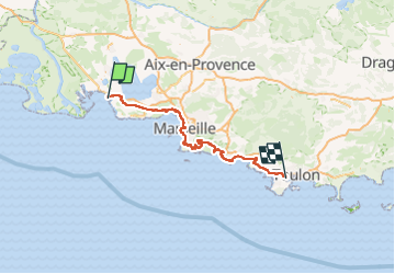
Trail of 140 km to be discovered at France. This trail is proposed by Patriste.

Description

Quatrième étape de mon Mare Nostrum Gravel de Cerbère à Menton.
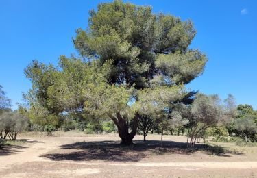
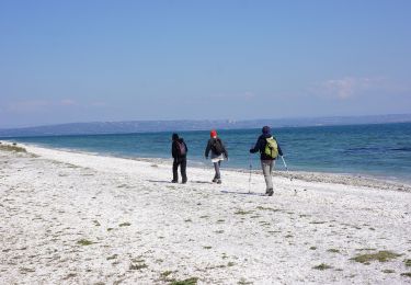
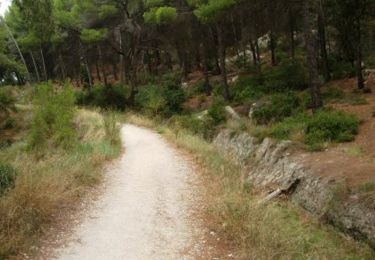
Passage près de la mer mais aussi incursions dans les massifs littoraux.
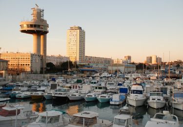
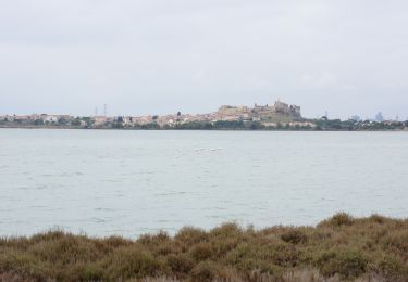
Programme du jour : Martigues, collines de la Nerthe, Marseille, Marseilleveyre et le canal de Marseille à la Campagne Pastré, les calanques jusqu'à Cassis, Col de Sormiou, Col des Baumettes, Col des Escourtines, Col de Morgiou, Col de Sugiton, Col de la Gineste, Col de la Gardiole, Port-Miou, route des crêtes jusqu'à La Ciotat, Six-Fours, etc.

Compte-rendu complet et photos sur www.lecyclerit.com.

Elevation profile

Positioning

Country:
France
Region :
Unknown
Department/Province :
Unknown
Municipality :
Unknown
Location:
Unknown
Start:(Dec)
Start:(UTM)
660647 ; 4807566 (31T) N.

Trails nearby

Trail On foot Port-de-Bouc - La Presqu’ile - Le sentier du littoral - Photo
On foot
GUIDE+

On foot

Easy
Port-de-Bouc, Provence-Alpes-Côte d'Azur, Bouches-du-Rhône, France
3.9 km | 4.5 km-effort
1h 0min
Yes
Trail On foot Port-de-Bouc - Forêt de Castillon Etangs de Pourra et d’Engrenier - Photo
On foot
GUIDE+

On foot

Easy
Port-de-Bouc, Provence-Alpes-Côte d'Azur, Bouches-du-Rhône, France
6.1 km | 7.7 km-effort
1h 45min
No
Trail Walking Martigues - Parc de Figuerolles 26.5.24 - Photo
Walking
GUIDE
fredetpascale

Walking

Easy
Martigues, Provence-Alpes-Côte d'Azur, Bouches-du-Rhône, France
9.4 km | 11 km-effort
3h 0min
Yes
Trail Walking Martigues - le parc de Figuerolles - Photo
Walking
GUIDE
amiral13

Walking

Very easy
(1)
Martigues, Provence-Alpes-Côte d'Azur, Bouches-du-Rhône, France
9.4 km | 11 km-effort
3h 13min
Yes
Trail On foot Martigues - Boucle de Figuerolles - Photo
On foot
GUIDE+

On foot

Easy
Martigues, Provence-Alpes-Côte d'Azur, Bouches-du-Rhône, France
6 km | 7.2 km-effort
1h 38min
Yes
Trail Walking Martigues - Martigues - parc de Figuerolles - Photo
Walking
mhetpierre

Walking

Very easy
(1)
Martigues, Provence-Alpes-Côte d'Azur, Bouches-du-Rhône, France
9.5 km | 11.8 km-effort
3h 38min
Yes
Trail Walking Port-de-Bouc - St Mitre les Remparts - les étangs - Photo
Walking
mhetpierre

Walking

Difficult
(1)
Port-de-Bouc, Provence-Alpes-Côte d'Azur, Bouches-du-Rhône, France
10.8 km | 13.1 km-effort
3h 35min
Yes
Trail On foot Fos-sur-Mer - Fos - tour etang de l'Estomac - Photo
On foot
mhetpierre

On foot

Easy
Fos-sur-Mer, Provence-Alpes-Côte d'Azur, Bouches-du-Rhône, France
8.3 km | 9.2 km-effort
2h 5min
Yes
Trail Mountain bike Port-de-Bouc - Forêt de Castillon - Port de Bouc - Photo
Mountain bike
tracegps

Mountain bike

Medium
(1)
Port-de-Bouc, Provence-Alpes-Côte d'Azur, Bouches-du-Rhône, France
12.2 km | 14.6 km-effort
55min
Yes


Close
My subscriptions