![](/images/other/stat-length.png)
![Trail Walking Voerendaal - Ubachsberg - Photo](https://media.geolcdn.com/t/1900/400/d88cde66-eb84-4f59-9345-cf6fc456e898.jpg&format=pjpeg&maxdim=2)
Ubachsberg
Je vous emmène sur mes chemins
Par Mumu.larandonneuse
![Length](/images/other/stat-length.png)
![Max alt](https://static1.geolcdn.com/siteimages/upload/files/1508320355ic_sort_altitude_max_24dp.png)
![Uphill gradient](https://static1.geolcdn.com/siteimages/upload/files/1508320355ic_sort_den_pos_24dp.png)
![Km-Effort](/images/other/stat-length.png)
![Min alt](https://static1.geolcdn.com/siteimages/upload/files/1508320355ic_sort_altitude_min_24dp.png)
![Downhill gradient](https://static1.geolcdn.com/siteimages/upload/files/1508320355ic_sort_den_neg_24dp.png)
![Boucle](https://static1.geolcdn.com/siteimages/upload/files/16400158638029165_repeat_loop_refresh_sync_direction_icon.png)
![Walking](https://static1.geolcdn.com/sitytour/trail-icons/101.png)
3h09
Difficulty : Medium
![Scan this QR Code to open this trail in the SityTrail application](https://capi.geolives.com/qq0zvz2zws4bq2lad0pu/sitytour/trails/3976010/qr.png?size=200)
FREE GPS app for hiking
About
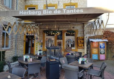
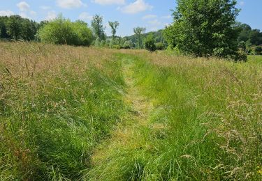
Trail Walking of 14 km to be discovered at Limburg, Unknown, Voerendaal. This trail is proposed by Je vous emmène sur mes chemins .
Description
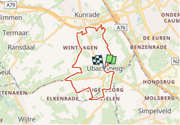
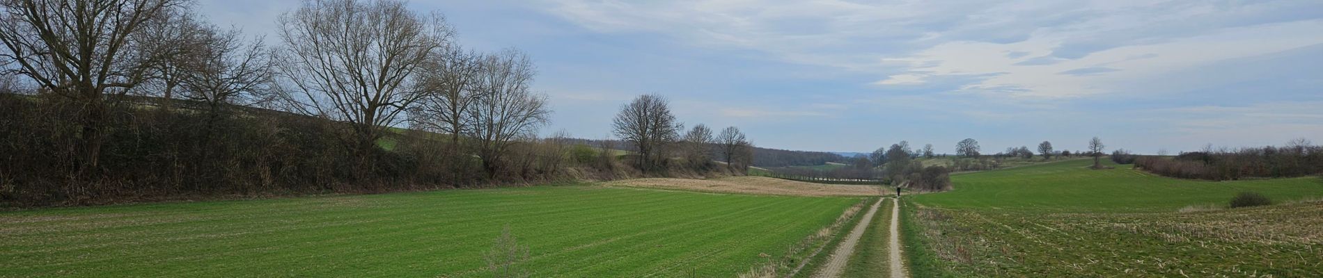
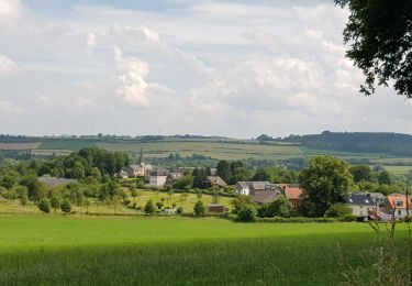
🇳🇱 Une randonnée dans la région de Voerendaal passant par le Kunderberg et plusieurs hameaux : Winthagen, Colmont, Trintelen et Mingersborg.
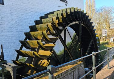
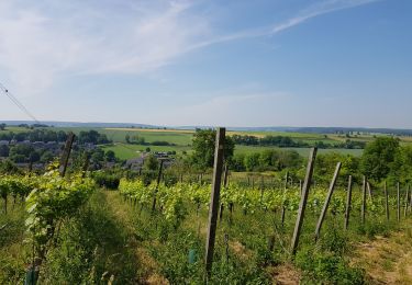
🏘 Ubachsberg est situé au milieu du "Land van Kalk", sur son propre plateau. Tout autour se trouvent des collines de prairies arides, des vignobles, des murs calcaires abrupts et des vergers fruitiers.
www.visitzuidlimburg.fr
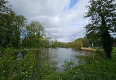
👀 Des panoramas à 360°
Positioning
Comments
Trails nearby
![Trail Walking Gulpen-Wittem - 2024-07-05_10h26m55_landsrade-g4-gulpen-wittem- - Photo](https://media.geolcdn.com/t/375/260/21c97729-ea16-405b-b733-eb2ef5b79dcc.jpg&format=jpg&maxdim=2)
![Walking Walking](https://static1.geolcdn.com/sitytour/trail-icons/101.png)
Walking
![](/images/other/stat-length.png)
![](https://static1.geolcdn.com/siteimages/upload/files/16400158638029165_repeat_loop_refresh_sync_direction_icon.png)
![Trail Walking Gulpen-Wittem - 2021-11-26_14h13m03_1450 (2) - Photo](https://media.geolcdn.com/t/375/260/c6f56cbd-561d-45be-8633-9d909ae47436.jpg&format=jpg&maxdim=2)
![Walking Walking](https://static1.geolcdn.com/sitytour/trail-icons/101.png)
Walking
![](/images/other/stat-length.png)
![](https://static1.geolcdn.com/siteimages/upload/files/16400158638029165_repeat_loop_refresh_sync_direction_icon.png)
![Trail Walking Gulpen-Wittem - 2021-10-27_21h13m45_1225 - Photo](https://media.geolcdn.com/t/375/260/5eb7c815-cdad-419c-9110-728d3ac43338.jpg&format=jpg&maxdim=2)
![Walking Walking](https://static1.geolcdn.com/sitytour/trail-icons/101.png)
Walking
![](/images/other/stat-length.png)
![](https://static1.geolcdn.com/siteimages/upload/files/16400158638029165_repeat_loop_refresh_sync_direction_icon.png)
![Trail Walking Gulpen-Wittem - 2021-10-27_20h47m33_1105 - Photo](https://media.geolcdn.com/t/375/260/115742d6-93f7-467f-9808-8e4bc3de0870.jpg&format=jpg&maxdim=2)
![Walking Walking](https://static1.geolcdn.com/sitytour/trail-icons/101.png)
Walking
![](/images/other/stat-length.png)
![](https://static1.geolcdn.com/siteimages/upload/files/16400158638029165_repeat_loop_refresh_sync_direction_icon.png)
![Trail Walking Gulpen-Wittem - 2021-07-01_13h51m24_077 - Photo](https://media.geolcdn.com/t/375/260/215e9d9a-5676-4aab-b7ac-fe070e30f244.jpg&format=jpg&maxdim=2)
![Walking Walking](https://static1.geolcdn.com/sitytour/trail-icons/101.png)
Walking
![](/images/other/stat-length.png)
![](https://static1.geolcdn.com/siteimages/upload/files/16400158638029165_repeat_loop_refresh_sync_direction_icon.png)
![Trail Walking Gulpen-Wittem - 2021-06-14_21h05m37_853 - Photo](https://media.geolcdn.com/t/375/260/4793f524-5e32-489e-afec-b0432ab44946.jpg&format=jpg&maxdim=2)
![Walking Walking](https://static1.geolcdn.com/sitytour/trail-icons/101.png)
Walking
![](/images/other/stat-length.png)
![](https://static1.geolcdn.com/siteimages/upload/files/16400158638029165_repeat_loop_refresh_sync_direction_icon.png)
![Trail Walking Gulpen-Wittem - 2022-06-10_16h45m42_1555 - Photo](https://media.geolcdn.com/t/375/260/ext.jpg?maxdim=2&url=https%3A%2F%2Fstatic1.geolcdn.com%2Fsiteimages%2Fupload%2Ffiles%2F1553511878bg_sport_marche.png)
![Walking Walking](https://static1.geolcdn.com/sitytour/trail-icons/101.png)
Walking
![](/images/other/stat-length.png)
![](https://static1.geolcdn.com/siteimages/upload/files/16400158638029165_repeat_loop_refresh_sync_direction_icon.png)
![Trail Walking Gulpen-Wittem - Wijlre - Photo](https://media.geolcdn.com/t/375/260/1f37460d-555a-4cb4-9779-3e8cd2d4f315.jpg&format=jpg&maxdim=2)
![Walking Walking](https://static1.geolcdn.com/sitytour/trail-icons/101.png)
![Trail Walking Voerendaal - Balade des châteaux - Photo](https://media.geolcdn.com/t/375/260/429ccad7-a9a0-46f3-9f3b-59ca949a9311.jpg&format=jpg&maxdim=2)
![Walking Walking](https://static1.geolcdn.com/sitytour/trail-icons/101.png)
Walking
![](/images/other/stat-length.png)
![](https://static1.geolcdn.com/siteimages/upload/files/16400158638029165_repeat_loop_refresh_sync_direction_icon.png)