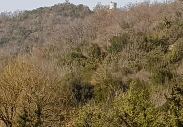
5.6 km | 7.8 km-effort
Clairac
jl.david
User
Length
7.2 km
Max alt
178 m
Uphill gradient
164 m
Km-Effort
9.4 km
Min alt
53 m
Downhill gradient
164 m
Boucle
Yes
Creation date :
2024-03-02 09:43:12.679
Updated on :
2024-04-05 20:39:22.036
2h08
Difficulty : Medium
FREE GPS app for hiking
About
Trail Walking of 7.2 km to be discovered at New Aquitaine, Lot-et-Garonne, Clairac. This trail is proposed by jl.david.
Positioning
Country:
France
Region :
New Aquitaine
Department/Province :
Lot-et-Garonne
Municipality :
Clairac
Location:
Unknown
Start:(Dec)
Start:(UTM)
291116 ; 4915295 (31T) N.
Comments
Trails nearby
Unet, petite randonnée entre Garonne et Lot - Pays Val de Garonne - Gascogne
Walking
Medium
(1)
Tonneins,
New Aquitaine,
Lot-et-Garonne,
France
2h 0min
Yes
Clairac, une boucle semi urbaine au bord du Lot - Pays de la vallée du Lot
Walking
Easy
Clairac,
New Aquitaine,
Lot-et-Garonne,
France
4.9 km | 5.5 km-effort
1h 40min
Yes
Unet, petite randonnée entre Garonne et Lot - Pays Val de Garonne - Gascogne
Mountain bike
Medium
Tonneins,
New Aquitaine,
Lot-et-Garonne,
France
5.6 km | 7.8 km-effort
45min
Yes
ASPTT DU 21/03/2024 _ Boucle Ayet/Pech de Berre/Ayet
Walking
Difficult
Nicole,
New Aquitaine,
Lot-et-Garonne,
France
11.1 km | 15.3 km-effort
3h 28min
Yes
Nicole 47 - Pech de Berre - Unet - Pech de Berre
Mountain bike
Difficult
Nicole,
New Aquitaine,
Lot-et-Garonne,
France
14.3 km | 19 km-effort
1h 34min
Yes
Unet
Walking
Medium
Tonneins,
New Aquitaine,
Lot-et-Garonne,
France
7.5 km | 9.9 km-effort
2h 44min
No
Pauville Tonneins
Walking
Medium
Tonneins,
New Aquitaine,
Lot-et-Garonne,
France
7.5 km | 10 km-effort
2h 15min
Yes
Unet
Walking
Medium
Tonneins,
New Aquitaine,
Lot-et-Garonne,
France
6.4 km | 8.9 km-effort
2h 15min
Yes
Clairac court
Walking
Medium
Clairac,
New Aquitaine,
Lot-et-Garonne,
France
5.3 km | 6.4 km-effort
1h 27min
Yes