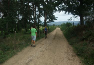
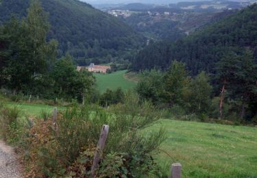
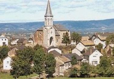
Trail  Val d'Arcomie - Le Calvaire du Recoux et la Pierre Branlante de la Roche - Photo

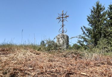
Le Calvaire du Recoux et la Pierre Branlante de la Roche

© OpenStreetMap contributors
Length
Length
13.1 km
Max alt
Max alt
1066 m
Uphill gradient
Uphill gradient
282 m
Km-Effort
Km-Effort  
16.8 km
Min alt
Min alt
928 m
Downhill gradient
Downhill gradient
282 m
Boucle
Boucle
Yes
Creation date :
2024-02-29 17:26:46.884
Updated on :
2024-02-29 17:26:46.884

(1 Reviews)


Scan this QR Code to open this trail in the SityTrail application

FREE GPS app for hiking

Logo SityTrail SityTrail

IGN / Geographical institutes

Download SityTrail from the App Store Download SityTrail from Google Play

Logo SityTrail SityTrail World

The world is yours!

Download SityTrail from the App Store Download SityTrail from Google Play Download SityTrail on Huawei AppGallery

About

Trail of 13.1 km to be discovered at Auvergne-Rhône-Alpes, Cantal, Val d'Arcomie. This trail is proposed by nicolas54230.

Elevation profile

Points of interest

Point of interest Val d'Arcomie - Parking cimetière - Photo
nicolas54230
VAL D'ARCOMIE 
Point of interest Val d'Arcomie - Carrefour de Deneyres - Photo
nicolas54230
VAL D'ARCOMIE 
Point of interest Val d'Arcomie - Intersection avant la D248 - Photo
nicolas54230
Point of interest Val d'Arcomie - Croisement vers la Bessière - Photo
nicolas54230
Point of interest Val d'Arcomie - Sortie de Rageac - Photo
nicolas54230
VAL D'ARCOMIE 
Point of interest Val d'Arcomie - Croisement D348 - Photo
nicolas54230
VAL D'ARCOMIE 
Point of interest Val d'Arcomie - Saint-Marc  - Photo
nicolas54230
VAL D'ARCOMIE 
Point of interest Val d'Arcomie - Fourche - Photo
nicolas54230
VAL D'ARCOMIE 
Point of interest Val d'Arcomie - Accès au calvaire - Photo
nicolas54230
VAL D'ARCOMIE 
Point of interest Val d'Arcomie - Embranchement à droite route de la Bessière - Photo
nicolas54230
Point of interest Val d'Arcomie - Traversée de la D248 - Photo
nicolas54230
VAL D'ARCOMIE 
Point of interest Val d'Arcomie - Croisée Route de Sanière - Photo
nicolas54230
Point of interest Val d'Arcomie - Route D248 - Photo
nicolas54230
VAL D'ARCOMIE 
Point of interest Val d'Arcomie - Carrefour de la boucle - Photo
nicolas54230
VAL D'ARCOMIE 
Point of interest Val d'Arcomie - Parking cimetière - Photo
nicolas54230
VAL D'ARCOMIE 

Positioning

Country:
France
Region :
Auvergne-Rhône-Alpes
Department/Province :
Cantal
Municipality :
Val d'Arcomie
Location:
Faverolles
Start:(UTM)
512027 ; 4972671 (31T) N.

Comments

Please log in to post a review or rate the element


Trails nearby

Trail Walking Val d'Arcomie - Circuit Margeride Truyère - Saint Marc et Saint Just - Photo
Walking
tracegps

Walking

Medium
(1)
Val d'Arcomie, Auvergne-Rhône-Alpes, Cantal, France
14.7 km | 18.8 km-effort
3h 25min
Yes
Trail Walking Maurines - LES GORGES DU BES - Photo
Walking
Phil36

Walking

Medium
(1)
Maurines, Auvergne-Rhône-Alpes, Cantal, France
6.5 km | 9.2 km-effort
2h 5min
Yes
Trail Mountain bike Val d'Arcomie - La vallée de la Truyère près de Loubaresse - Photo
Mountain bike
tracegps

Mountain bike

Medium
Val d'Arcomie, Auvergne-Rhône-Alpes, Cantal, France
10.5 km | 14.7 km-effort
1h 30min
Yes
Trail Walking Val d'Arcomie - La vallée de la Truyère près de Loubaresse - Photo
Walking
tracegps

Walking

Medium
Val d'Arcomie, Auvergne-Rhône-Alpes, Cantal, France
10.5 km | 14.7 km-effort
2h 40min
Yes
Trail Mountain bike Val d'Arcomie - Petit Circuit panoramique - Faverolles - Photo
Mountain bike
tracegps

Mountain bike

Easy
Val d'Arcomie, Auvergne-Rhône-Alpes, Cantal, France
4.4 km | 6.1 km-effort
19min
Yes
Trail Walking Val d'Arcomie - Petit Circuit panoramique - Faverolles - Photo
Walking
tracegps

Walking

Easy
Val d'Arcomie, Auvergne-Rhône-Alpes, Cantal, France
4.4 km | 6.1 km-effort
1h 10min
Yes
Trail Mountain bike Val d'Arcomie - Grand Tour de Faverolles - Photo
Mountain bike
tracegps

Mountain bike

Medium
Val d'Arcomie, Auvergne-Rhône-Alpes, Cantal, France
10.3 km | 13.7 km-effort
1h 0min
Yes
Trail Walking Val d'Arcomie - Grand Tour de Faverolles - Photo
Walking
tracegps

Walking

Medium
(1)
Val d'Arcomie, Auvergne-Rhône-Alpes, Cantal, France
10.3 km | 13.7 km-effort
2h 34min
Yes
Trail Walking Maurines - le bez,départ de Morsange  - Photo
Walking
GILOU440

Walking

Medium
Maurines, Auvergne-Rhône-Alpes, Cantal, France
6.6 km | 9.3 km-effort
2h 45min
Yes


Close
My subscriptions