![](/images/other/stat-length.png)
![Trail Walking Évenos - Cap Gros en partant du col du corps de Garde - Photo](https://media.geolcdn.com/t/1900/400/ccb67bc2-636c-41db-bcb8-403fc7ac864d.jpg&format=pjpeg&maxdim=2)
Cap Gros en partant du col du corps de Garde
FSantoni
User
![Length](/images/other/stat-length.png)
Length
17.1 km
![Max alt](https://static1.geolcdn.com/siteimages/upload/files/1508320355ic_sort_altitude_max_24dp.png)
Max alt
572 m
![Uphill gradient](https://static1.geolcdn.com/siteimages/upload/files/1508320355ic_sort_den_pos_24dp.png)
Uphill gradient
704 m
![Km-Effort](/images/other/stat-length.png)
Km-Effort
26 km
![Min alt](https://static1.geolcdn.com/siteimages/upload/files/1508320355ic_sort_altitude_min_24dp.png)
Min alt
237 m
![Downhill gradient](https://static1.geolcdn.com/siteimages/upload/files/1508320355ic_sort_den_neg_24dp.png)
Downhill gradient
704 m
![Boucle](https://static1.geolcdn.com/siteimages/upload/files/16400158638029165_repeat_loop_refresh_sync_direction_icon.png)
Boucle
Yes
Creation date :
2024-02-21 07:23:37.929
Updated on :
2024-02-21 17:13:02.085
![Walking](https://static1.geolcdn.com/sitytour/trail-icons/101.png)
6h29
Difficulty : Very difficult
![Scan this QR Code to open this trail in the SityTrail application](https://capi.geolives.com/qq0zvz2zws4bq2lad0pu/sitytour/trails/3957527/qr.png?size=200)
FREE GPS app for hiking
About
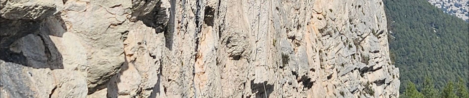
Trail Walking of 17.1 km to be discovered at Provence-Alpes-Côte d'Azur, Var, Évenos. This trail is proposed by FSantoni.
Description
Très beau parcours, assez technique avec plusieurs passages avec des éboulis.
Positioning
Country:
France
Region :
Provence-Alpes-Côte d'Azur
Department/Province :
Var
Municipality :
Évenos
Location:
Unknown
Start:(Dec)
Start:(UTM)
734770 ; 4783796 (31T) N.
Comments
Trails nearby
![Trail Walking Ollioules - SityTrail - 1041295 - le-destel-grotte-des-joncs - Photo](https://media.geolcdn.com/t/375/260/b00c002a-3425-4f84-ae24-7620ef9e7315.jpg&format=jpg&maxdim=2)
![Walking Walking](https://static1.geolcdn.com/sitytour/trail-icons/101.png)
SityTrail - 1041295 - le-destel-grotte-des-joncs
Walking
Medium
(1)
Ollioules,
Provence-Alpes-Côte d'Azur,
Var,
France
![](/images/other/stat-length.png)
11.8 km | 19.3 km-effort
4h 23min
![](https://static1.geolcdn.com/siteimages/upload/files/16400158638029165_repeat_loop_refresh_sync_direction_icon.png)
Yes
![Trail Walking Évenos - SityTrail - st anne d'evenos. - Photo](https://media.geolcdn.com/t/375/260/1a61a6ef-600e-4900-ae4e-54737b695f44.jpg&format=jpg&maxdim=2)
![Walking Walking](https://static1.geolcdn.com/sitytour/trail-icons/101.png)
SityTrail - st anne d'evenos.
Walking
Difficult
(1)
Évenos,
Provence-Alpes-Côte d'Azur,
Var,
France
![](/images/other/stat-length.png)
13 km | 18.7 km-effort
4h 15min
![](https://static1.geolcdn.com/siteimages/upload/files/16400158638029165_repeat_loop_refresh_sync_direction_icon.png)
Yes
![Trail Walking Le Revest-les-Eaux - Boucle: La ripelle - Source de la ripelle - Le Chateau de Tourris - Les grottes de sable - La carrière aux fourmis - Les puits renovés de M. Lambicchi - Les ruines des Olivières - La ferme de la Touravelle - à Le Revest-les-Eaux - Photo](https://media.geolcdn.com/t/375/260/0dbff04b-2a84-4eed-a6e8-7a56bc074382.jpg&format=jpg&maxdim=2)
![Walking Walking](https://static1.geolcdn.com/sitytour/trail-icons/101.png)
Boucle: La ripelle - Source de la ripelle - Le Chateau de Tourris - Les grott...
Walking
Medium
(1)
Le Revest-les-Eaux,
Provence-Alpes-Côte d'Azur,
Var,
France
![](/images/other/stat-length.png)
14.1 km | 21 km-effort
4h 15min
![](https://static1.geolcdn.com/siteimages/upload/files/16400158638029165_repeat_loop_refresh_sync_direction_icon.png)
Yes
![Trail Walking Toulon - Faron côté nord - Photo](https://media.geolcdn.com/t/375/260/1a97f987-c174-4fc8-a435-d00586c57288.jpg&format=jpg&maxdim=2)
![Walking Walking](https://static1.geolcdn.com/sitytour/trail-icons/101.png)
Faron côté nord
Walking
Difficult
(1)
Toulon,
Provence-Alpes-Côte d'Azur,
Var,
France
![](/images/other/stat-length.png)
4.6 km | 10.1 km-effort
3h 8min
![](https://static1.geolcdn.com/siteimages/upload/files/16400158638029165_repeat_loop_refresh_sync_direction_icon.png)
No
![Trail Walking Le Revest-les-Eaux - 83 barrage revest les eaux 24-05-2021 - Photo](https://media.geolcdn.com/t/375/260/1106c6f7-fedf-4077-96a1-b48580038b53.jpg&format=jpg&maxdim=2)
![Walking Walking](https://static1.geolcdn.com/sitytour/trail-icons/101.png)
83 barrage revest les eaux 24-05-2021
Walking
Medium
(1)
Le Revest-les-Eaux,
Provence-Alpes-Côte d'Azur,
Var,
France
![](/images/other/stat-length.png)
8 km | 12.3 km-effort
3h 41min
![](https://static1.geolcdn.com/siteimages/upload/files/16400158638029165_repeat_loop_refresh_sync_direction_icon.png)
Yes
![Trail Walking Toulon - Tour Du Baou par falaises - Photo](https://media.geolcdn.com/t/375/260/ext.jpg?maxdim=2&url=https%3A%2F%2Fservices.sitytrail.com%2FGeolivesWS%2FDownloadMedia.ashx%3FTrailID%3D166161%26Media%3D20121215151840.jpeg)
![Walking Walking](https://static1.geolcdn.com/sitytour/trail-icons/101.png)
Tour Du Baou par falaises
Walking
Medium
(1)
Toulon,
Provence-Alpes-Côte d'Azur,
Var,
France
![](/images/other/stat-length.png)
7.3 km | 11.3 km-effort
2h 10min
![](https://static1.geolcdn.com/siteimages/upload/files/16400158638029165_repeat_loop_refresh_sync_direction_icon.png)
Yes
![Trail Walking Évenos - Le broussan croupatier fin randonnée - Photo](https://media.geolcdn.com/t/375/260/ec3fd25e-452d-47c7-8bcf-accd29bcb68e.jpg&format=jpg&maxdim=2)
![Walking Walking](https://static1.geolcdn.com/sitytour/trail-icons/101.png)
Le broussan croupatier fin randonnée
Walking
Medium
(3)
Évenos,
Provence-Alpes-Côte d'Azur,
Var,
France
![](/images/other/stat-length.png)
10.6 km | 14.9 km-effort
5h 18min
![](https://static1.geolcdn.com/siteimages/upload/files/16400158638029165_repeat_loop_refresh_sync_direction_icon.png)
Yes
![Trail Walking Le Revest-les-Eaux - Boucle: Ripelle - Touravelle - Ruines des olivieres - Carrière aux fourmis - Grottes de sables - Vieille valette - Tourris - Source - Ripelle - Photo](https://media.geolcdn.com/t/375/260/ext.jpg?maxdim=2&url=https%3A%2F%2Fstatic1.geolcdn.com%2Fsiteimages%2Fupload%2Ffiles%2F1553511878bg_sport_marche.png)
![Walking Walking](https://static1.geolcdn.com/sitytour/trail-icons/101.png)
Boucle: Ripelle - Touravelle - Ruines des olivieres - Carrière aux fourmis ...
Walking
Medium
(1)
Le Revest-les-Eaux,
Provence-Alpes-Côte d'Azur,
Var,
France
![](/images/other/stat-length.png)
13.4 km | 19.4 km-effort
5h 0min
![](https://static1.geolcdn.com/siteimages/upload/files/16400158638029165_repeat_loop_refresh_sync_direction_icon.png)
Yes
![Trail Walking Évenos - Sainte Anne d'Evenos Le Gros Cerveau - Photo](https://media.geolcdn.com/t/375/260/ext.jpg?maxdim=2&url=https%3A%2F%2Fservices.sitytrail.com%2FGeolivesWS%2FDownloadMedia.ashx%3FTrailID%3D104105%26Media%3D7169_2.jpg)
![Walking Walking](https://static1.geolcdn.com/sitytour/trail-icons/101.png)
Sainte Anne d'Evenos Le Gros Cerveau
Walking
Difficult
(3)
Évenos,
Provence-Alpes-Côte d'Azur,
Var,
France
![](/images/other/stat-length.png)
7 km | 11.8 km-effort
3h 30min
![](https://static1.geolcdn.com/siteimages/upload/files/16400158638029165_repeat_loop_refresh_sync_direction_icon.png)
Yes