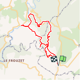
![](/images/other/stat-length.png)
![Trail Walking Notre-Dame-de-Londres - Ravin des Arcs - Pont Saint Etienne d'Issensac - Photo](https://media.geolcdn.com/t/1900/400/ext.pjpeg?maxdim=2&url=https%3A%2F%2Fstatic1.geolcdn.com%2Fsiteimages%2Fupload%2Ffiles%2F1553511878bg_sport_marche.png)
Ravin des Arcs - Pont Saint Etienne d'Issensac
vertygo
User
![Length](/images/other/stat-length.png)
![Max alt](https://static1.geolcdn.com/siteimages/upload/files/1508320355ic_sort_altitude_max_24dp.png)
![Uphill gradient](https://static1.geolcdn.com/siteimages/upload/files/1508320355ic_sort_den_pos_24dp.png)
![Km-Effort](/images/other/stat-length.png)
![Min alt](https://static1.geolcdn.com/siteimages/upload/files/1508320355ic_sort_altitude_min_24dp.png)
![Downhill gradient](https://static1.geolcdn.com/siteimages/upload/files/1508320355ic_sort_den_neg_24dp.png)
![Boucle](https://static1.geolcdn.com/siteimages/upload/files/16400158638029165_repeat_loop_refresh_sync_direction_icon.png)
![Walking](https://static1.geolcdn.com/sitytour/trail-icons/101.png)
6h04
Difficulty : Medium
![Scan this QR Code to open this trail in the SityTrail application](https://capi.geolives.com/qq0zvz2zws4bq2lad0pu/sitytour/trails/395744/qr.png?size=200)
FREE GPS app for hiking
About
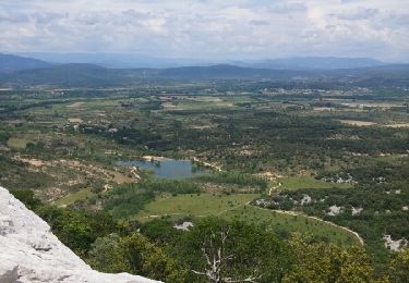
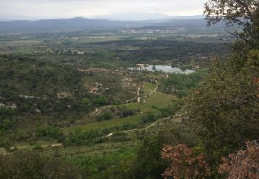
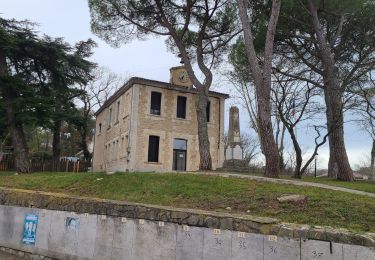
Trail Walking of 19.7 km to be discovered at Occitania, Hérault, Notre-Dame-de-Londres. This trail is proposed by vertygo.
Description
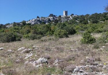
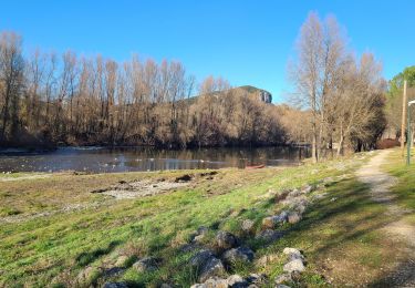
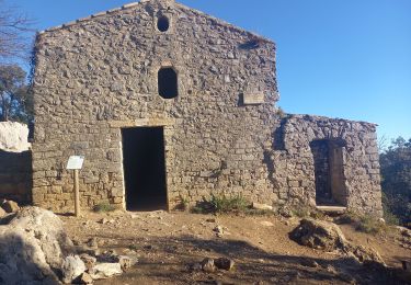
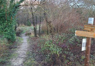
Départ du pont de Masclac au Nord de Saint Martin de Londres - Deux débuts de parcours possibles pour atteindre le Ravin des Arcs, par le GR Sud qui oblige un passage à gué, ou par le GR Nord si le Lamalou est trop haut. Après avoir profité des curiosités au niveau des arcs, emprunter le GR vers le Nord en surplomb des gorges. Le Roc Rouge vaut le détour pour le large panorama offert sur les gorges du Lamalou, avec au Sud Est le Pic Saint Loup, et au Nord Ouest le Massif de La Séranne. Reprendre le GR vers le Nord en empruntant une voie abandonnée surplombant la Combe Pluvieuse. Rejoindre le Pont de Saint Etienne d'Issensac en descendant l'Hérault sur 200 m. Reprendre la route sur 1 km pour rejoindre la Combe des Mûriers et contourner une grande carrière en activité. Le retour par le Sud s'effectue par des sentiers plus ou moins étroits au début. Les sentiers au point 412m du Grand Bois de Boissière sont à l'abandon. Il faut bartasser sur 300m en descente pour atteindre des voies beaucoup plus larges et rejoindre plus loin le GR vers le point de départ.
Positioning
Comments
Trails nearby
![Trail Walking Cazevieille - le tour du pic st loup - Photo](https://media.geolcdn.com/t/375/260/ext.jpg?maxdim=2&url=https%3A%2F%2Fservices.sitytrail.com%2FGeolivesWS%2FDownloadMedia.ashx%3FTrailID%3D564155%26Media%3Dfix__20160505154449.jpg)
![Walking Walking](https://static1.geolcdn.com/sitytour/trail-icons/101.png)
Walking
![](/images/other/stat-length.png)
![](https://static1.geolcdn.com/siteimages/upload/files/16400158638029165_repeat_loop_refresh_sync_direction_icon.png)
![Trail Walking Mas-de-Londres - 2 Mas de Londres par la Jasse du 18-01-2025 - Photo](https://media.geolcdn.com/t/375/260/192185da-9693-40df-bfdc-9922ac5fb37b.jpg&format=jpg&maxdim=2)
![Walking Walking](https://static1.geolcdn.com/sitytour/trail-icons/101.png)
Walking
![](/images/other/stat-length.png)
![](https://static1.geolcdn.com/siteimages/upload/files/16400158638029165_repeat_loop_refresh_sync_direction_icon.png)
![Trail Walking Mas-de-Londres - A Mas de Londres à Saint Bauzille de Putois par le GR 60 du 17-01-2025 - Photo](https://media.geolcdn.com/t/375/260/b8a71293-24db-4889-bcb9-e61559e24369.jpg&format=jpg&maxdim=2)
![Walking Walking](https://static1.geolcdn.com/sitytour/trail-icons/101.png)
Walking
![](/images/other/stat-length.png)
![](https://static1.geolcdn.com/siteimages/upload/files/16400158638029165_repeat_loop_refresh_sync_direction_icon.png)
![Trail Walking Cazevieille - Pic St Loup + Crête 16.12.23 - Photo](https://media.geolcdn.com/t/375/260/bfdaf89a-9773-4f5d-a083-c292c0cb02a4.jpg&format=jpg&maxdim=2)
![Walking Walking](https://static1.geolcdn.com/sitytour/trail-icons/101.png)
Walking
![](/images/other/stat-length.png)
![](https://static1.geolcdn.com/siteimages/upload/files/16400158638029165_repeat_loop_refresh_sync_direction_icon.png)
![Trail Walking Cazevieille - cazevieille-pic st loup-lac fe la jasse - Photo](https://media.geolcdn.com/t/375/260/ext.jpg?maxdim=2&url=https%3A%2F%2Fservices.sitytrail.com%2FGeolivesWS%2FDownloadMedia.ashx%3FTrailID%3D579300%26Media%3Dfix__20160604134108.jpg)
![Walking Walking](https://static1.geolcdn.com/sitytour/trail-icons/101.png)
Walking
![](/images/other/stat-length.png)
![](https://static1.geolcdn.com/siteimages/upload/files/16400158638029165_repeat_loop_refresh_sync_direction_icon.png)
![Trail Nordic walking Cazevieille - cazevieille + lac de la jasse - Photo](https://media.geolcdn.com/t/375/260/ext.jpg?maxdim=2&url=https%3A%2F%2Fservices.sitytrail.com%2FGeolivesWS%2FDownloadMedia.ashx%3FTrailID%3D565622%26Media%3Dfix__20160508095919.jpg)
![Nordic walking Nordic walking](https://static1.geolcdn.com/sitytour/trail-icons/102.png)
Nordic walking
![](/images/other/stat-length.png)
![](https://static1.geolcdn.com/siteimages/upload/files/16400158638029165_repeat_loop_refresh_sync_direction_icon.png)
![Trail Walking Notre-Dame-de-Londres - Ravin des Arc 01 - Photo](https://media.geolcdn.com/t/375/260/ext.jpg?maxdim=2&url=https%3A%2F%2Fstatic1.geolcdn.com%2Fsiteimages%2Fupload%2Ffiles%2F1553511878bg_sport_marche.png)
![Walking Walking](https://static1.geolcdn.com/sitytour/trail-icons/101.png)
Walking
![](/images/other/stat-length.png)
![](https://static1.geolcdn.com/siteimages/upload/files/16400158638029165_repeat_loop_refresh_sync_direction_icon.png)
![Trail Walking Mas-de-Londres - 4 Mas de Londres - La Liquière - La Borie du 23-01-2025 - Photo](https://media.geolcdn.com/t/375/260/05102a87-29f6-4667-8235-12dc17719fa1.jpg&format=jpg&maxdim=2)
![Walking Walking](https://static1.geolcdn.com/sitytour/trail-icons/101.png)
Walking
![](/images/other/stat-length.png)
![](https://static1.geolcdn.com/siteimages/upload/files/16400158638029165_repeat_loop_refresh_sync_direction_icon.png)
![Trail Walking Mas-de-Londres - 1 Mas de Londres par la Borie du 14/01/2025 - Photo](https://media.geolcdn.com/t/375/260/9f35497f-19ee-4dfe-a684-9fc067c1b5db.jpg&format=jpg&maxdim=2)
![Walking Walking](https://static1.geolcdn.com/sitytour/trail-icons/101.png)
Walking
![](/images/other/stat-length.png)
![](https://static1.geolcdn.com/siteimages/upload/files/16400158638029165_repeat_loop_refresh_sync_direction_icon.png)