Trail On foot Sausset-les-Pins - Sausset les pins Cap Couronne - Photo
© OpenStreetMap contributors
Length
Length
7 km
Max alt
Max alt
26 m
Uphill gradient
Uphill gradient
67 m
Km-Effort
Km-Effort  
8 km
Min alt
Min alt
0 m
Downhill gradient
Downhill gradient
85 m
Boucle
Boucle
No
Creation date :
2024-02-18 16:06:27.657
Updated on :
2024-02-18 16:08:01.807

(0 Reviews)

On foot
On foot
1h48
Difficulty : Easy
Walking
Walking
1h48
Difficulty : Medium
Nordic walking
Nordic walking
0m
Difficulty : Very easy

Scan this QR Code to open this trail in the SityTrail application

FREE GPS app for hiking

Logo SityTrail SityTrail

IGN / Geographical institutes

Download SityTrail from the App Store Download SityTrail from Google Play

Logo SityTrail SityTrail World

The world is yours!

Download SityTrail from the App Store Download SityTrail from Google Play Download SityTrail on Huawei AppGallery

About

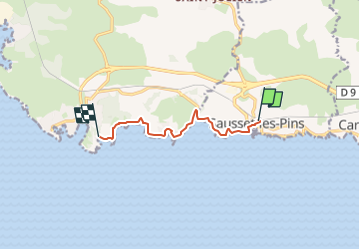
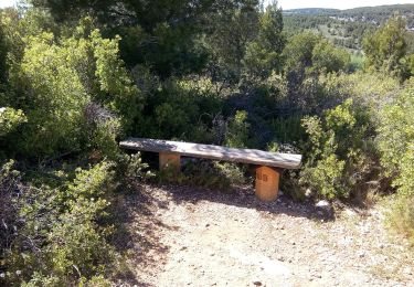
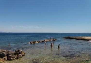
Trail On foot of 7 km to be discovered at Provence-Alpes-Côte d'Azur, Bouches-du-Rhône, Sausset-les-Pins. This trail is proposed by portefaix.

Description

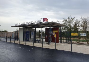
Tracé depuis la gare de Sausset pour une rando en aller retour sur le sentier des douaniers

Elevation profile

Positioning

Country:
France
Region :
Provence-Alpes-Côte d'Azur
Department/Province :
Bouches-du-Rhône
Municipality :
Sausset-les-Pins
Location:
Unknown
Start:(UTM)
671050 ; 4799927 (31T) N.

Trails nearby

Trail Walking Martigues - PF-La Côte bleue - Cap Couronne - Photo
Walking
MicDul

Walking

Very easy
(2)
Martigues, Provence-Alpes-Côte d'Azur, Bouches-du-Rhône, France
21 km | 24 km-effort
5h 18min
Yes
Trail Walking Martigues - Cap couronne  - Photo
Walking
GUIDE
nadinebondoux

Walking

Medium
Martigues, Provence-Alpes-Côte d'Azur, Bouches-du-Rhône, France
21 km | 25 km-effort
5h 17min
Yes
Trail On foot Martigues - Les carrières de pierre de La Couronne - Photo
On foot
GUIDE+

On foot

Easy
Martigues, Provence-Alpes-Côte d'Azur, Bouches-du-Rhône, France
3.1 km | 3.4 km-effort
45min
No
Trail On foot Martigues - Boucle de Boumandariel - Photo
On foot
GUIDE+

On foot

Easy
Martigues, Provence-Alpes-Côte d'Azur, Bouches-du-Rhône, France
5.8 km | 6.6 km-effort
1h 30min
Yes
Trail On foot Martigues - Le Cap Couronne - Photo
On foot
GUIDE+

On foot

Medium
Martigues, Provence-Alpes-Côte d'Azur, Bouches-du-Rhône, France
20 km | 24 km-effort
5h 22min
No
Trail On foot Sausset-les-Pins - Mer et Pinéde Valapoux - Photo
On foot
GUIDE+

On foot

Easy
Sausset-les-Pins, Provence-Alpes-Côte d'Azur, Bouches-du-Rhône, France
6.6 km | 7.9 km-effort
1h 47min
Yes
Trail On foot Carry-le-Rouet - Le Vallon de Jaume par les Grottes - Photo
On foot
GUIDE+

On foot

Easy
Carry-le-Rouet, Provence-Alpes-Côte d'Azur, Bouches-du-Rhône, France
7.5 km | 10.2 km-effort
2h 19min
No
Trail On foot Carry-le-Rouet - Le Tour du Romaron - Photo
On foot
GUIDE+

On foot

Easy
Carry-le-Rouet, Provence-Alpes-Côte d'Azur, Bouches-du-Rhône, France
7.3 km | 10 km-effort
2h 15min
No
Trail On foot Carry-le-Rouet - Entre calanques et collines - Photo
On foot
GUIDE+

On foot

Easy
Carry-le-Rouet, Provence-Alpes-Côte d'Azur, Bouches-du-Rhône, France
11.8 km | 14.6 km-effort
3h 19min
No


Close
My subscriptions