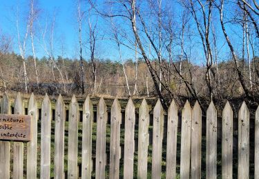
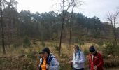
Trail Walking Fontainebleau - GLM-150311 - PVerte-Fourceau-Béatrix - Photo

GLM-150311 - PVerte-Fourceau-Béatrix

 randodan
randodan

User

© OpenStreetMap contributors
Length
Length
16.5 km
Max alt
Max alt
141 m
Uphill gradient
Uphill gradient
290 m
Km-Effort
Km-Effort  
20 km
Min alt
Min alt
88 m
Downhill gradient
Downhill gradient
294 m
Boucle
Boucle
Yes
Creation date :
2015-03-17 00:00:00.0
Updated on :
2015-03-17 00:00:00.0

(1 Reviews)

Walking
Walking
6h00
Difficulty : Medium

Scan this QR Code to open this trail in the SityTrail application

FREE GPS app for hiking

Logo SityTrail SityTrail
IGN / Geographical institutes

Download SityTrail from the App Store Download SityTrail from Google Play

Logo SityTrail SityTrail World
The world is yours!

Download SityTrail from the App Store Download SityTrail from Google Play Download SityTrail on Huawei AppGallery

About

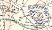
Trail Walking of 16.5 km to be discovered at Ile-de-France, Seine-et-Marne, Fontainebleau. This trail is proposed by randodan.

Description

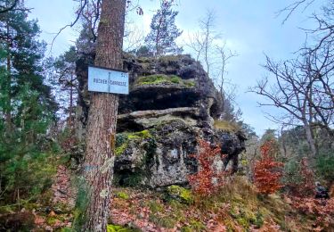
Les Gais Lurons à la découverte des abris de carriers du Rocher Fourceau<br>
- 11 mars 2015 -<br>
8h45, départ du parking de la Plaine Verte . Cap à l'Est jusqu'aux Naturalistes, puis cap au Nord via la Mare aux Fées . Routes de la Grande Mare, des Ecuries de la Reine, et des Forts de Marlotte.<br>
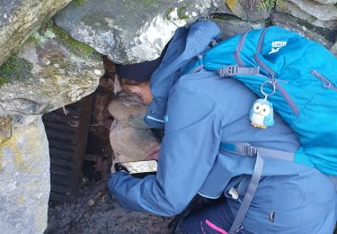
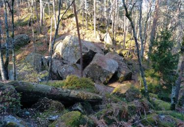
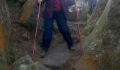
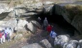
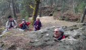
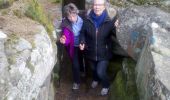
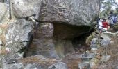
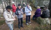
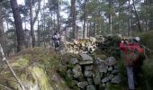
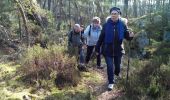
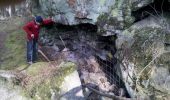
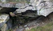
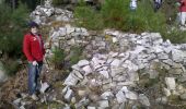
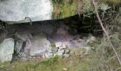
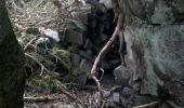
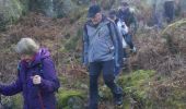
10h, on part en RTT <small>(Rando Tout Terrain)</small> pour la "course au trésor" . Premier abri trouvé par JC et JP, 2e par Nadine, 3e aperçu par Bernard ; bref, chacun se passionne pour cette chasse à l'abri . Le 4e, le plus beau : il a couloir, chambre, fenêtre, et même salon de jardin ! Mais vers 10h45 les estomacs n'ont plus la patience d'attendre l'abri suivant et réclament la pause chamallows.<br>
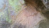
Un dernier abri sur cette crête à côté duquel Claude découvre des gravures rupestres, puis on descend prendre la Route de Valmy . Deux derniers abris pour les 3 plus mordus et ensuite on allonge le pas, plein Sud, car tous sont tenaillés par la faim.<br>
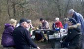
12h45, sommes attablés confortablement et Bernard ouvre les hostilités avec sa célèbre et fameuse Epinette (cuvée 2012), accompagnée d'une pizza de Nadine, et pour clore le pique-nique, un gâteau de Geneviève.<br>
14h, partons pour une petite boucle sur le Denecourt 11 jusqu'à la Grotte Béatrix.<br>
16h, de retour au parking, après une interview d'un représentant de l'ONF sur notre avis concernant l'entretient (entre-autre) du massif forestier de Fontainebleau.<br>
11 participants.

Elevation profile

Photos

Points of interest

Point of interest Fontainebleau - 01 - Sur la Route de la Grande Mare, en approche de la Gorge aux Loups, un arbre creux - Photo
randodan
Point of interest Fontainebleau - 02 - Le 1er abri - Photo
randodan
FONTAINEBLEAU 
Point of interest Fontainebleau - 03 - Le 2e abri - Photo
randodan
FONTAINEBLEAU 
Point of interest Fontainebleau - 04 - Le 3e abri - Photo
randodan
FONTAINEBLEAU 
Point of interest Fontainebleau - 05 - Entre 2 abris <small>(© Jean-Claude)</small> - Photo
randodan
Point of interest Fontainebleau - 06 - Le 4e abri - Photo
randodan
FONTAINEBLEAU 
Point of interest Fontainebleau - 07 - 10h45, pause chamallows - Photo
randodan
Point of interest Fontainebleau - 08 - Le 5e abri - Photo
randodan
FONTAINEBLEAU 
Point of interest Fontainebleau - 09 -  Gravures rupestres - Photo
randodan
Point of interest Fontainebleau - 10 - La descente vers Valmy - Photo
randodan
Point of interest Fontainebleau - 11 - Sur Valmy - Photo
randodan
FONTAINEBLEAU 
Point of interest Fontainebleau - 12 - Sur le retour, un 6e abri - Photo
randodan
Point of interest Fontainebleau - 13 - Le 7e et dernier abri - Photo
randodan
Point of interest Fontainebleau - 14 - Le pique-nique sur l'aire de la Plaine Verte - Photo
randodan
Point of interest Fontainebleau - 15 - Dans la Brèche de Bièra (B) - Photo
randodan
Point of interest Fontainebleau - 16 -  Le Fauteuil d’Isidore Bonheur (Z) <small>(Frère de Rosa)</small> - Photo
randodan
Point of interest Fontainebleau - 17 - La Grotte Béatrix - Photo
randodan
Point of interest Fontainebleau - 18 - Dans la descente du Sentier de l'Enfer - Photo
randodan
Point of interest Fontainebleau - 19 - Quelques liens très intéressants - Photo
randodan

Positioning

Country:
France
Region :
Ile-de-France
Department/Province :
Seine-et-Marne
Municipality :
Fontainebleau
Location:
Unknown
Start:(UTM)
479830 ; 5355688 (31U) N.

Comments

Please log in to post a review or rate the element


Trails nearby

Trail Walking Fontainebleau - La Mare aux Fées 18km - Forêt de Fontainebleau - Photo
Walking
onftest

Walking

Medium
(5)
Fontainebleau, Ile-de-France, Seine-et-Marne, France
18 km | 22 km-effort
4h 41min
Yes
Trail On foot Fontainebleau - Boucle 28 km en forêt de Fontainebleau  - Photo
On foot
GUIDE
chessyca

On foot

Medium
(1)
Fontainebleau, Ile-de-France, Seine-et-Marne, France
28 km | 34 km-effort
7h 43min
Yes
Trail Walking Fontainebleau - Boucle 30 km Veni Venelles Vici - Photo
Walking
GUIDE
chessyca

Walking

Very difficult
(1)
Fontainebleau, Ile-de-France, Seine-et-Marne, France
30 km | 35 km-effort
6h 0min
No
Trail Walking Bourron-Marlotte - Boucle Bourron Marlotte ( reco Didier) - Photo
Walking
GUIDE
chessyca

Walking

Easy
(1)
Bourron-Marlotte, Ile-de-France, Seine-et-Marne, France
28 km | 32 km-effort
5h 35min
Yes
Trail Walking Fontainebleau - Rocher Fourceau-Petit Mont Chauvet SR210523Ve?? fmg - Photo
Walking
fmg

Walking

Very difficult
(2)
Fontainebleau, Ile-de-France, Seine-et-Marne, France
19.5 km | 24 km-effort
5h 27min
Yes
Trail Walking Fontainebleau - Rando mares aux fees Gilles18 km - Photo
Walking
GUIDE
jeanmarcMasson

Walking

Very difficult
(1)
Fontainebleau, Ile-de-France, Seine-et-Marne, France
17.8 km | 22 km-effort
4h 58min
Yes
Trail Walking Fontainebleau - viennes carosses - Photo
Walking
Yannick.Boireau

Walking

Very easy
(2)
Fontainebleau, Ile-de-France, Seine-et-Marne, France
10.8 km | 14 km-effort
2h 50min
Yes
Trail Walking Fontainebleau - Sentier Denecourt N°9 Rocher des Demoiselles - Photo
Walking
aubr

Walking

Medium
(1)
Fontainebleau, Ile-de-France, Seine-et-Marne, France
5 km | 6.3 km-effort
1h 25min
Yes
Trail On foot Moret-Loing-et-Orvanne - La basse vallée du Lunain version 30 km - Photo
On foot
GUIDE
chessyca

On foot

Difficult
Moret-Loing-et-Orvanne, Ile-de-France, Seine-et-Marne, France
30 km | 34 km-effort
7h 39min
Yes


Close
My subscriptions