


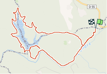

18.2 km | 27 km-effort


User


FREE GPS app for hiking
 SityTrail
IGN / Geographical institutes
SityTrail World
The world is yours!
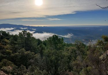
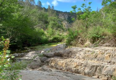
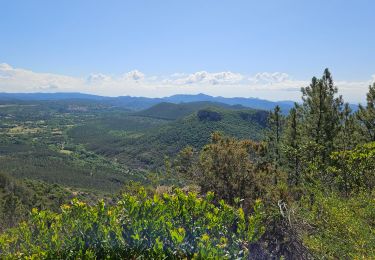
Trail Walking of 8.1 km to be discovered at Provence-Alpes-Côte d'Azur, Var, Saint-Paul-en-Forêt. This trail is proposed by cb8310.
rando sans soucis autour du lac de Meaulx, sauf après le barrage avec un passage abrupt à flanc de colline qui devrait être mieux indiqué car très dangereux ,d'où demi-tour pour emprunter un petit sentier à travers la forêt qui nous ramène au point de départ

Walking

On foot

Walking


sport

sport

sport
Walking
Walking
Walking