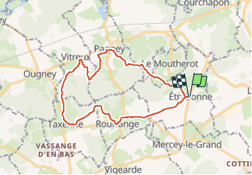
![](/images/other/stat-length.png)
![Trail Walking Étrabonne - etrabonne et plus que ça - Photo](https://media.geolcdn.com/t/1900/400/9c32791f-b75f-4c77-981b-2e4e8f164f2f.jpg&format=pjpeg&maxdim=2)
etrabonne et plus que ça
eltonnermou
User
![Length](/images/other/stat-length.png)
![Max alt](https://static1.geolcdn.com/siteimages/upload/files/1508320355ic_sort_altitude_max_24dp.png)
![Uphill gradient](https://static1.geolcdn.com/siteimages/upload/files/1508320355ic_sort_den_pos_24dp.png)
![Km-Effort](/images/other/stat-length.png)
![Min alt](https://static1.geolcdn.com/siteimages/upload/files/1508320355ic_sort_altitude_min_24dp.png)
![Downhill gradient](https://static1.geolcdn.com/siteimages/upload/files/1508320355ic_sort_den_neg_24dp.png)
![Boucle](https://static1.geolcdn.com/siteimages/upload/files/16400158638029165_repeat_loop_refresh_sync_direction_icon.png)
![Walking](https://static1.geolcdn.com/sitytour/trail-icons/101.png)
2h37
Difficulty : Medium
![Scan this QR Code to open this trail in the SityTrail application](https://capi.geolives.com/qq0zvz2zws4bq2lad0pu/sitytour/trails/3947551/qr.png?size=200)
FREE GPS app for hiking
About
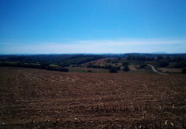
Trail Walking of 15.5 km to be discovered at Bourgogne-Franche-Comté, Doubs, Étrabonne. This trail is proposed by eltonnermou.
Description
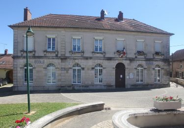
parking proche église, devant la mairie
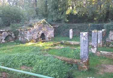
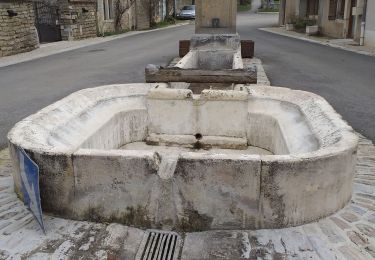
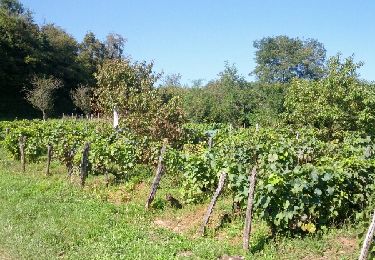
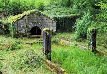
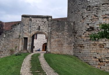
Randonnée très agréable, de très belles bâtisses et château (Étrabonne) .... à travers le paysage vallonné de notre région, avec de longues parties boisées.
Profitez de la traversée des villages pour admirez ces belles bâtisses, maisons de maîtres.
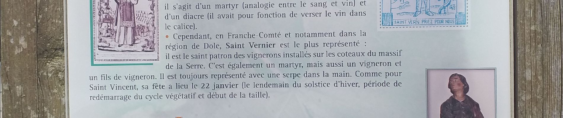
Et comme d'habitude, dans ces milieux "naturels" laissez vous surprendre par la vue fugace d'un chevreuil ou autre animal.
Positioning
Comments
Trails nearby
![Trail On foot Taxenne - Sentier de la Vigne - Photo](https://media.geolcdn.com/t/375/260/9bc3673e-5b69-4c3a-9376-a4e1ef265916.jpeg&format=jpg&maxdim=2)
![On foot On foot](https://static1.geolcdn.com/sitytour/trail-icons/100.png)
On foot
![](/images/other/stat-length.png)
![](https://static1.geolcdn.com/siteimages/upload/files/16400158638029165_repeat_loop_refresh_sync_direction_icon.png)
![Trail Walking Ferrières-les-Bois - Ferrières les bois - Photo](https://media.geolcdn.com/t/375/260/4aeeec34-c040-4993-adf2-b738b54dc94e.jpg&format=jpg&maxdim=2)
![Walking Walking](https://static1.geolcdn.com/sitytour/trail-icons/101.png)
Walking
![](/images/other/stat-length.png)
![](https://static1.geolcdn.com/siteimages/upload/files/16400158638029165_repeat_loop_refresh_sync_direction_icon.png)
![Trail Walking Taxenne - taxenne - Photo](https://media.geolcdn.com/t/375/260/ffa89f18-ac17-443d-97ec-31e2ee860f3f.jpg&format=jpg&maxdim=2)
![Walking Walking](https://static1.geolcdn.com/sitytour/trail-icons/101.png)
Walking
![](/images/other/stat-length.png)
![](https://static1.geolcdn.com/siteimages/upload/files/16400158638029165_repeat_loop_refresh_sync_direction_icon.png)
![Trail Nordic walking Taxenne - Taxenne - Vitreux - Rouffange - Photo](https://media.geolcdn.com/t/375/260/ext.jpg?maxdim=2&url=https%3A%2F%2Fservices.sitytrail.com%2FGeolivesWS%2FDownloadMedia.ashx%3FTrailID%3D342230%26Media%3Dfix__20140904160222.jpg)
![Nordic walking Nordic walking](https://static1.geolcdn.com/sitytour/trail-icons/102.png)
Nordic walking
![](/images/other/stat-length.png)
![](https://static1.geolcdn.com/siteimages/upload/files/16400158638029165_repeat_loop_refresh_sync_direction_icon.png)
![Trail Walking Ferrières-les-Bois - ferrières - Photo](https://media.geolcdn.com/t/375/260/6f3c0884-e1a9-4c92-a3e4-4a98ba4fb04f.jpg&format=jpg&maxdim=2)
![Walking Walking](https://static1.geolcdn.com/sitytour/trail-icons/101.png)
Walking
![](/images/other/stat-length.png)
![](https://static1.geolcdn.com/siteimages/upload/files/16400158638029165_repeat_loop_refresh_sync_direction_icon.png)
![Trail Walking Rouffange - Rouffange 13km 20210826 - Photo](https://media.geolcdn.com/t/375/260/91776899-609f-49b6-a6fe-4802d0949975.jpg&format=jpg&maxdim=2)
![Walking Walking](https://static1.geolcdn.com/sitytour/trail-icons/101.png)
Walking
![](/images/other/stat-length.png)
![](https://static1.geolcdn.com/siteimages/upload/files/16400158638029165_repeat_loop_refresh_sync_direction_icon.png)
![Trail Walking Ferrières-les-Bois - Ferrières les bois - Photo](https://media.geolcdn.com/t/375/260/9d8f2981-2b5f-4b8e-8a19-6558d4fdc505.jpg&format=jpg&maxdim=2)
![Walking Walking](https://static1.geolcdn.com/sitytour/trail-icons/101.png)
Walking
![](/images/other/stat-length.png)
![](https://static1.geolcdn.com/siteimages/upload/files/16400158638029165_repeat_loop_refresh_sync_direction_icon.png)
![Trail Walking Le Moutherot - moutherot - Photo](https://media.geolcdn.com/t/375/260/ext.jpg?maxdim=2&url=https%3A%2F%2Fstatic1.geolcdn.com%2Fsiteimages%2Fupload%2Ffiles%2F1553511878bg_sport_marche.png)
![Walking Walking](https://static1.geolcdn.com/sitytour/trail-icons/101.png)
Walking
![](/images/other/stat-length.png)
![](https://static1.geolcdn.com/siteimages/upload/files/16400158638029165_repeat_loop_refresh_sync_direction_icon.png)
![Trail Walking Pagney - pagney moutherot - Photo](https://media.geolcdn.com/t/375/260/ext.jpg?maxdim=2&url=https%3A%2F%2Fstatic1.geolcdn.com%2Fsiteimages%2Fupload%2Ffiles%2F1553511878bg_sport_marche.png)
![Walking Walking](https://static1.geolcdn.com/sitytour/trail-icons/101.png)
Walking
![](/images/other/stat-length.png)
![](https://static1.geolcdn.com/siteimages/upload/files/16400158638029165_repeat_loop_refresh_sync_direction_icon.png)