Trail Walking Roquebrune-sur-Argens - Saint-Aygulf - La Gaillarde - Etangs de Villepey - Sentier des douaniers - Photo

Saint-Aygulf - La Gaillarde - Etangs de Villepey - Sentier des douaniers

© OpenStreetMap contributors
Length
Length
14 km
Max alt
Max alt
247 m
Uphill gradient
Uphill gradient
323 m
Km-Effort
Km-Effort  
18.3 km
Min alt
Min alt
0 m
Downhill gradient
Downhill gradient
322 m
Boucle
Boucle
Yes
Creation date :
2024-02-09 14:44:19.262
Updated on :
2024-02-09 14:48:23.21

(0 Reviews)

Walking
Walking
4h09
Difficulty : Medium

Scan this QR Code to open this trail in the SityTrail application

FREE GPS app for hiking

Logo SityTrail SityTrail

IGN / Geographical institutes

Download SityTrail from the App Store Download SityTrail from Google Play

Logo SityTrail SityTrail World

The world is yours!

Download SityTrail from the App Store Download SityTrail from Google Play Download SityTrail on Huawei AppGallery

About

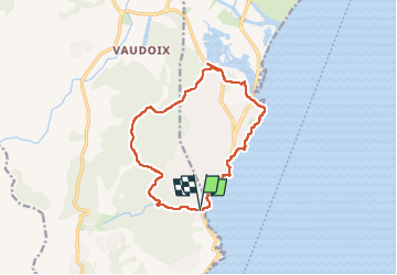
Trail Walking of 14 km to be discovered at Provence-Alpes-Côte d'Azur, Var, Roquebrune-sur-Argens. This trail is proposed by boulinevelyne.

Description

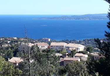
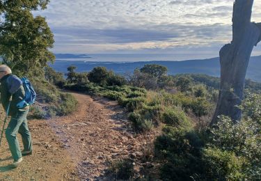
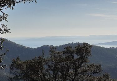
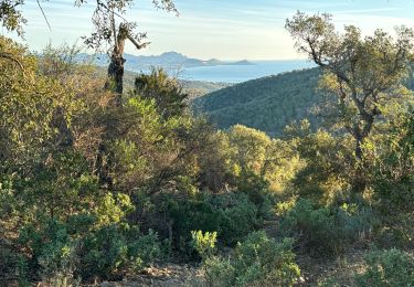
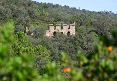
Une randonnée très variée. Départ du bord de mer pour monter au sommet des petites Maures. Très beau panorama. Descente par un beau vallon vers les étangs de Villepey et retour par le sentier des douaniers.
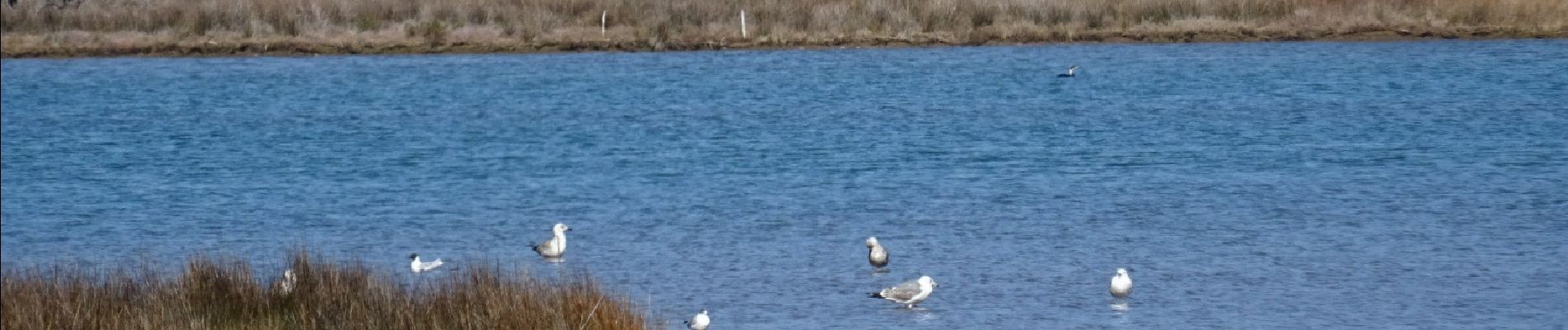
Début mars vous avez encore les mimosas en fleurs. Observation des oiseaux aux étangs de Villepey. Attention le retour par le sentier des douaniers n'est pas toujours facile, il se dégrade régulièrement. Il est possible d'écourter si les genoux en ont assez en remontant sur la route.

Elevation profile

Photos

Points of interest

Point of interest Fréjus - pt2 - Photo
boulinevelyne
FRÉJUS 
Point of interest Roquebrune-sur-Argens - pt1 - Photo
boulinevelyne
ROQUEBRUNE-SUR-ARGENS 

Positioning

Country:
France
Region :
Provence-Alpes-Côte d'Azur
Department/Province :
Var
Municipality :
Roquebrune-sur-Argens
Location:
Unknown
Start:(Dec)
Start:(UTM)
314609 ; 4804199 (32T) N.

Trails nearby

Trail Walking Fréjus - Etang de Villepey - Photo
Walking
marmotte83

Walking

Very easy
(2)
Fréjus, Provence-Alpes-Côte d'Azur, Var, France
6.5 km | 7 km-effort
3h 4min
Yes
Trail Walking Roquebrune-sur-Argens - 200526 Les Issambres - Photo
Walking
bebenoit83

Walking

Medium
(1)
Roquebrune-sur-Argens, Provence-Alpes-Côte d'Azur, Var, France
8.3 km | 12.2 km-effort
2h 33min
Yes
Trail Walking Roquebrune-sur-Argens - la Gaillarde  - Photo
Walking
GUIDE
nadinebondoux

Walking

Easy
Roquebrune-sur-Argens, Provence-Alpes-Côte d'Azur, Var, France
6.5 km | 10.1 km-effort
1h 59min
Yes
Trail Walking Roquebrune-sur-Argens - Gaillarde - Photo
Walking
erikr

Walking

Easy
(2)
Roquebrune-sur-Argens, Provence-Alpes-Côte d'Azur, Var, France
8.3 km | 12.7 km-effort
2h 40min
Yes
Trail Walking Fréjus - VVA 2109 Etangs de Villepey - Photo
Walking
jmheydorff

Walking

Easy
(1)
Fréjus, Provence-Alpes-Côte d'Azur, Var, France
17 km | 19.6 km-effort
4h 13min
Yes
Trail Walking Fréjus - petites maures  - Photo
Walking
Matamimi

Walking

Difficult
Fréjus, Provence-Alpes-Côte d'Azur, Var, France
12.9 km | 17.5 km-effort
4h 47min
No
Trail Walking Roquebrune-sur-Argens - Col du Bougnon : la Garonnette - Photo
Walking
ETMU5496

Walking

Medium
Roquebrune-sur-Argens, Provence-Alpes-Côte d'Azur, Var, France
17.6 km | 28 km-effort
6h 16min
Yes
Trail Walking Roquebrune-sur-Argens - La Bergerie - Piste des Clapiers - Bastide Abbe - Photo
Walking
LtZIP

Walking

Easy
Roquebrune-sur-Argens, Provence-Alpes-Côte d'Azur, Var, France
10.2 km | 13.4 km-effort
2h 39min
Yes
Trail Walking Roquebrune-sur-Argens - LES ISSAMBRES - BOUCLE PAR SAN PEIRE - Photo
Walking
jean-marie.parachini

Walking

Easy
Roquebrune-sur-Argens, Provence-Alpes-Côte d'Azur, Var, France
8.8 km | 11.5 km-effort
5h 6min
Yes


Close
My subscriptions