![](/images/other/stat-length.png)
![Trail Walking Laudun-l'Ardoise - Camp de César - Photo](https://media.geolcdn.com/t/1900/400/d5a384ff-a456-4015-9a11-54cd89317120.jpg&format=pjpeg&maxdim=2)
Camp de César
GOIOLIRIBES
User
![Length](/images/other/stat-length.png)
![Max alt](https://static1.geolcdn.com/siteimages/upload/files/1508320355ic_sort_altitude_max_24dp.png)
![Uphill gradient](https://static1.geolcdn.com/siteimages/upload/files/1508320355ic_sort_den_pos_24dp.png)
![Km-Effort](/images/other/stat-length.png)
![Min alt](https://static1.geolcdn.com/siteimages/upload/files/1508320355ic_sort_altitude_min_24dp.png)
![Downhill gradient](https://static1.geolcdn.com/siteimages/upload/files/1508320355ic_sort_den_neg_24dp.png)
![Boucle](https://static1.geolcdn.com/siteimages/upload/files/16400158638029165_repeat_loop_refresh_sync_direction_icon.png)
![Walking](https://static1.geolcdn.com/sitytour/trail-icons/101.png)
6h17
Difficulty : Very difficult
![Scan this QR Code to open this trail in the SityTrail application](https://capi.geolives.com/qq0zvz2zws4bq2lad0pu/sitytour/trails/3943303/qr.png?size=200)
FREE GPS app for hiking
About
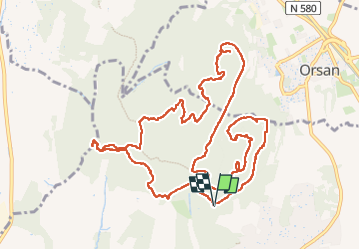
Trail Walking of 14.9 km to be discovered at Occitania, Gard, Laudun-l'Ardoise. This trail is proposed by GOIOLIRIBES.
Description
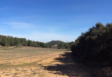
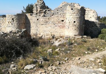
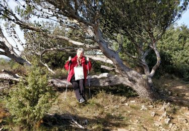
Départ de la randonnée au parking du camp de César. Très belle randonnée de 15 kms avec un peu de dénivelé (3 montées caillouteuses) qui se méritent pour arriver à de beaux panoramas. Chemins très agréables et la plupart ombragés.
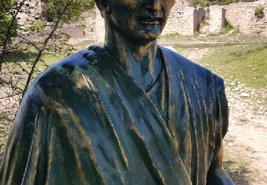
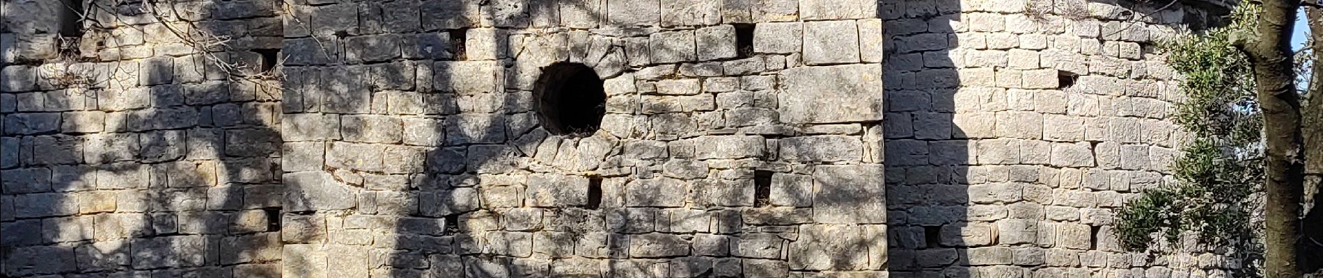
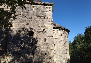
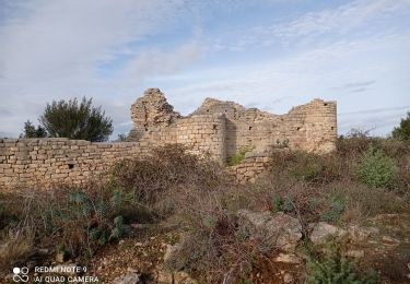
Ensuite oppidum, ruines, et Chapelle de Castres au milieu des chênes.
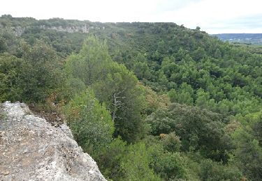
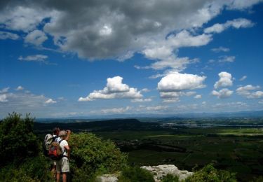
Repas tiré du sac, installés au bord de la falaise avec vue sur le Rhône.
Positioning
Comments
Trails nearby
![Trail Walking Laudun-l'Ardoise - 30 camp de cesar - Photo](https://media.geolcdn.com/t/375/260/3a336c68-96d1-47ed-8893-44d2a09973df.jpg&format=jpg&maxdim=2)
![Walking Walking](https://static1.geolcdn.com/sitytour/trail-icons/101.png)
Walking
![](/images/other/stat-length.png)
![](https://static1.geolcdn.com/siteimages/upload/files/16400158638029165_repeat_loop_refresh_sync_direction_icon.png)
![Trail Walking Laudun-l'Ardoise - 30 camp de César 12/07/23 - Photo](https://media.geolcdn.com/t/375/260/b6923c2c-a6f4-44eb-961e-2efc9564941a.jpg&format=jpg&maxdim=2)
![Walking Walking](https://static1.geolcdn.com/sitytour/trail-icons/101.png)
Walking
![](/images/other/stat-length.png)
![](https://static1.geolcdn.com/siteimages/upload/files/16400158638029165_repeat_loop_refresh_sync_direction_icon.png)
![Trail Walking Chusclan - PF-Chusclan - Dent de Marcoule et Château de Gicon - Photo](https://media.geolcdn.com/t/375/260/f10873c5-07cb-49fe-9595-b037cf2e17a6.jpg&format=jpg&maxdim=2)
![Walking Walking](https://static1.geolcdn.com/sitytour/trail-icons/101.png)
Walking
![](/images/other/stat-length.png)
![](https://static1.geolcdn.com/siteimages/upload/files/16400158638029165_repeat_loop_refresh_sync_direction_icon.png)
![Trail Mountain bike Bagnols-sur-Cèze - Rando VTT du plateau de Lacau 35km - Photo](https://media.geolcdn.com/t/375/260/ext.jpg?maxdim=2&url=https%3A%2F%2Fservices.sitytrail.com%2FGeolivesWS%2FDownloadMedia.ashx%3FTrailID%3D632644%26Media%3Dfix__20160918110742.jpg)
![Mountain bike Mountain bike](https://static1.geolcdn.com/sitytour/trail-icons/202.png)
Mountain bike
![](/images/other/stat-length.png)
![](https://static1.geolcdn.com/siteimages/upload/files/16400158638029165_repeat_loop_refresh_sync_direction_icon.png)
![Trail Walking Orsan - Chapelle St Pierre - Photo](https://media.geolcdn.com/t/375/260/ext.jpg?maxdim=2&url=https%3A%2F%2Fstatic1.geolcdn.com%2Fsiteimages%2Fupload%2Ffiles%2F1553511878bg_sport_marche.png)
![Walking Walking](https://static1.geolcdn.com/sitytour/trail-icons/101.png)
Walking
![](/images/other/stat-length.png)
![](https://static1.geolcdn.com/siteimages/upload/files/16400158638029165_repeat_loop_refresh_sync_direction_icon.png)
![Trail Walking Orsan - Orsan - Chapelle de St Jean de Castres - Photo](https://media.geolcdn.com/t/375/260/ext.jpg?maxdim=2&url=https%3A%2F%2Fservices.sitytrail.com%2FGeolivesWS%2FDownloadMedia.ashx%3FTrailID%3D105314%26Media%3D9005_4.jpg)
![Walking Walking](https://static1.geolcdn.com/sitytour/trail-icons/101.png)
Walking
![](/images/other/stat-length.png)
![](https://static1.geolcdn.com/siteimages/upload/files/16400158638029165_repeat_loop_refresh_sync_direction_icon.png)
![Trail Walking Orsan - Orsan - Photo](https://media.geolcdn.com/t/375/260/4eb1248d-2eba-4484-ab8d-a608b5d56ba5.jpg&format=jpg&maxdim=2)
![Walking Walking](https://static1.geolcdn.com/sitytour/trail-icons/101.png)
![Trail Walking Laudun-l'Ardoise - Camp César 1 - Photo](https://media.geolcdn.com/t/375/260/c5bd3f62-f30a-42fe-a946-ba9608c8e44c.jpg&format=jpg&maxdim=2)
![Walking Walking](https://static1.geolcdn.com/sitytour/trail-icons/101.png)
Walking
![](/images/other/stat-length.png)
![](https://static1.geolcdn.com/siteimages/upload/files/16400158638029165_repeat_loop_refresh_sync_direction_icon.png)
![Trail Walking Orsan - Camp de César - Photo](https://media.geolcdn.com/t/375/260/ext.jpg?maxdim=2&url=https%3A%2F%2Fservices.sitytrail.com%2FGeolivesWS%2FDownloadMedia.ashx%3FTrailID%3D951262%26Media%3Dfix__20180425145646.jpg)
![Walking Walking](https://static1.geolcdn.com/sitytour/trail-icons/101.png)