


 (null)2d73a32012fbb405f85d3457f10971c41")
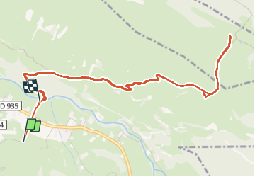

7.7 km | 11.3 km-effort


FREE GPS app for hiking
 SityTrail
IGN / Geographical institutes
SityTrail World
The world is yours!
Trail Walking of 7.1 km to be discovered at Occitania, Hautespyrenees, Campan. This trail is proposed by (null) (null)2d73a32012fbb405f85d3457f10971c41.
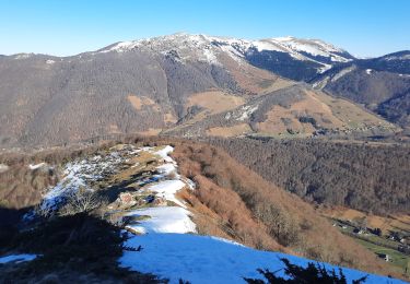
Soleil au dessus mer de nuages

Walking

Road bike
Walking
Walking
Walking
Walking
Snowshoes

Walking
Walking