


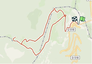

7.6 km | 10.8 km-effort

User GUIDE


FREE GPS app for hiking
 SityTrail
IGN / Geographical institutes
SityTrail World
The world is yours!
Trail Walking of 13.7 km to be discovered at Auvergne-Rhône-Alpes, Drôme, Chamaloc. This trail is proposed by thonyc.
Au départ du col du Rousset, entrée sud du tunnel.
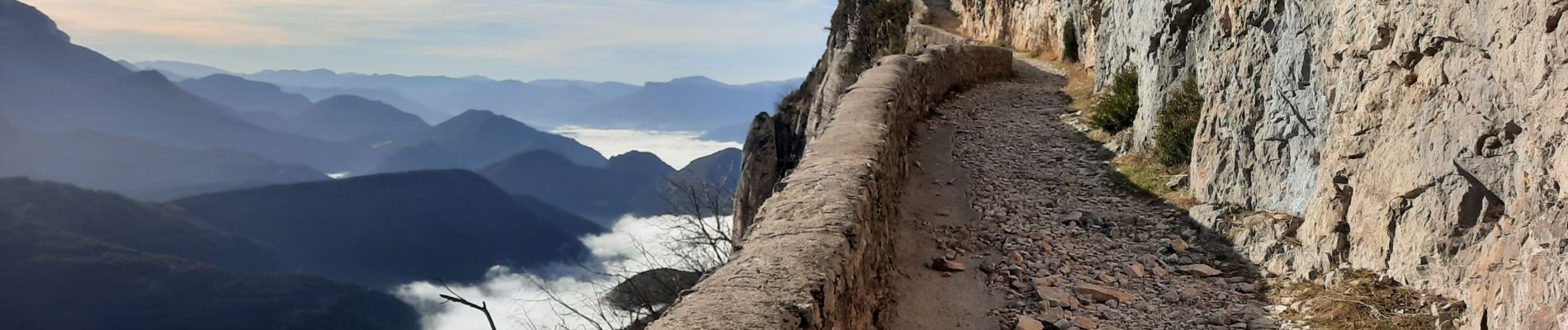
De très beaux panaoramas et une superbe montée le long de la falaise, en à-pic sur la vallée.


Snowshoes

Mountain bike

Walking

Walking

Walking
Walking
Walking

Walking

Walking