![](/images/other/stat-length.png)
![Trail Walking Longny les Villages - [Itinéraire] Le coteau de la Bandonnière - Photo](https://media.geolcdn.com/t/1900/400/ext.pjpeg?maxdim=2&url=https%3A%2F%2Fstatic1.geolcdn.com%2Fsiteimages%2Fupload%2Ffiles%2F1553511878bg_sport_marche.png)
[Itinéraire] Le coteau de la Bandonnière
ODDAD78
User
![Length](/images/other/stat-length.png)
![Max alt](https://static1.geolcdn.com/siteimages/upload/files/1508320355ic_sort_altitude_max_24dp.png)
![Uphill gradient](https://static1.geolcdn.com/siteimages/upload/files/1508320355ic_sort_den_pos_24dp.png)
![Km-Effort](/images/other/stat-length.png)
![Min alt](https://static1.geolcdn.com/siteimages/upload/files/1508320355ic_sort_altitude_min_24dp.png)
![Downhill gradient](https://static1.geolcdn.com/siteimages/upload/files/1508320355ic_sort_den_neg_24dp.png)
![Boucle](https://static1.geolcdn.com/siteimages/upload/files/16400158638029165_repeat_loop_refresh_sync_direction_icon.png)
![Walking](https://static1.geolcdn.com/sitytour/trail-icons/101.png)
18m
Difficulty : Easy
![Scan this QR Code to open this trail in the SityTrail application](https://capi.geolives.com/qq0zvz2zws4bq2lad0pu/sitytour/trails/3939678/qr.png?size=200)
FREE GPS app for hiking
About
Trail Walking of 827 m to be discovered at Normandy, Orne, Longny les Villages. This trail is proposed by ODDAD78.
Description
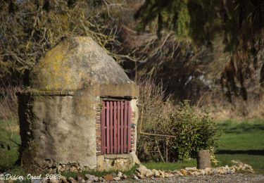
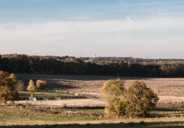
Sur ce coteau ensoleillé du Perche vivent une flore et une faune originales, aux tendances méridionales : thym, serpolet, mantes religieuses et criquets se rencontrent aisément en période estivale.
Des chèvres et moutons de race rustique, particulièrement adaptés à ce milieu, sont chargés d’entretenir la végétation.
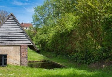
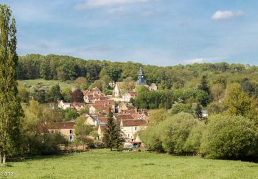
Ce sentier fait partie des Espaces Naturels Sensibles de l'Orne. Dominant le bourg de Longny-au-Perche il vous permettra, sur 900 mètres, de découvrir de multiples facettes d'un patrimoine naturel exceptionnellement préservé.
Pas à pas (Rando-Perche)
Départ : Longny-les-Villages Arrivée : Longny-les-Villages Communes : 1. Longny-au-Perche
Territoires refuges pour nombre de plantes (orchidées sauvages) et insectes (criquets, sauterelles, papillons), ces milieux apparaissent sur des sols pauvres. Le pâturage naturel (lapins, chevreuils) ou introduit par l'homme (moutons, chèvres), les conditions météorologiques et topographiques maintiennent une végétation rase, composée principalement de graminées.
Plus de 130 espèces végétales sont présentes sur le coteau. Sentier de découverte ouvert au public (900 m).
Site en accès libre toute l'année.
Visites guidées :
Association Faune et Flore de l’Orne. Tél. 02 33 26 26 62
Positioning
Comments
Trails nearby
![Trail Walking Longny les Villages - [Itinéraire] La Brisardière - Photo](https://media.geolcdn.com/t/375/260/19108d03-3d8a-43b4-b05b-172408edde68.jpeg&format=jpg&maxdim=2)
![Walking Walking](https://static1.geolcdn.com/sitytour/trail-icons/101.png)
Walking
![](/images/other/stat-length.png)
![](https://static1.geolcdn.com/siteimages/upload/files/16400158638029165_repeat_loop_refresh_sync_direction_icon.png)
![Trail Walking Bizou - [Itinéraire] Les sables du Perche - Photo](https://media.geolcdn.com/t/375/260/6b586e88-fad3-40df-be07-9b2a61186b9b.jpeg&format=jpg&maxdim=2)
![Walking Walking](https://static1.geolcdn.com/sitytour/trail-icons/101.png)
Walking
![](/images/other/stat-length.png)
![](https://static1.geolcdn.com/siteimages/upload/files/16400158638029165_repeat_loop_refresh_sync_direction_icon.png)
![Trail On foot Longny les Villages - Attelage - Forêt et Panoramas - forêt de Réno-Valdieu - Photo](https://media.geolcdn.com/t/375/260/db99a0ed-9413-4500-8368-446623bccd86.jpeg&format=jpg&maxdim=2)
![On foot On foot](https://static1.geolcdn.com/sitytour/trail-icons/100.png)
On foot
![](/images/other/stat-length.png)
![](https://static1.geolcdn.com/siteimages/upload/files/16400158638029165_repeat_loop_refresh_sync_direction_icon.png)
![Trail Walking Longny les Villages - La Fonte - Malétable 7,8 km - Photo](https://media.geolcdn.com/t/375/260/58715638-860a-4ade-9990-a9918a4f42a8.jpeg&format=jpg&maxdim=2)
![Walking Walking](https://static1.geolcdn.com/sitytour/trail-icons/101.png)
Walking
![](/images/other/stat-length.png)
![](https://static1.geolcdn.com/siteimages/upload/files/16400158638029165_repeat_loop_refresh_sync_direction_icon.png)
![Trail Walking Le Mage - Le Mage - Longny-au-Perche (Longny les Villages) 11 km - Photo](https://media.geolcdn.com/t/375/260/7da85c06-6bc5-432c-afb8-5444ae0d01ad.jpg&format=jpg&maxdim=2)
![Walking Walking](https://static1.geolcdn.com/sitytour/trail-icons/101.png)
Walking
![](/images/other/stat-length.png)
![](https://static1.geolcdn.com/siteimages/upload/files/16400158638029165_repeat_loop_refresh_sync_direction_icon.png)
![Trail Walking Le Mage - Le Mage - Moutiers-au-Perche 9,2 km - Photo](https://media.geolcdn.com/t/375/260/2d6a74b1-d9ee-4f0d-9acb-9c00ceb2d8ab.jpg&format=jpg&maxdim=2)
![Walking Walking](https://static1.geolcdn.com/sitytour/trail-icons/101.png)
Walking
![](/images/other/stat-length.png)
![](https://static1.geolcdn.com/siteimages/upload/files/16400158638029165_repeat_loop_refresh_sync_direction_icon.png)
![Trail Walking Longny les Villages - Longny-au-Perche (Longny-les-Villages) - Moutiers-au-Perche 13 km - Photo](https://media.geolcdn.com/t/375/260/994a1e71-8c6d-4d56-88cb-a3f14cc14c65.jpg&format=jpg&maxdim=2)
![Walking Walking](https://static1.geolcdn.com/sitytour/trail-icons/101.png)
Walking
![](/images/other/stat-length.png)
![](https://static1.geolcdn.com/siteimages/upload/files/16400158638029165_repeat_loop_refresh_sync_direction_icon.png)
![Trail Walking Longny les Villages - Longny-au-Perche (Longny-les-Villages) - Tourouvre 22 km - Photo](https://media.geolcdn.com/t/375/260/f6a882c6-7265-4c4e-81b2-b739ea6f09f8.jpg&format=jpg&maxdim=2)
![Walking Walking](https://static1.geolcdn.com/sitytour/trail-icons/101.png)
Walking
![](/images/other/stat-length.png)
![](https://static1.geolcdn.com/siteimages/upload/files/16400158638029165_repeat_loop_refresh_sync_direction_icon.png)
![Trail Walking Bizou - Bizou 10.1 Km - Photo](https://media.geolcdn.com/t/375/260/4d9e3be8-2feb-4dcb-8c0c-693e0d367f80.jpeg&format=jpg&maxdim=2)
![Walking Walking](https://static1.geolcdn.com/sitytour/trail-icons/101.png)