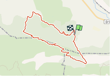
12.4 km | 23 km-effort
Pierre Impie et Roc de l'Aigle
Clo0413
User
Length
10.9 km
Max alt
1191 m
Uphill gradient
723 m
Km-Effort
21 km
Min alt
571 m
Downhill gradient
721 m
Boucle
Yes
Creation date :
2024-01-29 08:21:11.276
Updated on :
2024-01-29 18:08:09.029
4h39
Difficulty : Very difficult
FREE GPS app for hiking
About
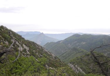
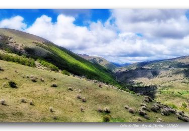
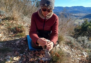
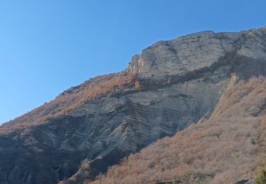
Trail Walking of 10.9 km to be discovered at Provence-Alpes-Côte d'Azur, Hautes-Alpes, Val-Buëch-Méouge. This trail is proposed by Clo0413.
Description
Randonnée sportive
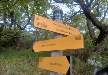
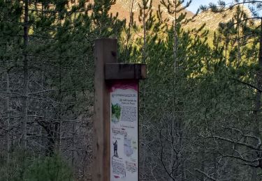
Bien suivre la trace GPX pour les sentiers non balisés
Positioning
Country:
France
Region :
Provence-Alpes-Côte d'Azur
Department/Province :
Hautes-Alpes
Municipality :
Val-Buëch-Méouge
Location:
Unknown
Start:(Dec)
Start:(UTM)
728955 ; 4898235 (31T) N.
Comments
Trails nearby
Rocher de pierre Impie, roc de l'aigle, pas de Berches
Walking
Medium
Val-Buëch-Méouge,
Provence-Alpes-Côte d'Azur,
Hautes-Alpes,
France
6h 1min
No
BEVONS crêtes de Chapage o l s m
Walking
Medium
Sisteron,
Provence-Alpes-Côte d'Azur,
Alpes-de-Haute-Provence,
France
8.2 km | 15 km-effort
2h 37min
Yes
PF-Le Jabron (04) entre Bevons et le Vieux Noyer
Walking
Difficult
(1)
Bevons,
Provence-Alpes-Côte d'Azur,
Alpes-de-Haute-Provence,
France
14.4 km | 22 km-effort
4h 57min
Yes
Crête de l'âne, des Planes et Roc de Gloritte Via Plaugiers
Walking
Very difficult
Val-Buëch-Méouge,
Provence-Alpes-Côte d'Azur,
Hautes-Alpes,
France
11.1 km | 23 km-effort
5h 19min
Yes
BEVONS. TOUR DE PENSIER .LE COLLET. CHAPELLE ST BEVONS. PAS DE L ESSAILLON. L...
Walking
Medium
Bevons,
Provence-Alpes-Côte d'Azur,
Alpes-de-Haute-Provence,
France
11.9 km | 17.9 km-effort
3h 15min
Yes
SISTERON . LE BOIS DE LA BUCHE . ROCHER DU TURC . CRETE DU MOLLARD . BATISTON...
Walking
Difficult
Sisteron,
Provence-Alpes-Côte d'Azur,
Alpes-de-Haute-Provence,
France
16.3 km | 24 km-effort
4h 34min
Yes
Bevons pierre impie roc de l'aigle 15.6km 950m
Walking
Medium
Bevons,
Provence-Alpes-Côte d'Azur,
Alpes-de-Haute-Provence,
France
15.6 km | 27 km-effort
8h 13min
Yes
Les Chapelles du vieux Noyer
Walking
Medium
Noyers-sur-Jabron,
Provence-Alpes-Côte d'Azur,
Alpes-de-Haute-Provence,
France
10.6 km | 16.6 km-effort
4h 2min
Yes
RIBIERS, col de Blauges . crêtes des Planes n
Walking
Medium
Val-Buëch-Méouge,
Provence-Alpes-Côte d'Azur,
Hautes-Alpes,
France
8.9 km | 17.5 km-effort
4h 39min
Yes