Trail Walking Cabrespine - reco Cabrespine - Pic de Nore - refuge Del Tap - Photo

reco Cabrespine - Pic de Nore - refuge Del Tap

© OpenStreetMap contributors
Length
Length
23 km
Max alt
Max alt
1214 m
Uphill gradient
Uphill gradient
1296 m
Km-Effort
Km-Effort  
38 km
Min alt
Min alt
307 m
Downhill gradient
Downhill gradient
447 m
Boucle
Boucle
No
Creation date :
2024-01-20 06:49:29.289
Updated on :
2024-01-22 19:37:16.188

(0 Reviews)

Walking
Walking
7h45
Difficulty : Very difficult

Scan this QR Code to open this trail in the SityTrail application

FREE GPS app for hiking

Logo SityTrail SityTrail

IGN / Geographical institutes

Download SityTrail from the App Store Download SityTrail from Google Play

Logo SityTrail SityTrail World

The world is yours!

Download SityTrail from the App Store Download SityTrail from Google Play Download SityTrail on Huawei AppGallery

About

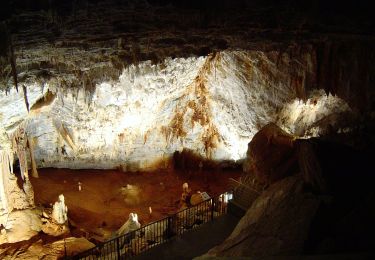
Trail Walking of 23 km to be discovered at Occitania, Aude, Cabrespine. This trail is proposed by jacques delaporte.

Description

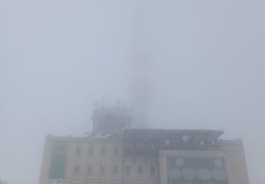
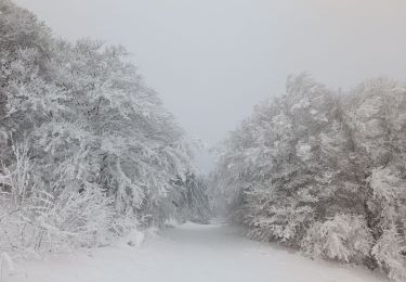
Belle randonnée et belle reconnaissance, toujours un bonheur de gravir le Pic de Nore, ça monte et ça monte toujours,environ 847 m de dénivelé( -) c'est normal..
Je regrette de ne pas avoir rencontré la neige mais le temps était froid et ensoleillé sans brume...

Elevation profile

Photos

Positioning

Country:
France
Region :
Occitania
Department/Province :
Aude
Municipality :
Cabrespine
Location:
Unknown
Start:(UTM)
456312 ; 4801184 (31T) N.

Trails nearby

Trail Walking Castans - Boucle des ruisseaux - Castans - Photo
Walking
tracegps

Walking

Medium
(5)
Castans, Occitania, Aude, France
6.4 km | 10 km-effort
4h 0min
Yes
Trail On foot Cabrespine - Les Villages Perchés - Photo
On foot
GUIDE+

On foot

Easy
Cabrespine, Occitania, Aude, France
8.3 km | 14.7 km-effort
3h 21min
No
Trail On foot Cabrespine - Boucle du Gouffre de Cabrespine - Photo
On foot
GUIDE+

On foot

Easy
Cabrespine, Occitania, Aude, France
4.9 km | 8.7 km-effort
1h 59min
No
Trail Walking Villeneuve-Minervois - pujol de bosc castanviel - Photo
Walking
henribatut

Walking

Easy
Villeneuve-Minervois, Occitania, Aude, France
15.9 km | 23 km-effort
5h 20min
Yes
Trail Walking Sallèles-Cabardès - Sallèles Cabardès - Pradellles Cabardès - Pic du Nore-   - Photo
Walking
jacques delaporte

Walking

Very difficult
Sallèles-Cabardès, Occitania, Aude, France
65 km | 0 m-effort
23h 36min
Yes
Trail Walking Sallèles-Cabardès - Reco Le Pic de Nore  - Photo
Walking
jacques delaporte

Walking

Very difficult
Sallèles-Cabardès, Occitania, Aude, France
54 km | 79 km-effort
21h 27min
Yes
Trail Walking Limousis - Limousis  - Photo
Walking
Christophe Ferreres

Walking

Difficult
Limousis, Occitania, Aude, France
9.8 km | 14.9 km-effort
3h 48min
Yes
Trail Walking Limousis - Mont Simel  - Photo
Walking
bernardbelmas

Walking

Medium
Limousis, Occitania, Aude, France
9.6 km | 13.9 km-effort
3h 39min
Yes
Trail On foot Pradelles-Cabardès - Pradelles,roc de l'aigle,cabrespine,pradelles - Photo
On foot
Dupleix

On foot

Difficult
Pradelles-Cabardès, Occitania, Aude, France
15.3 km | 24 km-effort
5h 50min
Yes


Close
My subscriptions