29 km | 33 km-effort
gazeran gazeran
CRETTE
User
Length
24 km
Max alt
181 m
Uphill gradient
293 m
Km-Effort
28 km
Min alt
129 m
Downhill gradient
293 m
Boucle
Yes
Creation date :
2024-01-14 16:29:34.529
Updated on :
2024-01-14 16:31:06.513
6h19
Difficulty : Very difficult
FREE GPS app for hiking
About
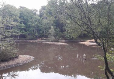
Trail Walking of 24 km to be discovered at Ile-de-France, Yvelines, Gazeran. This trail is proposed by CRETTE .
Positioning
Country:
France
Region :
Ile-de-France
Department/Province :
Yvelines
Municipality :
Gazeran
Location:
Unknown
Start:(Dec)
Start:(UTM)
409482 ; 5387475 (31U) N.
Comments
Trails nearby
_Les étangs de Hollande
Mountain bike
Medium
(2)
Rambouillet,
Ile-de-France,
Yvelines,
France
2h 9min
Yes
Sortie du 25/06/2015
Walking
Medium
(1)
Poigny-la-Forêt,
Ile-de-France,
Yvelines,
France
12.5 km | 14.6 km-effort
3h 13min
Yes
*De Rambouillet au Perray en Yveline
On foot
Very easy
(1)
Rambouillet,
Ile-de-France,
Yvelines,
France
14.2 km | 15.7 km-effort
Unknown
No
DEB_BF_Gazeran_14-07-19_Tracé
Walking
Very difficult
(1)
Gazeran,
Ile-de-France,
Yvelines,
France
25 km | 30 km-effort
6h 28min
Yes
Droue sur Drouette st hillarion
Walking
Very easy
(1)
Droue-sur-Drouette,
Centre-Loire Valley,
Eure-et-Loir,
France
11.6 km | 13.8 km-effort
3h 0min
Yes
_Les fabuleux trésors du Parc de Rambouillet
Walking
Medium
Rambouillet,
Ile-de-France,
Yvelines,
France
6.8 km | 7.9 km-effort
1h 30min
Yes
Le tour du Grand paris via le GR1étape 19 - Rambouillet - Montfort l'Amaury
Walking
Difficult
Rambouillet,
Ile-de-France,
Yvelines,
France
38 km | 45 km-effort
6h 48min
No
Rochers d'Angennes Yvelines
Walking
Medium
Poigny-la-Forêt,
Ile-de-France,
Yvelines,
France
6.3 km | 7.6 km-effort
1h 58min
Yes
2022-05-01_EtangCoupeGorge_MaresDeVilpert
Walking
Easy
Rambouillet,
Ile-de-France,
Yvelines,
France
11.2 km | 12.3 km-effort
2h 34min
Yes