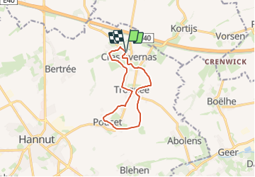
![](/images/other/stat-length.png)
![Trail Walking Hannut - Tracé - Photo](https://media.geolcdn.com/t/1900/400/ext.pjpeg?maxdim=2&url=https%3A%2F%2Fstatic1.geolcdn.com%2Fsiteimages%2Fupload%2Ffiles%2F1553511878bg_sport_marche.png)
Tracé
jipysn
User
![Length](/images/other/stat-length.png)
![Max alt](https://static1.geolcdn.com/siteimages/upload/files/1508320355ic_sort_altitude_max_24dp.png)
![Uphill gradient](https://static1.geolcdn.com/siteimages/upload/files/1508320355ic_sort_den_pos_24dp.png)
![Km-Effort](/images/other/stat-length.png)
![Min alt](https://static1.geolcdn.com/siteimages/upload/files/1508320355ic_sort_altitude_min_24dp.png)
![Downhill gradient](https://static1.geolcdn.com/siteimages/upload/files/1508320355ic_sort_den_neg_24dp.png)
![Boucle](https://static1.geolcdn.com/siteimages/upload/files/16400158638029165_repeat_loop_refresh_sync_direction_icon.png)
![Walking](https://static1.geolcdn.com/sitytour/trail-icons/101.png)
2h15
Difficulty : Medium
![Scan this QR Code to open this trail in the SityTrail application](https://capi.geolives.com/qq0zvz2zws4bq2lad0pu/sitytour/trails/3915930/qr.png?size=200)
FREE GPS app for hiking
About
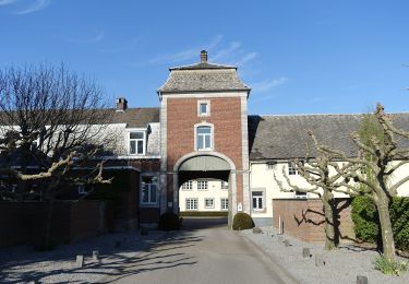
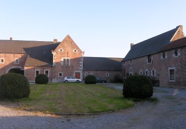
Trail Walking of 9.2 km to be discovered at Wallonia, Liège, Hannut. This trail is proposed by jipysn.
Description
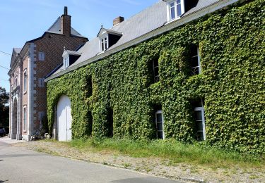
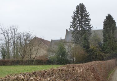
Le village de Poucet est particulièrement apprécié pour ses arbres fruitiers. En avril, les arbres se parent de leurs plus belles fleurs. Les vergers ressemblent alors à une vaste mer de fleur. C'est donc la période idéale pour se promener entre deux vergers colorés en respirant l’air pur de la campagne.
Source: http://www.hannut.be
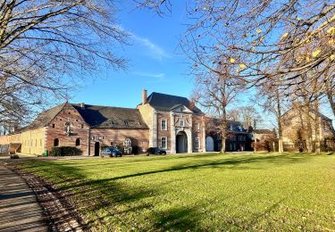
Point de départ: 1 Rue Grégoire Wauthier , Cras-Avernas
Balisage 🟩.
Positioning
Comments
Trails nearby
![Trail Walking Hannut - La Balade des Chevées - Photo](https://media.geolcdn.com/t/375/260/c40a8656-229d-4d2b-8925-ffea50baaa2d.jpeg&format=jpg&maxdim=2)
![Walking Walking](https://static1.geolcdn.com/sitytour/trail-icons/101.png)
Walking
![](/images/other/stat-length.png)
![](https://static1.geolcdn.com/siteimages/upload/files/16400158638029165_repeat_loop_refresh_sync_direction_icon.png)
![Trail Walking Geer - Promenade le long du Geer et réserve - Photo](https://media.geolcdn.com/t/375/260/4fc37dda-e21b-43f8-a27a-3af14e8a0d8e.jpg&format=jpg&maxdim=2)
![Walking Walking](https://static1.geolcdn.com/sitytour/trail-icons/101.png)
Walking
![](/images/other/stat-length.png)
![](https://static1.geolcdn.com/siteimages/upload/files/16400158638029165_repeat_loop_refresh_sync_direction_icon.png)
![Trail Walking Hannut - La balade des chevées (5km) - Photo](https://media.geolcdn.com/t/375/260/4f5eaa7c-e24d-4247-898f-e668713f7776.jpg&format=jpg&maxdim=2)
![Walking Walking](https://static1.geolcdn.com/sitytour/trail-icons/101.png)
Walking
![](/images/other/stat-length.png)
![](https://static1.geolcdn.com/siteimages/upload/files/16400158638029165_repeat_loop_refresh_sync_direction_icon.png)
![Trail On foot Geer - Promenade des Peupliers - Photo](https://media.geolcdn.com/t/375/260/f68fd01a-6493-4bfb-8eb0-00aa4284b467.jpeg&format=jpg&maxdim=2)
![On foot On foot](https://static1.geolcdn.com/sitytour/trail-icons/100.png)
On foot
![](/images/other/stat-length.png)
![](https://static1.geolcdn.com/siteimages/upload/files/16400158638029165_repeat_loop_refresh_sync_direction_icon.png)
![Trail On foot Geer - Promenade du Geer - Photo](https://media.geolcdn.com/t/375/260/b73edfb0-f782-4f6f-af6c-98fa8486e229.jpeg&format=jpg&maxdim=2)
![On foot On foot](https://static1.geolcdn.com/sitytour/trail-icons/100.png)
On foot
![](/images/other/stat-length.png)
![](https://static1.geolcdn.com/siteimages/upload/files/16400158638029165_repeat_loop_refresh_sync_direction_icon.png)
![Trail On foot Landen - Toegankelijke Zevenbronnenwandeling - Photo](https://media.geolcdn.com/t/375/260/e270a4ca-93be-4e8c-87ad-1e5a316b4c2c.jpeg&format=jpg&maxdim=2)
![On foot On foot](https://static1.geolcdn.com/sitytour/trail-icons/100.png)
On foot
![](/images/other/stat-length.png)
![](https://static1.geolcdn.com/siteimages/upload/files/16400158638029165_repeat_loop_refresh_sync_direction_icon.png)
![Trail Walking Hannut - Hannut R3 - Photo](https://media.geolcdn.com/t/375/260/351999e5-0250-48b0-befe-e572848e7b6f.jpeg&format=jpg&maxdim=2)
![Walking Walking](https://static1.geolcdn.com/sitytour/trail-icons/101.png)
![Trail Walking Hannut - Hannut R2 - Photo](https://media.geolcdn.com/t/375/260/9358d202-85bd-4dba-8039-3673f9a4abc1.jpeg&format=jpg&maxdim=2)
![Walking Walking](https://static1.geolcdn.com/sitytour/trail-icons/101.png)
![Trail Walking Hannut - Hannut R1 - Photo](https://media.geolcdn.com/t/375/260/a48ae00d-4092-46f8-a66f-79f8591894ca.jpeg&format=jpg&maxdim=2)
![Walking Walking](https://static1.geolcdn.com/sitytour/trail-icons/101.png)