


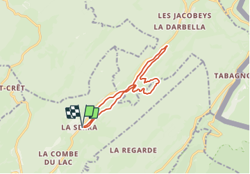

14.5 km | 20 km-effort


User


FREE GPS app for hiking
 SityTrail
IGN / Geographical institutes
SityTrail World
The world is yours!
Trail Snowshoes of 12 km to be discovered at Bourgogne-Franche-Comté, Jura, Lamoura. This trail is proposed by mricard.
Randonnée suivant les chemins tracés de raquettes et certaines pistes de ski de fond combinant différents parcours proposés sur le plan fourni par la société de gestion des pistes.

Walking

Cycle

Walking

Walking

Walking

Walking

Walking
Bicycle tourism
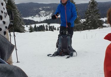
Snowshoes