![](/images/other/stat-length.png)
![Trail Walking Flayosc - Tracé actuel: 13 JAN 2024 14:16 - Photo](https://media.geolcdn.com/t/1900/400/ext.pjpeg?maxdim=2&url=https%3A%2F%2Fstatic1.geolcdn.com%2Fsiteimages%2Fupload%2Ffiles%2F1553511878bg_sport_marche.png)
Tracé actuel: 13 JAN 2024 14:16
felix83
User
![Length](/images/other/stat-length.png)
![Max alt](https://static1.geolcdn.com/siteimages/upload/files/1508320355ic_sort_altitude_max_24dp.png)
![Uphill gradient](https://static1.geolcdn.com/siteimages/upload/files/1508320355ic_sort_den_pos_24dp.png)
![Km-Effort](/images/other/stat-length.png)
![Min alt](https://static1.geolcdn.com/siteimages/upload/files/1508320355ic_sort_altitude_min_24dp.png)
![Downhill gradient](https://static1.geolcdn.com/siteimages/upload/files/1508320355ic_sort_den_neg_24dp.png)
![Boucle](https://static1.geolcdn.com/siteimages/upload/files/16400158638029165_repeat_loop_refresh_sync_direction_icon.png)
![Walking](https://static1.geolcdn.com/sitytour/trail-icons/101.png)
1h59
Difficulty : Medium
![Scan this QR Code to open this trail in the SityTrail application](https://capi.geolives.com/qq0zvz2zws4bq2lad0pu/sitytour/trails/3915439/qr.png?size=200)
FREE GPS app for hiking
About
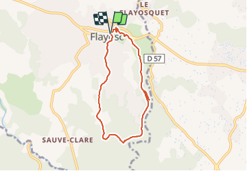
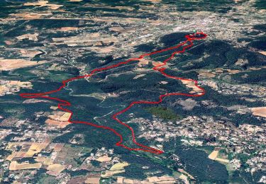
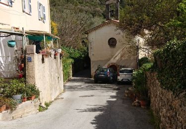
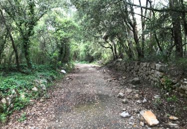
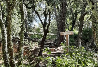
Trail Walking of 6.7 km to be discovered at Provence-Alpes-Côte d'Azur, Var, Flayosc. This trail is proposed by felix83.
Description
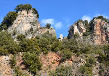
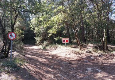
Petite randonnée agréable au sud de Flayosc. Elle commence par une montée et se termine par une montée. Attention sur le parcours nous marchons sur l'ancienne voie férrée du train des pignes et il y a 2 tunnels. Il est conseiller de prendre le chemin qui permet de passer au dessus des tunnels. La Chapelle St Jean est en contrebas de l'ancienne voie férrée à 250 m environ.
Positioning
Comments
Trails nearby
![Trail Walking Flayosc - Flayosc - Photo](https://media.geolcdn.com/t/375/260/ext.jpg?maxdim=2&url=https%3A%2F%2Fstatic1.geolcdn.com%2Fsiteimages%2Fupload%2Ffiles%2F1553511878bg_sport_marche.png)
![Walking Walking](https://static1.geolcdn.com/sitytour/trail-icons/101.png)
Walking
![](/images/other/stat-length.png)
![](https://static1.geolcdn.com/siteimages/upload/files/16400158638029165_repeat_loop_refresh_sync_direction_icon.png)
![Trail Walking Lorgues - SityTrail - Le hameau de Sauveclare - Photo](https://media.geolcdn.com/t/375/260/bc0b058e-af96-4d28-bc15-d4c1c9d787b7.jpg&format=jpg&maxdim=2)
![Walking Walking](https://static1.geolcdn.com/sitytour/trail-icons/101.png)
Walking
![](/images/other/stat-length.png)
![](https://static1.geolcdn.com/siteimages/upload/files/16400158638029165_repeat_loop_refresh_sync_direction_icon.png)
![Trail Walking Lorgues - Lorgues et l'Ermitage Saint-Ferréol - Photo](https://media.geolcdn.com/t/375/260/e62c5b83-8a2e-4772-82d8-7fdc4c20c935.jpg&format=jpg&maxdim=2)
![Walking Walking](https://static1.geolcdn.com/sitytour/trail-icons/101.png)
Walking
![](/images/other/stat-length.png)
![](https://static1.geolcdn.com/siteimages/upload/files/16400158638029165_repeat_loop_refresh_sync_direction_icon.png)
![Trail Walking Draguignan - Rebouillon le long de la Nartuby - Photo](https://media.geolcdn.com/t/375/260/5546167f-335f-4958-9f3e-7305fd054196.jpg&format=jpg&maxdim=2)
![Walking Walking](https://static1.geolcdn.com/sitytour/trail-icons/101.png)
Walking
![](/images/other/stat-length.png)
![](https://static1.geolcdn.com/siteimages/upload/files/16400158638029165_repeat_loop_refresh_sync_direction_icon.png)
![Walking Walking](https://static1.geolcdn.com/sitytour/trail-icons/101.png)
Walking
![](/images/other/stat-length.png)
![](https://static1.geolcdn.com/siteimages/upload/files/16400158638029165_repeat_loop_refresh_sync_direction_icon.png)
![Trail Walking Flayosc - 20210922 Berne3 les Oussiayes - Photo](https://media.geolcdn.com/t/375/260/63a967ae-524a-431f-b327-781a014fa426.jpg&format=jpg&maxdim=2)
![Walking Walking](https://static1.geolcdn.com/sitytour/trail-icons/101.png)
Walking
![](/images/other/stat-length.png)
![](https://static1.geolcdn.com/siteimages/upload/files/16400158638029165_repeat_loop_refresh_sync_direction_icon.png)
![Trail Road bike Draguignan - la clape - Photo](https://media.geolcdn.com/t/375/260/0765a432-74ac-42bd-825e-91e99e328dea.jpg&format=jpg&maxdim=2)
![Road bike Road bike](https://static1.geolcdn.com/sitytour/trail-icons/201.png)
Road bike
![](/images/other/stat-length.png)
![](https://static1.geolcdn.com/siteimages/upload/files/16400158638029165_repeat_loop_refresh_sync_direction_icon.png)
![Trail Walking Draguignan - Draguignan ancien Malmont 8 km - Photo](https://media.geolcdn.com/t/375/260/d56117bc-a147-4869-afed-96120be49fdb.jpg&format=jpg&maxdim=2)
![Walking Walking](https://static1.geolcdn.com/sitytour/trail-icons/101.png)
Walking
![](/images/other/stat-length.png)
![](https://static1.geolcdn.com/siteimages/upload/files/16400158638029165_repeat_loop_refresh_sync_direction_icon.png)
![Trail Walking Lorgues - Lorgues - sentier découverte Saint-Ferréol - Photo](https://media.geolcdn.com/t/375/260/45684484-d312-4a9e-82bd-16f54a0668a9.jpg&format=jpg&maxdim=2)
![Walking Walking](https://static1.geolcdn.com/sitytour/trail-icons/101.png)
Walking
![](/images/other/stat-length.png)
![](https://static1.geolcdn.com/siteimages/upload/files/16400158638029165_repeat_loop_refresh_sync_direction_icon.png)