![](/images/other/stat-length.png)
![Trail Walking Barneville-sur-Seine - Barneville-PT-7,4KM - Photo](https://media.geolcdn.com/t/1900/400/ext.pjpeg?maxdim=2&url=https%3A%2F%2Fstatic1.geolcdn.com%2Fsiteimages%2Fupload%2Ffiles%2F1553511878bg_sport_marche.png)
Barneville-PT-7,4KM
philippe76
User
![Length](/images/other/stat-length.png)
Length
7.5 km
![Max alt](https://static1.geolcdn.com/siteimages/upload/files/1508320355ic_sort_altitude_max_24dp.png)
Max alt
145 m
![Uphill gradient](https://static1.geolcdn.com/siteimages/upload/files/1508320355ic_sort_den_pos_24dp.png)
Uphill gradient
88 m
![Km-Effort](/images/other/stat-length.png)
Km-Effort
9.1 km
![Min alt](https://static1.geolcdn.com/siteimages/upload/files/1508320355ic_sort_altitude_min_24dp.png)
Min alt
0 m
![Downhill gradient](https://static1.geolcdn.com/siteimages/upload/files/1508320355ic_sort_den_neg_24dp.png)
Downhill gradient
217 m
![Boucle](https://static1.geolcdn.com/siteimages/upload/files/16400158638029165_repeat_loop_refresh_sync_direction_icon.png)
Boucle
No
Creation date :
2015-06-03 00:00:00.0
Updated on :
2015-06-03 00:00:00.0
![Walking](https://static1.geolcdn.com/sitytour/trail-icons/101.png)
1h57
Difficulty : Medium
![Scan this QR Code to open this trail in the SityTrail application](https://capi.geolives.com/qq0zvz2zws4bq2lad0pu/sitytour/trails/391428/qr.png?size=200)
FREE GPS app for hiking
About
Trail Walking of 7.5 km to be discovered at Normandy, Eure, Barneville-sur-Seine. This trail is proposed by philippe76.
Description
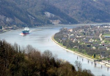
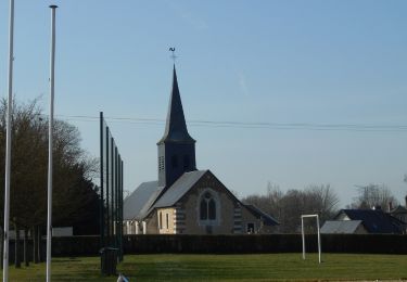
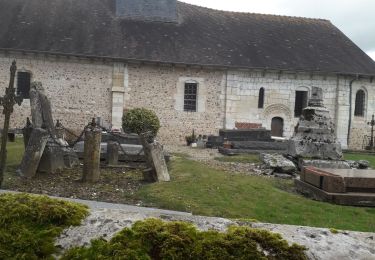
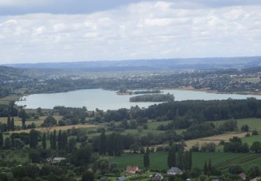
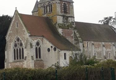
Départ de l'église de Barneville-sur-Seine, rue du village. TD et AD, AG et AD pour rejoindre le chemin des Cotes. AG et AD le GR23 vers la Seine. AG en bord de Seine jusqu'au bac de Jumièges.
Positioning
Country:
France
Region :
Normandy
Department/Province :
Eure
Municipality :
Barneville-sur-Seine
Location:
Unknown
Start:(Dec)
Start:(UTM)
343787 ; 5471856 (31U) N.
Comments
Trails nearby
![Trail Walking Saint-Ouen-de-Thouberville - Saint-Ouen de Thouberville- Le Mesnil et la Pierre TTournante - Photo](https://media.geolcdn.com/t/375/260/f2450d67-38f3-46a5-aba6-c5e54414bed0.jpg&format=jpg&maxdim=2)
![Walking Walking](https://static1.geolcdn.com/sitytour/trail-icons/101.png)
Saint-Ouen de Thouberville- Le Mesnil et la Pierre TTournante
Walking
Medium
(1)
Saint-Ouen-de-Thouberville,
Normandy,
Eure,
France
![](/images/other/stat-length.png)
12.5 km | 15.3 km-effort
3h 35min
![](https://static1.geolcdn.com/siteimages/upload/files/16400158638029165_repeat_loop_refresh_sync_direction_icon.png)
Yes
![Trail Equestrian Barneville-sur-Seine - Circuit des Côtes - Barneville sur Seine - Photo](https://media.geolcdn.com/t/375/260/ext.jpg?maxdim=2&url=https%3A%2F%2Fservices.sitytrail.com%2FGeolivesWS%2FDownloadMedia.ashx%3FTrailID%3D111652%26Media%3D7891_1.jpg)
![Equestrian Equestrian](https://static1.geolcdn.com/sitytour/trail-icons/300.png)
Circuit des Côtes - Barneville sur Seine
Equestrian
Easy
(1)
Barneville-sur-Seine,
Normandy,
Eure,
France
![](/images/other/stat-length.png)
5.9 km | 8 km-effort
1h 0min
![](https://static1.geolcdn.com/siteimages/upload/files/16400158638029165_repeat_loop_refresh_sync_direction_icon.png)
Yes
![Walking Walking](https://static1.geolcdn.com/sitytour/trail-icons/101.png)
20230302-Barneville sur Seine
Walking
Difficult
Barneville-sur-Seine,
Normandy,
Eure,
France
![](/images/other/stat-length.png)
13.1 km | 16.6 km-effort
3h 31min
![](https://static1.geolcdn.com/siteimages/upload/files/16400158638029165_repeat_loop_refresh_sync_direction_icon.png)
Yes
![Trail Walking Barneville-sur-Seine - Les Grottes de l'Aubrière - Photo](https://media.geolcdn.com/t/375/260/ext.jpg?maxdim=2&url=https%3A%2F%2Fstatic1.geolcdn.com%2Fsiteimages%2Fupload%2Ffiles%2F1553511878bg_sport_marche.png)
![Walking Walking](https://static1.geolcdn.com/sitytour/trail-icons/101.png)
Les Grottes de l'Aubrière
Walking
Medium
(1)
Barneville-sur-Seine,
Normandy,
Eure,
France
![](/images/other/stat-length.png)
23 km | 29 km-effort
6h 23min
![](https://static1.geolcdn.com/siteimages/upload/files/16400158638029165_repeat_loop_refresh_sync_direction_icon.png)
Yes
![Trail Walking Saint-Ouen-de-Thouberville - Saint-Ouen de Thouberville. Vers la pierre Tourmante et le Mesnil version 12-11-21 - Photo](https://media.geolcdn.com/t/375/260/b86f4944-9744-4f8e-8b37-981417450b71.jpg&format=jpg&maxdim=2)
![Walking Walking](https://static1.geolcdn.com/sitytour/trail-icons/101.png)
Saint-Ouen de Thouberville. Vers la pierre Tourmante et le Mesnil version 12...
Walking
Difficult
Saint-Ouen-de-Thouberville,
Normandy,
Eure,
France
![](/images/other/stat-length.png)
12.8 km | 15.6 km-effort
3h 55min
![](https://static1.geolcdn.com/siteimages/upload/files/16400158638029165_repeat_loop_refresh_sync_direction_icon.png)
Yes
![Walking Walking](https://static1.geolcdn.com/sitytour/trail-icons/101.png)
20210617-Mauny
Walking
Medium
Mauny,
Normandy,
Seine-Maritime,
France
![](/images/other/stat-length.png)
13.4 km | 17.1 km-effort
3h 56min
![](https://static1.geolcdn.com/siteimages/upload/files/16400158638029165_repeat_loop_refresh_sync_direction_icon.png)
Yes
![Trail Walking Saint-Ouen-de-Thouberville - Saint-ouen de Thouberville vers Caumont et la Trinité - Photo](https://media.geolcdn.com/t/375/260/65995c4c-1068-4aea-b32b-c3e75089db70.jpg&format=jpg&maxdim=2)
![Walking Walking](https://static1.geolcdn.com/sitytour/trail-icons/101.png)
Saint-ouen de Thouberville vers Caumont et la Trinité
Walking
Medium
Saint-Ouen-de-Thouberville,
Normandy,
Eure,
France
![](/images/other/stat-length.png)
9.4 km | 11.2 km-effort
2h 44min
![](https://static1.geolcdn.com/siteimages/upload/files/16400158638029165_repeat_loop_refresh_sync_direction_icon.png)
Yes
![Walking Walking](https://static1.geolcdn.com/sitytour/trail-icons/101.png)
20200207-Barneville Journee
Walking
Difficult
Barneville-sur-Seine,
Normandy,
Eure,
France
![](/images/other/stat-length.png)
22 km | 29 km-effort
6h 35min
![](https://static1.geolcdn.com/siteimages/upload/files/16400158638029165_repeat_loop_refresh_sync_direction_icon.png)
Yes
![Trail Walking Bourg-Achard - La belle Epine - Photo](https://media.geolcdn.com/t/375/260/b0ee3f85-baa3-4ee2-b67f-18d8213a59cf.jpg&format=jpg&maxdim=2)
![Walking Walking](https://static1.geolcdn.com/sitytour/trail-icons/101.png)
La belle Epine
Walking
Easy
(2)
Bourg-Achard,
Normandy,
Eure,
France
![](/images/other/stat-length.png)
10.1 km | 11 km-effort
3h 15min
![](https://static1.geolcdn.com/siteimages/upload/files/16400158638029165_repeat_loop_refresh_sync_direction_icon.png)
Yes