


Paraty 01

DECHAMPD
User
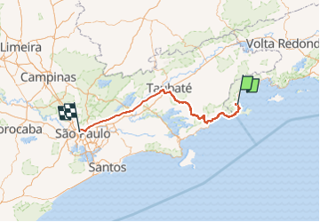

Length
299 km

Max alt
1017 m

Uphill gradient
6267 m
Km-Effort
380 km

Min alt
-2 m

Downhill gradient
5520 m
Boucle
No
Creation date :
2024-01-02 15:09:16.0
Updated on :
2024-02-23 16:05:12.303
3h13
Difficulty : Very easy

FREE GPS app for hiking
 SityTrail
IGN / Geographical institutes
SityTrail World
The world is yours!
About
Trail Car of 299 km to be discovered at Rio de Janeiro, Unknown, Paraty. This trail is proposed by DECHAMPD.
Description
de Sao Paulo à Paraty
Positioning
Country:
Brazil
Region :
Rio de Janeiro
Department/Province :
Unknown
Municipality :
Paraty
Location:
Unknown
Start:(Dec)
Start:(UTM)
529411 ; 7432335 (23K) S.
Comments
Trails nearby