


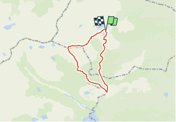

15.1 km | 24 km-effort


User


FREE GPS app for hiking
 SityTrail
IGN / Geographical institutes
SityTrail World
The world is yours!
Trail Walking of 11.4 km to be discovered at Occitania, Pyrénées-Orientales, Formiguères. This trail is proposed by 34christophe.
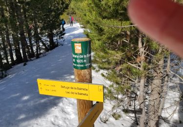
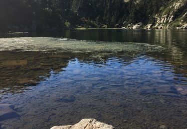
refuge, les Pérics, étang la LLosa, cabane de la Balmeta, refuge
rando programmée mais non encore réalisée : j'ignore s'il existe un sentier entre le km 3 et le km 4,7

Walking


sport
Walking

Walking

Snowshoes
Walking
Walking
Snowshoes
Walking