![](/images/other/stat-length.png)
![Trail Walking Saint-Simon - Oyez - Photo](https://media.geolcdn.com/t/1900/400/ext.pjpeg?maxdim=2&url=https%3A%2F%2Fstatic1.geolcdn.com%2Fsiteimages%2Fupload%2Ffiles%2F1553511878bg_sport_marche.png)
Oyez
Jean-Marie Bousquet
User
![Length](/images/other/stat-length.png)
Length
12.2 km
![Max alt](https://static1.geolcdn.com/siteimages/upload/files/1508320355ic_sort_altitude_max_24dp.png)
Max alt
971 m
![Uphill gradient](https://static1.geolcdn.com/siteimages/upload/files/1508320355ic_sort_den_pos_24dp.png)
Uphill gradient
374 m
![Km-Effort](/images/other/stat-length.png)
Km-Effort
17.2 km
![Min alt](https://static1.geolcdn.com/siteimages/upload/files/1508320355ic_sort_altitude_min_24dp.png)
Min alt
687 m
![Downhill gradient](https://static1.geolcdn.com/siteimages/upload/files/1508320355ic_sort_den_neg_24dp.png)
Downhill gradient
372 m
![Boucle](https://static1.geolcdn.com/siteimages/upload/files/16400158638029165_repeat_loop_refresh_sync_direction_icon.png)
Boucle
Yes
Creation date :
2023-12-15 13:36:09.471
Updated on :
2023-12-15 16:30:52.085
![Walking](https://static1.geolcdn.com/sitytour/trail-icons/101.png)
2h39
Difficulty : Medium
![Scan this QR Code to open this trail in the SityTrail application](https://capi.geolives.com/qq0zvz2zws4bq2lad0pu/sitytour/trails/3893870/qr.png?size=200)
FREE GPS app for hiking
About
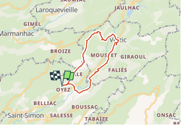
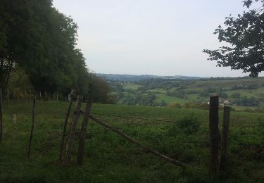
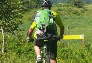
Trail Walking of 12.2 km to be discovered at Auvergne-Rhône-Alpes, Cantal, Saint-Simon. This trail is proposed by Jean-Marie Bousquet.
Description
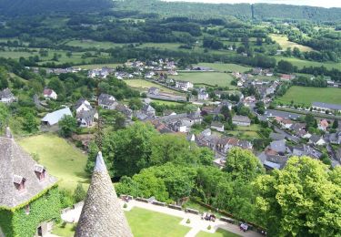
boucle au départ de Oyez, via Antenne de Broussoux, bois de Laverniere, Velzic, Clavières et Rouffiac.
Positioning
Country:
France
Region :
Auvergne-Rhône-Alpes
Department/Province :
Cantal
Municipality :
Saint-Simon
Location:
Unknown
Start:(Dec)
Start:(UTM)
461763 ; 4980637 (31T) N.
Comments
Trails nearby
![Trail Walking Polminhac - Polminhac - Autour du donjon - Photo](https://media.geolcdn.com/t/375/260/ext.jpg?maxdim=2&url=https%3A%2F%2Fservices.sitytrail.com%2FGeolivesWS%2FDownloadMedia.ashx%3FTrailID%3D112772%26Media%3D12297_3.jpg)
![Walking Walking](https://static1.geolcdn.com/sitytour/trail-icons/101.png)
Polminhac - Autour du donjon
Walking
Easy
(1)
Polminhac,
Auvergne-Rhône-Alpes,
Cantal,
France
![](/images/other/stat-length.png)
5.2 km | 8.6 km-effort
2h 0min
![](https://static1.geolcdn.com/siteimages/upload/files/16400158638029165_repeat_loop_refresh_sync_direction_icon.png)
Yes
![Trail Walking Lascelle - Roman de Jordanne - Photo](https://media.geolcdn.com/t/375/260/ext.jpg?maxdim=2&url=https%3A%2F%2Fstatic1.geolcdn.com%2Fsiteimages%2Fupload%2Ffiles%2F1553511878bg_sport_marche.png)
![Walking Walking](https://static1.geolcdn.com/sitytour/trail-icons/101.png)
Roman de Jordanne
Walking
Medium
(1)
Lascelle,
Auvergne-Rhône-Alpes,
Cantal,
France
![](/images/other/stat-length.png)
17.7 km | 27 km-effort
5h 54min
![](https://static1.geolcdn.com/siteimages/upload/files/16400158638029165_repeat_loop_refresh_sync_direction_icon.png)
Yes
![Trail Walking Lascelle - Arbre de quenouille, rocher saint curial, col de berganti - Photo](https://media.geolcdn.com/t/375/260/ext.jpg?maxdim=2&url=https%3A%2F%2Fmedia.geolcdn.com%2Ff%2F7c9d82cf-6b3d-4485-8853-0a39a0f6136c.jpg)
![Walking Walking](https://static1.geolcdn.com/sitytour/trail-icons/101.png)
Arbre de quenouille, rocher saint curial, col de berganti
Walking
Easy
Lascelle,
Auvergne-Rhône-Alpes,
Cantal,
France
![](/images/other/stat-length.png)
12.8 km | 19 km-effort
3h 37min
![](https://static1.geolcdn.com/siteimages/upload/files/16400158638029165_repeat_loop_refresh_sync_direction_icon.png)
Yes
![Trail Walking Aurillac - La Via Arverna (Aurillac - Laroquebrou) - Photo](https://media.geolcdn.com/t/375/260/ext.jpg?maxdim=2&url=https%3A%2F%2Fservices.sitytrail.com%2FGeolivesWS%2FDownloadMedia.ashx%3FTrailID%3D173012%26Media%3D14513_6.jpg)
![Walking Walking](https://static1.geolcdn.com/sitytour/trail-icons/101.png)
La Via Arverna (Aurillac - Laroquebrou)
Walking
Difficult
Aurillac,
Auvergne-Rhône-Alpes,
Cantal,
France
![](/images/other/stat-length.png)
35 km | 42 km-effort
9h 15min
![](https://static1.geolcdn.com/siteimages/upload/files/16400158638029165_repeat_loop_refresh_sync_direction_icon.png)
No
![Trail Mountain bike Aurillac - Aurillac- st jean de done-Naucelle - Photo](https://media.geolcdn.com/t/375/260/ext.jpg?maxdim=2&url=https%3A%2F%2Fservices.sitytrail.com%2FGeolivesWS%2FDownloadMedia.ashx%3FTrailID%3D834122%26Media%3D20170923172554.jpg)
![Mountain bike Mountain bike](https://static1.geolcdn.com/sitytour/trail-icons/202.png)
Aurillac- st jean de done-Naucelle
Mountain bike
Easy
Aurillac,
Auvergne-Rhône-Alpes,
Cantal,
France
![](/images/other/stat-length.png)
18.8 km | 25 km-effort
1h 56min
![](https://static1.geolcdn.com/siteimages/upload/files/16400158638029165_repeat_loop_refresh_sync_direction_icon.png)
Yes
![Trail Mountain bike Lascelle - Espace VTT FFC - Grand Site du Puy Mary - Vallée de la Jordanne - Circuit N°5 Circuit du Mazieux. - Photo](https://media.geolcdn.com/t/375/260/ext.jpg?maxdim=2&url=https%3A%2F%2Fservices.sitytrail.com%2FGeolivesWS%2FDownloadMedia.ashx%3FTrailID%3D106129%26Media%3D10368_1.jpg)
![Mountain bike Mountain bike](https://static1.geolcdn.com/sitytour/trail-icons/202.png)
Espace VTT FFC - Grand Site du Puy Mary - Vallée de la Jordanne - Circuit N°5...
Mountain bike
Difficult
Lascelle,
Auvergne-Rhône-Alpes,
Cantal,
France
![](/images/other/stat-length.png)
27 km | 41 km-effort
4h 49min
![](https://static1.geolcdn.com/siteimages/upload/files/16400158638029165_repeat_loop_refresh_sync_direction_icon.png)
Yes
![Trail Mountain bike Saint-Simon - DC43 km - Photo](https://media.geolcdn.com/t/375/260/ext.jpg?maxdim=2&url=https%3A%2F%2Fstatic1.geolcdn.com%2Fsiteimages%2Fupload%2Ffiles%2F1524743154velo.jpg)
![Mountain bike Mountain bike](https://static1.geolcdn.com/sitytour/trail-icons/202.png)
DC43 km
Mountain bike
Very difficult
Saint-Simon,
Auvergne-Rhône-Alpes,
Cantal,
France
![](/images/other/stat-length.png)
42 km | 66 km-effort
4h 22min
![](https://static1.geolcdn.com/siteimages/upload/files/16400158638029165_repeat_loop_refresh_sync_direction_icon.png)
No
![Trail Mountain bike Velzic - deriv chaîne 2023 - Photo](https://media.geolcdn.com/t/375/260/ext.jpg?maxdim=2&url=https%3A%2F%2Fstatic1.geolcdn.com%2Fsiteimages%2Fupload%2Ffiles%2F1524743154velo.jpg)
![Mountain bike Mountain bike](https://static1.geolcdn.com/sitytour/trail-icons/202.png)
deriv chaîne 2023
Mountain bike
Difficult
Velzic,
Auvergne-Rhône-Alpes,
Cantal,
France
![](/images/other/stat-length.png)
55 km | 80 km-effort
4h 43min
![](https://static1.geolcdn.com/siteimages/upload/files/16400158638029165_repeat_loop_refresh_sync_direction_icon.png)
Yes
![Trail Walking Saint-Simon - boucle de Velzic - Photo](https://media.geolcdn.com/t/375/260/ext.jpg?maxdim=2&url=https%3A%2F%2Fstatic1.geolcdn.com%2Fsiteimages%2Fupload%2Ffiles%2F1553511878bg_sport_marche.png)
![Walking Walking](https://static1.geolcdn.com/sitytour/trail-icons/101.png)
boucle de Velzic
Walking
Difficult
Saint-Simon,
Auvergne-Rhône-Alpes,
Cantal,
France
![](/images/other/stat-length.png)
19.3 km | 31 km-effort
5h 10min
![](https://static1.geolcdn.com/siteimages/upload/files/16400158638029165_repeat_loop_refresh_sync_direction_icon.png)
No