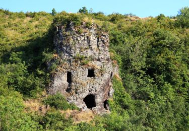
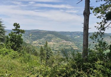
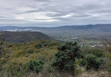
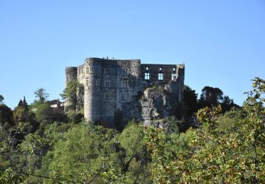
Trail Walking Alba-la-Romaine - La Croix Juliau - Alba la Romaine. - Photo

La Croix Juliau - Alba la Romaine.

 Maryma
Maryma

User

© OpenStreetMap contributors
Length
Length
17.3 km
Max alt
Max alt
546 m
Uphill gradient
Uphill gradient
558 m
Km-Effort
Km-Effort  
25 km
Min alt
Min alt
177 m
Downhill gradient
Downhill gradient
557 m
Boucle
Boucle
Yes
Creation date :
2023-12-13 07:25:41.725
Updated on :
2023-12-25 18:37:09.195

(1 Reviews)

Walking
Walking
5h36
Difficulty : Very difficult

Scan this QR Code to open this trail in the SityTrail application

FREE GPS app for hiking

Logo SityTrail SityTrail

IGN / Geographical institutes

Download SityTrail from the App Store Download SityTrail from Google Play

Logo SityTrail SityTrail World

The world is yours!

Download SityTrail from the App Store Download SityTrail from Google Play Download SityTrail on Huawei AppGallery

About

Trail Walking of 17.3 km to be discovered at Auvergne-Rhône-Alpes, Ardèche, Alba-la-Romaine. This trail is proposed by Maryma.

Description

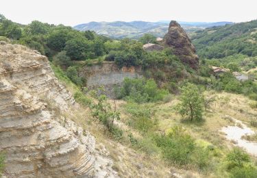
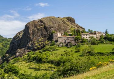
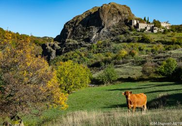
La montée vers la Croix de Juliau c'est un sentier "Plein la vue" . Il vous immerge dans la beauté préservée de l'Ardèche. En chemin, vous découvrirez la faune et la flore locales.

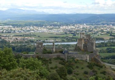
Arrivé au sommet, vous serez récompensé par une vue à couper le souffle qui semble tout droit sortie d'un rêve. La Croix de Juliau ne trône plus, mais le panorama à 360° sera toujours bien présent : votre regard ira de Villeneuve de Berg à la Dent de Rez, en passant par des villages authentiques comme Mirabel, St Jean le Centenier, St Pons, Alba la Romaine, et Valvignères, mais aussi par le Mont Ventoux, le Coiron et le Vercors. N'oubliez surtout pas votre appareil photo pour capturer ces grands espaces !

Certaines légendes attribuent le nom du mont Juliau à Jules César (qui est bien passé par là), mais d'autres sources contredisent cette théorie. Toutefois la présence romaine est attestée depuis la découverte d'une villa, et d'un temple dédié au devin Jules César et à Auguste (ou à Diane selon les sources).

Extrait du site https://groupe.ardeche-guide.com/sommet-de-la-croix-de-juliau

Elevation profile

Positioning

Country:
France
Region :
Auvergne-Rhône-Alpes
Department/Province :
Ardèche
Municipality :
Alba-la-Romaine
Location:
Unknown
Start:(UTM)
626842 ; 4934580 (31T) N.

Comments

Please log in to post a review or rate the element


Trails nearby

Trail Walking Alba-la-Romaine - Alba côté Coiron 7km - Photo
Walking
GUIDE
thonyc

Walking

Easy
(1)
Alba-la-Romaine, Auvergne-Rhône-Alpes, Ardèche, France
7.1 km | 9.5 km-effort
2h 30min
Yes
Trail Walking Alba-la-Romaine - 2022-03-12_17h47m49_Sceautres-La carrière 15km.gpx.xml - Photo
Walking
chancha

Walking

Very difficult
(1)
Alba-la-Romaine, Auvergne-Rhône-Alpes, Ardèche, France
14.7 km | 22 km-effort
4h 57min
Yes
Trail Walking Aubignas - Aubignas Chenavari 17km - Photo
Walking
GUIDE
thonyc

Walking

Difficult
Aubignas, Auvergne-Rhône-Alpes, Ardèche, France
16.5 km | 25 km-effort
5h 20min
Yes
Trail Mountain bike Aubignas - Aubignas tour coiron all mountain - Photo
Mountain bike
royco

Mountain bike

Difficult
(2)
Aubignas, Auvergne-Rhône-Alpes, Ardèche, France
20 km | 30 km-effort
1h 54min
No
Trail Walking Saint-Jean-le-Centenier - 07 balmes montbrun Mirabel zel 29.03.23 - Photo
Walking
GUIDE
randodyssée

Walking

Medium
Saint-Jean-le-Centenier, Auvergne-Rhône-Alpes, Ardèche, France
19 km | 28 km-effort
7h 44min
Yes
Trail Walking Saint-Pons - Saint pons - Photo
Walking
Vero7684

Walking

Medium
Saint-Pons, Auvergne-Rhône-Alpes, Ardèche, France
16.1 km | 23 km-effort
5h 0min
Yes
Trail Walking Aubignas - Aubignas-La carrière 12km - Photo
Walking
GUIDE
thonyc

Walking

Difficult
Aubignas, Auvergne-Rhône-Alpes, Ardèche, France
11.8 km | 16.9 km-effort
3h 41min
Yes
Trail Walking Saint-Pons - 26 sceautre - Photo
Walking
GUIDE
randodyssée

Walking

Medium
Saint-Pons, Auvergne-Rhône-Alpes, Ardèche, France
18.5 km | 28 km-effort
6h 12min
Yes
Trail Walking Saint-Pons - St Pons Plaine du Regard 12km - Photo
Walking
GUIDE
thonyc

Walking

Medium
Saint-Pons, Auvergne-Rhône-Alpes, Ardèche, France
12.4 km | 19.3 km-effort
4h 2min
Yes


Close
My subscriptions