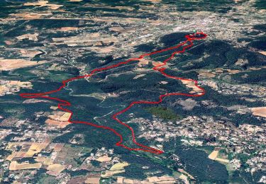
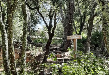
8.3 km | 10.6 km-effort
Saint Ferréol
HENRY83
User
Length
8.5 km
Max alt
303 m
Uphill gradient
242 m
Km-Effort
11.7 km
Min alt
174 m
Downhill gradient
242 m
Boucle
Yes
Creation date :
2023-12-11 12:59:04.081
Updated on :
2023-12-11 15:49:18.414
2h43
Difficulty : Medium
FREE GPS app for hiking
About
Trail Walking of 8.5 km to be discovered at Provence-Alpes-Côte d'Azur, Var, Lorgues. This trail is proposed by HENRY83.
Positioning
Country:
France
Region :
Provence-Alpes-Côte d'Azur
Department/Province :
Var
Municipality :
Lorgues
Location:
Unknown
Start:(Dec)
Start:(UTM)
287667 ; 4819774 (32T) N.
Comments
Trails nearby
SityTrail - Le hameau de Sauveclare
Walking
Easy
Lorgues,
Provence-Alpes-Côte d'Azur,
Var,
France
14.2 km | 20 km-effort
6h 0min
Yes
Lorgues et l'Ermitage Saint-Ferréol
Walking
Medium
Lorgues,
Provence-Alpes-Côte d'Azur,
Var,
France
5.5 km | 8 km-effort
1h 48min
Yes
20210922 Berne3 les Oussiayes
Walking
Medium
Flayosc,
Provence-Alpes-Côte d'Azur,
Var,
France
11.5 km | 14.8 km-effort
4h 39min
Yes
20190130 Mentone Est rando réelle.
Walking
Easy
Lorgues,
Provence-Alpes-Côte d'Azur,
Var,
France
17.4 km | 22 km-effort
4h 40min
Yes
Lorgues - sentier découverte Saint-Ferréol
Walking
Easy
Lorgues,
Provence-Alpes-Côte d'Azur,
Var,
France
2.6 km | 3.8 km-effort
1h 3min
Yes
"Les Peylons"
Walking
Medium
Flayosc,
Provence-Alpes-Côte d'Azur,
Var,
France
9 km | 11.4 km-effort
2h 35min
Yes
Tour St Jaumes pont d’argens thoronet
sport
Very easy
Lorgues,
Provence-Alpes-Côte d'Azur,
Var,
France
18.1 km | 23 km-effort
Unknown
Yes
Château de BERNE Flayosc
Walking
Easy
(1)
Flayosc,
Provence-Alpes-Côte d'Azur,
Var,
France
9.4 km | 12.5 km-effort
3h 3min
Yes