Trail Walking Centrès - Taurines 2023-1 - Photo

Taurines 2023-1

© OpenStreetMap contributors
Length
Length
19.3 km
Max alt
Max alt
580 m
Uphill gradient
Uphill gradient
530 m
Km-Effort
Km-Effort  
26 km
Min alt
Min alt
433 m
Downhill gradient
Downhill gradient
531 m
Boucle
Boucle
Yes
Creation date :
2023-12-07 08:21:37.516
Updated on :
2023-12-08 22:32:19.165

(1 Reviews)

Walking
Walking
5h59
Difficulty : Very difficult

Scan this QR Code to open this trail in the SityTrail application

FREE GPS app for hiking

Logo SityTrail SityTrail

IGN / Geographical institutes

Download SityTrail from the App Store Download SityTrail from Google Play

Logo SityTrail SityTrail World

The world is yours!

Download SityTrail from the App Store Download SityTrail from Google Play Download SityTrail on Huawei AppGallery

About

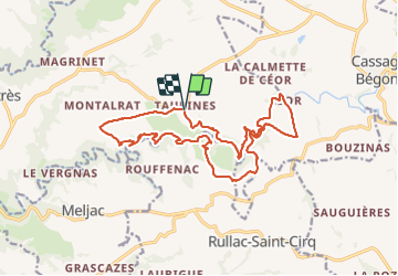
Trail Walking of 19.3 km to be discovered at Occitania, Aveyron, Centrès. This trail is proposed by Frayssinet.

Description

Plusieurs chemins impraticables, plein de buissons. balisage très très vieux, souvent invisible.
Itinéraire souvent abandonné

Elevation profile

Positioning

Country:
France
Region :
Occitania
Department/Province :
Aveyron
Municipality :
Centrès
Location:
Unknown
Start:(UTM)
457362 ; 4889847 (31T) N.

Comments

Please log in to post a review or rate the element


très bonne randonnée 5


Trails nearby

Trail Walking Centrès - Taurines 2023-2 - Photo
Walking
Frayssinet

Walking

Very difficult
Centrès, Occitania, Aveyron, France
17.9 km | 24 km-effort
5h 26min
Yes


Close
My subscriptions