![](/images/other/stat-length.png)
![Trail Walking De Panne - sgr kust (gr régional côte) day 1/4 - Photo](https://media.geolcdn.com/t/1900/400/aaa2f88c-b432-496b-9e73-3678850a8b83.jpg&format=pjpeg&maxdim=2)
sgr kust (gr régional côte) day 1/4
Charles Lemaire
User GUIDE
![Length](/images/other/stat-length.png)
![Max alt](https://static1.geolcdn.com/siteimages/upload/files/1508320355ic_sort_altitude_max_24dp.png)
![Uphill gradient](https://static1.geolcdn.com/siteimages/upload/files/1508320355ic_sort_den_pos_24dp.png)
![Km-Effort](/images/other/stat-length.png)
![Min alt](https://static1.geolcdn.com/siteimages/upload/files/1508320355ic_sort_altitude_min_24dp.png)
![Downhill gradient](https://static1.geolcdn.com/siteimages/upload/files/1508320355ic_sort_den_neg_24dp.png)
![Boucle](https://static1.geolcdn.com/siteimages/upload/files/16400158638029165_repeat_loop_refresh_sync_direction_icon.png)
![Walking](https://static1.geolcdn.com/sitytour/trail-icons/101.png)
6h32
Difficulty : Very difficult
![Scan this QR Code to open this trail in the SityTrail application](https://capi.geolives.com/qq0zvz2zws4bq2lad0pu/sitytour/trails/3887090/qr.png?size=200)
FREE GPS app for hiking
About
Trail Walking of 27 km to be discovered at Flanders, West Flanders, De Panne. This trail is proposed by Charles Lemaire.
Description
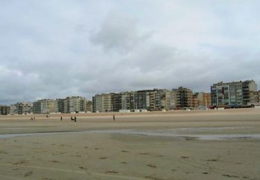
Une journée pour se persuader que la côte belge, ce n'est pas que du béton et le front de mer.
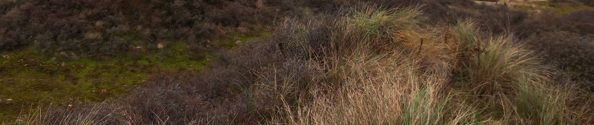
Une étape exigeante. Des franchissements de dunes dans du sable mou mettent les jambes à dure épreuve.
Les moins vaillants pourront la raccourcir. Par exemple en arrivant la veille et en faisant la boucle initiale du Westhoek pour loger à La Panne ; ou bien en prenant le tram de la côte lorsque la fatigue se fait sentir.
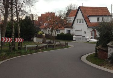
Logement facile à Nieuport.
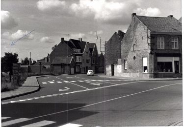
Positioning
Comments
Trails nearby
![Trail Walking Koksijde - St. Idesbald et Noorduinen - Photo](https://media.geolcdn.com/t/375/260/ext.jpg?maxdim=2&url=https%3A%2F%2Fservices.sitytrail.com%2FGeolivesWS%2FDownloadMedia.ashx%3FTrailID%3D168018%26Media%3D20121231143948.jpg)
![Walking Walking](https://static1.geolcdn.com/sitytour/trail-icons/101.png)
Walking
![](/images/other/stat-length.png)
![](https://static1.geolcdn.com/siteimages/upload/files/16400158638029165_repeat_loop_refresh_sync_direction_icon.png)
![Trail Mountain bike De Panne - 20240613 - TOTEMUS partiel - DE PANNE 16 Km - Photo](https://media.geolcdn.com/t/375/260/e6db3c74-8cd0-422d-a16f-519e8aed2213.jpg&format=jpg&maxdim=2)
![Mountain bike Mountain bike](https://static1.geolcdn.com/sitytour/trail-icons/202.png)
Mountain bike
![](/images/other/stat-length.png)
![](https://static1.geolcdn.com/siteimages/upload/files/16400158638029165_repeat_loop_refresh_sync_direction_icon.png)
![Trail Walking De Panne - 20240612 - TOTEMUS De Panne - 6.7 Km - Photo](https://media.geolcdn.com/t/375/260/c5970009-e40d-4347-b90a-1006eb79b5f8.jpg&format=jpg&maxdim=2)
![Walking Walking](https://static1.geolcdn.com/sitytour/trail-icons/101.png)
Walking
![](/images/other/stat-length.png)
![](https://static1.geolcdn.com/siteimages/upload/files/16400158638029165_repeat_loop_refresh_sync_direction_icon.png)
![Trail On foot Koksijde - IJslandvaarders - Photo](https://media.geolcdn.com/t/375/260/ff0167a3-9414-481c-8a7c-f8f5e15aac2c.jpeg&format=jpg&maxdim=2)
![On foot On foot](https://static1.geolcdn.com/sitytour/trail-icons/100.png)
On foot
![](/images/other/stat-length.png)
![](https://static1.geolcdn.com/siteimages/upload/files/16400158638029165_repeat_loop_refresh_sync_direction_icon.png)
![Trail On foot Veurne - Stadswandelroute Veurne - Photo](https://media.geolcdn.com/t/375/260/2a68b391-176c-49be-94c2-5b4152bca163.jpeg&format=jpg&maxdim=2)
![On foot On foot](https://static1.geolcdn.com/sitytour/trail-icons/100.png)
On foot
![](/images/other/stat-length.png)
![](https://static1.geolcdn.com/siteimages/upload/files/16400158638029165_repeat_loop_refresh_sync_direction_icon.png)
![Trail On foot Koksijde - Artiestenwandelroute - Photo](https://media.geolcdn.com/t/375/260/54053886-9eaa-4fd8-b3ef-a405e8574e3d.jpeg&format=jpg&maxdim=2)
![On foot On foot](https://static1.geolcdn.com/sitytour/trail-icons/100.png)
On foot
![](/images/other/stat-length.png)
![](https://static1.geolcdn.com/siteimages/upload/files/16400158638029165_repeat_loop_refresh_sync_direction_icon.png)
![Trail On foot De Panne - Westhoek wandelroute - Photo](https://media.geolcdn.com/t/375/260/6b99b450-f354-4687-ac8b-ac4e098bbfb2.jpeg&format=jpg&maxdim=2)
![On foot On foot](https://static1.geolcdn.com/sitytour/trail-icons/100.png)
On foot
![](/images/other/stat-length.png)
![](https://static1.geolcdn.com/siteimages/upload/files/16400158638029165_repeat_loop_refresh_sync_direction_icon.png)
![Trail On foot Koksijde - Doornpanne wandelroute - Photo](https://media.geolcdn.com/t/375/260/0863c493-c589-422a-b163-aa86b420f67c.jpeg&format=jpg&maxdim=2)
![On foot On foot](https://static1.geolcdn.com/sitytour/trail-icons/100.png)
On foot
![](/images/other/stat-length.png)
![](https://static1.geolcdn.com/siteimages/upload/files/16400158638029165_repeat_loop_refresh_sync_direction_icon.png)
![Trail Walking De Panne - w-belgie-westhoekreservaat - Photo](https://media.geolcdn.com/t/375/260/ext.jpg?maxdim=2&url=https%3A%2F%2Fstatic1.geolcdn.com%2Fsiteimages%2Fupload%2Ffiles%2F1553511878bg_sport_marche.png)
![Walking Walking](https://static1.geolcdn.com/sitytour/trail-icons/101.png)
Walking
![](/images/other/stat-length.png)
![](https://static1.geolcdn.com/siteimages/upload/files/16400158638029165_repeat_loop_refresh_sync_direction_icon.png)