Trail Walking Ronno - Ronno - Photo
© OpenStreetMap contributors
Length
Length
19.3 km
Max alt
Max alt
848 m
Uphill gradient
Uphill gradient
657 m
Km-Effort
Km-Effort  
28 km
Min alt
Min alt
524 m
Downhill gradient
Downhill gradient
653 m
Boucle
Boucle
Yes
Creation date :
2023-11-19 07:19:58.565
Updated on :
2023-11-19 12:16:09.459

(0 Reviews)

Walking
Walking
4h55
Difficulty : Medium

Scan this QR Code to open this trail in the SityTrail application

FREE GPS app for hiking

Logo SityTrail SityTrail

IGN / Geographical institutes

Download SityTrail from the App Store Download SityTrail from Google Play

Logo SityTrail SityTrail World

The world is yours!

Download SityTrail from the App Store Download SityTrail from Google Play Download SityTrail on Huawei AppGallery

About

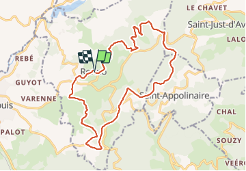
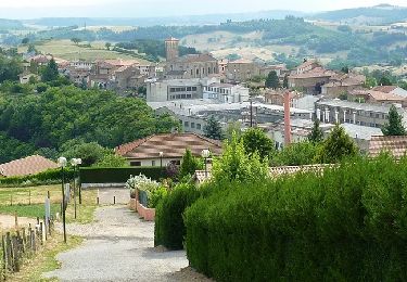
Trail Walking of 19.3 km to be discovered at Auvergne-Rhône-Alpes, Rhône, Ronno. This trail is proposed by fernand1254.

Description

Départ du parking de la salle des fêtes.
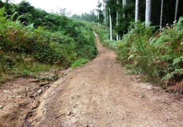
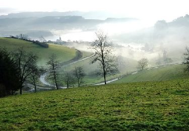
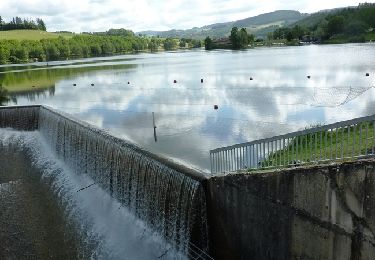
Beau parcours varié, sans difficulté majeure.

Elevation profile

Positioning

Country:
France
Region :
Auvergne-Rhône-Alpes
Department/Province :
Rhône
Municipality :
Ronno
Location:
Unknown
Start:(UTM)
607162 ; 5093265 (31T) N.

Trails nearby

Trail Walking Saint-Just-d'Avray - Des mollets d'aciers - Saint Just d'Avray - Photo
Walking
tracegps

Walking

Difficult
(2)
Saint-Just-d'Avray, Auvergne-Rhône-Alpes, Rhône, France
10.9 km | 16.5 km-effort
2h 45min
Yes
Trail Walking Cublize - 2024-08-29_08h31m38_Lac des sapins à cublize - Photo
Walking
Jean-Marc C

Walking

Very difficult
(1)
Cublize, Auvergne-Rhône-Alpes, Rhône, France
16.4 km | 23 km-effort
5h 18min
Yes
Trail Walking Ronno - lac des Sapins - Photo
Walking
Daniel Benteux

Walking

Easy
Ronno, Auvergne-Rhône-Alpes, Rhône, France
3.9 km | 4.7 km-effort
1h 0min
Yes
Trail Mountain bike Cublize - La Cubliz'Hard (2014-VTT-45km) - Cublize - Photo
Mountain bike
tracegps

Mountain bike

Very difficult
Cublize, Auvergne-Rhône-Alpes, Rhône, France
43 km | 61 km-effort
4h 30min
Yes
Trail Mountain bike Saint-Jean-la-Bussière - Rando du Pot au Feu (2014-VTT-40 km) - Saint Jean la Bussière - Photo
Mountain bike
tracegps

Mountain bike

Difficult
Saint-Jean-la-Bussière, Auvergne-Rhône-Alpes, Rhône, France
38 km | 54 km-effort
4h 0min
Yes
Trail Mountain bike Amplepuis - Ampl'Rando d'Automne (2013-VTT-50km) - Amplepuis - Photo
Mountain bike
tracegps

Mountain bike

Very difficult
Amplepuis, Auvergne-Rhône-Alpes, Rhône, France
48 km | 67 km-effort
4h 45min
Yes
Trail Mountain bike Saint-Jean-la-Bussière - Rando du Pot au Feu (2013-VTT-35 km) - Saint-Jean-la-Bussière - Photo
Mountain bike
tracegps

Mountain bike

Difficult
Saint-Jean-la-Bussière, Auvergne-Rhône-Alpes, Rhône, France
36 km | 49 km-effort
3h 15min
Yes
Trail Mountain bike Cublize - Lac des Sapins, VTT sur les crêtes entre Saint-Jean la Bussière et Saint Vincent de Reins - Cublize - Photo
Mountain bike
tracegps

Mountain bike

Medium
Cublize, Auvergne-Rhône-Alpes, Rhône, France
32 km | 42 km-effort
2h 45min
Yes
Trail Mountain bike Saint-Jean-la-Bussière - Rando du Pot au Feu (2012-VTT-35 km) - Saint Jean la Bussière - Photo
Mountain bike
tracegps

Mountain bike

Difficult
Saint-Jean-la-Bussière, Auvergne-Rhône-Alpes, Rhône, France
35 km | 48 km-effort
3h 15min
Yes


Close
My subscriptions