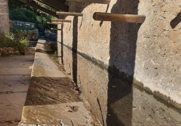
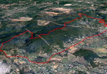
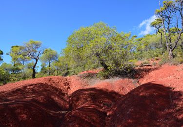
Trail Walking Tourtour - Tracé actuel: 18 NOV 2023 13:55 - Photo

Tracé actuel: 18 NOV 2023 13:55

 felix83
felix83

User

© OpenStreetMap contributors
Length
Length
6.8 km
Max alt
Max alt
674 m
Uphill gradient
Uphill gradient
129 m
Km-Effort
Km-Effort  
8.5 km
Min alt
Min alt
585 m
Downhill gradient
Downhill gradient
127 m
Boucle
Boucle
Yes
Creation date :
2023-11-18 15:59:42.905
Updated on :
2023-11-18 16:11:58.065

(0 Reviews)

Walking
Walking
1h56
Difficulty : Medium

Scan this QR Code to open this trail in the SityTrail application

FREE GPS app for hiking

Logo SityTrail SityTrail

IGN / Geographical institutes

Download SityTrail from the App Store Download SityTrail from Google Play

Logo SityTrail SityTrail World

The world is yours!

Download SityTrail from the App Store Download SityTrail from Google Play Download SityTrail on Huawei AppGallery

About

Trail Walking of 6.8 km to be discovered at Provence-Alpes-Côte d'Azur, Var, Tourtour. This trail is proposed by felix83.

Description

Petite rando d'environ 8 KM facile. Quelques montées mais bien étalées. Je l'ai faite en 1h30 lors de la reco mais j'ai prévu 2h15 de marche pour mon groupe. Pas de difficulté. Il y a 300m sur la départementale le reste sur les pistes ou chemins.
Grand parking à droite juste après le panneau "Tourtour"
Le retour avec la vue sur le village "dans le ciel" est très poétique.

Elevation profile

Positioning

Country:
France
Region :
Provence-Alpes-Côte d'Azur
Department/Province :
Var
Municipality :
Tourtour
Location:
Unknown
Start:(UTM)
282518 ; 4829750 (32T) N.

Trails nearby

Trail Walking Villecroze - 2023-10-31 Villecroz - Tourtour et tourisme  - Photo
Walking
GUIDE
Kargil

Walking

Medium
Villecroze, Provence-Alpes-Côte d'Azur, Var, France
17.6 km | 24 km-effort
5h 28min
Yes
Trail Walking Tourtour - Tourtour - Les Moulières - Photo
Walking
Sugg

Walking

Medium
(1)
Tourtour, Provence-Alpes-Côte d'Azur, Var, France
13.1 km | 15.6 km-effort
5h 0min
Yes
Trail Other activity Villecroze - fox  - Photo
Other activity
vicious

Other activity

Medium
(1)
Villecroze, Provence-Alpes-Côte d'Azur, Var, France
42 km | 52 km-effort
2h 24min
Yes
Trail Mountain bike Villecroze - st bart - Photo
Mountain bike
vicious

Mountain bike

Difficult
(1)
Villecroze, Provence-Alpes-Côte d'Azur, Var, France
33 km | 42 km-effort
2h 20min
Yes
Trail Mountain bike Villecroze - giant vs haibike - Photo
Mountain bike
vicious

Mountain bike

Medium
(1)
Villecroze, Provence-Alpes-Côte d'Azur, Var, France
29 km | 36 km-effort
1h 49min
Yes
Trail Walking Villecroze - Villecroze-  Domaine Saint Jean  - Photo
Walking
Chantheys

Walking

Easy
Villecroze, Provence-Alpes-Côte d'Azur, Var, France
4.3 km | 5.4 km-effort
1h 16min
No
Trail Walking Villecroze - Autour de Villecroze - Chapelles, Parcs et jardins - Photo
Walking
GUIDE
affinetataille

Walking

Medium
Villecroze, Provence-Alpes-Côte d'Azur, Var, France
15.8 km | 21 km-effort
7h 0min
Yes
Trail Walking Villecroze - Villecroze de Chapelles en Grottes - Photo
Walking
donda

Walking

Very difficult
Villecroze, Provence-Alpes-Côte d'Azur, Var, France
19.9 km | 28 km-effort
5h 49min
Yes
Trail Walking Villecroze - Villecroze - Chapelle Saint Victor - Pont Gourgeon - Jardin botanique - Photo
Walking
LtZIP

Walking

Medium
Villecroze, Provence-Alpes-Côte d'Azur, Var, France
15.1 km | 21 km-effort
4h 26min
Yes


Close
My subscriptions