


Maroc 01-11-2023

honda400xr
User
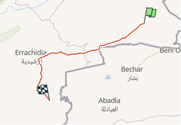

Length
363 km

Max alt
1165 m

Uphill gradient
2072 m
Km-Effort
392 km

Min alt
694 m

Downhill gradient
2536 m
Boucle
No
Creation date :
2023-11-01 10:31:29.189
Updated on :
2023-11-01 17:45:28.785
7h13
Difficulty : Very easy

FREE GPS app for hiking
 SityTrail
IGN / Geographical institutes
SityTrail World
The world is yours!
About
Trail Trail of 363 km to be discovered at Oriental, Pachalik de Bouarfa, Bouarfa. This trail is proposed by honda400xr.
Positioning
Country:
Morocco
Region :
Oriental
Department/Province :
Pachalik de Bouarfa
Municipality :
Bouarfa
Location:
Unknown
Start:(Dec)
Start:(UTM)
597735 ; 3599757 (30S) N.
Comments
Trails nearby