![](/images/other/stat-length.png)
![Trail Walking Phalempin - Chateau de l'Ermitage - Photo](https://media.geolcdn.com/t/1900/400/fb96e4bd-60dc-41fb-80cf-f070429bf33d.jpg&format=pjpeg&maxdim=2)
Chateau de l'Ermitage
Greg813
User
![Length](/images/other/stat-length.png)
Length
9.3 km
![Max alt](https://static1.geolcdn.com/siteimages/upload/files/1508320355ic_sort_altitude_max_24dp.png)
Max alt
73 m
![Uphill gradient](https://static1.geolcdn.com/siteimages/upload/files/1508320355ic_sort_den_pos_24dp.png)
Uphill gradient
85 m
![Km-Effort](/images/other/stat-length.png)
Km-Effort
10.4 km
![Min alt](https://static1.geolcdn.com/siteimages/upload/files/1508320355ic_sort_altitude_min_24dp.png)
Min alt
35 m
![Downhill gradient](https://static1.geolcdn.com/siteimages/upload/files/1508320355ic_sort_den_neg_24dp.png)
Downhill gradient
83 m
![Boucle](https://static1.geolcdn.com/siteimages/upload/files/16400158638029165_repeat_loop_refresh_sync_direction_icon.png)
Boucle
Yes
Creation date :
2023-10-22 13:11:29.914
Updated on :
2023-10-27 13:46:41.742
![Walking](https://static1.geolcdn.com/sitytour/trail-icons/101.png)
2h21
Difficulty : Medium
![Scan this QR Code to open this trail in the SityTrail application](https://capi.geolives.com/qq0zvz2zws4bq2lad0pu/sitytour/trails/3847538/qr.png?size=200)
FREE GPS app for hiking
About
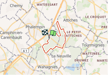
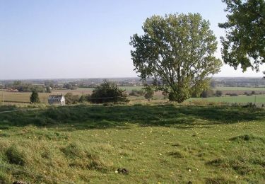
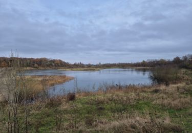
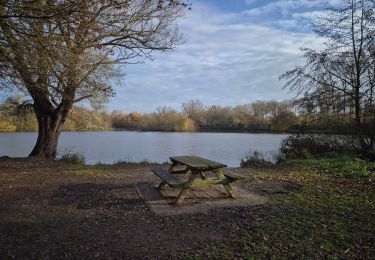
Trail Walking of 9.3 km to be discovered at Hauts-de-France, Nord, Phalempin. This trail is proposed by Greg813.
Description
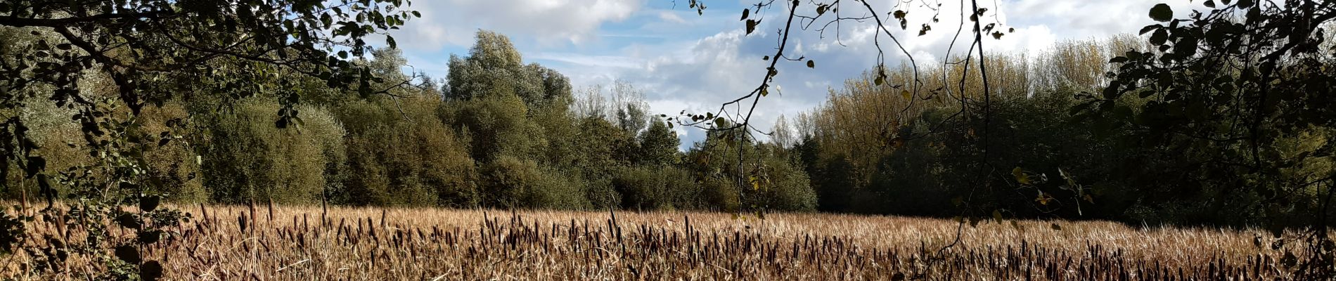
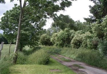
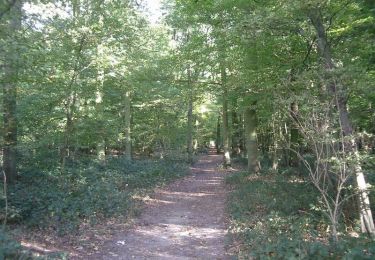
Petite ballade le long du pourtour du bois de l'Ermitage, à proximité de Phalempin.
Les chemins peuvent devenir boueux et glissants par temps pluvieux !
Positioning
Country:
France
Region :
Hauts-de-France
Department/Province :
Nord
Municipality :
Phalempin
Location:
Unknown
Start:(Dec)
Start:(UTM)
502406 ; 5595084 (31U) N.
Comments
Trails nearby
![Trail Walking Herrin - Circuit des Naviettes - Herrin - Photo](https://media.geolcdn.com/t/375/260/ext.jpg?maxdim=2&url=https%3A%2F%2Fservices.sitytrail.com%2FGeolivesWS%2FDownloadMedia.ashx%3FTrailID%3D109192%26Media%3D3236_6.jpg)
![Walking Walking](https://static1.geolcdn.com/sitytour/trail-icons/101.png)
Circuit des Naviettes - Herrin
Walking
Easy
(1)
Herrin,
Hauts-de-France,
Nord,
France
![](/images/other/stat-length.png)
5.7 km | 6 km-effort
1h 30min
![](https://static1.geolcdn.com/siteimages/upload/files/16400158638029165_repeat_loop_refresh_sync_direction_icon.png)
Yes
![Trail Walking Mons-en-Pévèle - Autour du site ornithologique du bois des Cinq Tailles - Mons en Pévèle - Photo](https://media.geolcdn.com/t/375/260/ext.jpg?maxdim=2&url=https%3A%2F%2Fservices.sitytrail.com%2FGeolivesWS%2FDownloadMedia.ashx%3FTrailID%3D107326%26Media%3D12216_6.jpg)
![Walking Walking](https://static1.geolcdn.com/sitytour/trail-icons/101.png)
Autour du site ornithologique du bois des Cinq Tailles - Mons en Pévèle
Walking
Medium
(4)
Mons-en-Pévèle,
Hauts-de-France,
Nord,
France
![](/images/other/stat-length.png)
11.2 km | 12.8 km-effort
2h 49min
![](https://static1.geolcdn.com/siteimages/upload/files/16400158638029165_repeat_loop_refresh_sync_direction_icon.png)
Yes
![Trail Walking Mons-en-Pévèle - Autour du château d'Assignies à Tourmignies - Mons-en-Pévèle - Photo](https://media.geolcdn.com/t/375/260/ext.jpg?maxdim=2&url=https%3A%2F%2Fservices.sitytrail.com%2FGeolivesWS%2FDownloadMedia.ashx%3FTrailID%3D107253%26Media%3D12133_6.jpg)
![Walking Walking](https://static1.geolcdn.com/sitytour/trail-icons/101.png)
Autour du château d'Assignies à Tourmignies - Mons-en-Pévèle
Walking
Difficult
(2)
Mons-en-Pévèle,
Hauts-de-France,
Nord,
France
![](/images/other/stat-length.png)
12.9 km | 14.3 km-effort
3h 15min
![](https://static1.geolcdn.com/siteimages/upload/files/16400158638029165_repeat_loop_refresh_sync_direction_icon.png)
Yes
![Trail Walking Libercourt - Rando 2 départ gare de Libercourt - Photo](https://media.geolcdn.com/t/375/260/6649baa4-bd92-471f-9e25-20f3b461a0d9.jpg&format=jpg&maxdim=2)
![Walking Walking](https://static1.geolcdn.com/sitytour/trail-icons/101.png)
Rando 2 départ gare de Libercourt
Walking
Easy
(1)
Libercourt,
Hauts-de-France,
Pas-de-Calais,
France
![](/images/other/stat-length.png)
13.1 km | 14.3 km-effort
2h 57min
![](https://static1.geolcdn.com/siteimages/upload/files/16400158638029165_repeat_loop_refresh_sync_direction_icon.png)
Yes
![Trail Walking Libercourt - rando 1 départ gare de Libercourt - Photo](https://media.geolcdn.com/t/375/260/9962cfa6-bdeb-49c8-a4d4-8f0619f68da8.jpg&format=jpg&maxdim=2)
![Walking Walking](https://static1.geolcdn.com/sitytour/trail-icons/101.png)
rando 1 départ gare de Libercourt
Walking
Easy
(1)
Libercourt,
Hauts-de-France,
Pas-de-Calais,
France
![](/images/other/stat-length.png)
13.7 km | 15.2 km-effort
2h 57min
![](https://static1.geolcdn.com/siteimages/upload/files/16400158638029165_repeat_loop_refresh_sync_direction_icon.png)
Yes
![Trail Walking Mons-en-Pévèle - Autour des Voyettes - Mons-en-Pévèle - Photo](https://media.geolcdn.com/t/375/260/ext.jpg?maxdim=2&url=https%3A%2F%2Fservices.sitytrail.com%2FGeolivesWS%2FDownloadMedia.ashx%3FTrailID%3D107254%26Media%3D12134_6.jpg)
![Walking Walking](https://static1.geolcdn.com/sitytour/trail-icons/101.png)
Autour des Voyettes - Mons-en-Pévèle
Walking
Easy
(1)
Mons-en-Pévèle,
Hauts-de-France,
Nord,
France
![](/images/other/stat-length.png)
3 km | 3.6 km-effort
45min
![](https://static1.geolcdn.com/siteimages/upload/files/16400158638029165_repeat_loop_refresh_sync_direction_icon.png)
Yes
![Trail Walking Mons-en-Pévèle - le paradis de mons en pévèle - Photo](https://media.geolcdn.com/t/375/260/ext.jpg?maxdim=2&url=https%3A%2F%2Fstatic1.geolcdn.com%2Fsiteimages%2Fupload%2Ffiles%2F1553511878bg_sport_marche.png)
![Walking Walking](https://static1.geolcdn.com/sitytour/trail-icons/101.png)
le paradis de mons en pévèle
Walking
Easy
(1)
Mons-en-Pévèle,
Hauts-de-France,
Nord,
France
![](/images/other/stat-length.png)
8.6 km | 9.8 km-effort
2h 15min
![](https://static1.geolcdn.com/siteimages/upload/files/16400158638029165_repeat_loop_refresh_sync_direction_icon.png)
Yes
![Trail Walking Avelin - circuit des chicons - Photo](https://media.geolcdn.com/t/375/260/c6c11125-df6c-403a-9c62-53c8254f7d6d.jpg&format=jpg&maxdim=2)
![Walking Walking](https://static1.geolcdn.com/sitytour/trail-icons/101.png)
circuit des chicons
Walking
Easy
Avelin,
Hauts-de-France,
Nord,
France
![](/images/other/stat-length.png)
11.7 km | 12.5 km-effort
2h 21min
![](https://static1.geolcdn.com/siteimages/upload/files/16400158638029165_repeat_loop_refresh_sync_direction_icon.png)
Yes
![Trail On foot Oignies - oignies et le parc des hautois - Photo](https://media.geolcdn.com/t/375/260/ext.jpg?maxdim=2&url=https%3A%2F%2Fstatic1.geolcdn.com%2Fsiteimages%2Fupload%2Ffiles%2F1545311037marcheuse_200dpi.jpg)
![On foot On foot](https://static1.geolcdn.com/sitytour/trail-icons/100.png)
oignies et le parc des hautois
On foot
Medium
(1)
Oignies,
Hauts-de-France,
Pas-de-Calais,
France
![](/images/other/stat-length.png)
9.8 km | 11.1 km-effort
Unknown
![](https://static1.geolcdn.com/siteimages/upload/files/16400158638029165_repeat_loop_refresh_sync_direction_icon.png)
Yes