


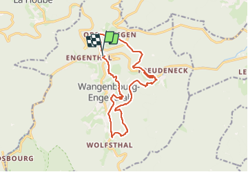

13.8 km | 18.7 km-effort


User


FREE GPS app for hiking
 SityTrail
IGN / Geographical institutes
SityTrail World
The world is yours!
Trail Walking of 15.8 km to be discovered at Grand Est, Bas-Rhin, Wangenbourg-Engenthal. This trail is proposed by MAD-CVW.
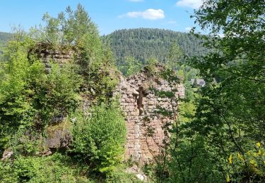
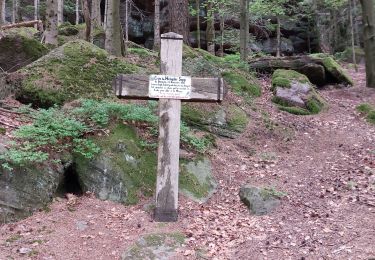
Au départ de Steigenbach (sur D218 entre Wangenbourg et Obersteigen) suivre GR532 rectangle jaune vers Obersteigen. Traverser le village en suivant la croix bleue et croix jaune, à la sortie du village, tourner à droite sur croix jaune qui traverse la route. En face descendre dans la forêt, quitter le sentier pour monter au Rotfels par chevalet rouge et rejoindre la croix jaune. Arrivé sur la D224, traverser et atteindre Freundeneck. Tourner à droite et monter au château, puis suivre anneau rouge en montée jusqu'au Kittelfelsen. Beau point vue. Poursuivre sur anneau rouge, au pont Brocard, tout droit par triangle jaune à quitter plus tard pour suivre anneau bleu sur magnifique sentier le long de l'impression ensemble des Rochers Neveu. Anneau bleu jusqu'à Les Huttes, descendre à droite le triangle rouge. A l'entrée de Wangenbourg, prendre à droite croix bleue/chevalet jaune pour rejoindre les ruines du chateau de Wangenbourg. Montée au donjon conseillée pour le beau panorama. Rejoindre parking par anneau rouge, puis chevalet jaune.

Walking

Walking

Walking

Walking

Walking
Walking

Walking

Walking