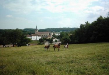
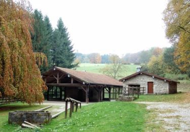
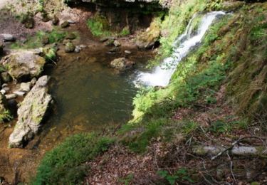
Trail Walking Xertigny - Cirkwi-Le_Hazot - Photo

Cirkwi-Le_Hazot

© OpenStreetMap contributors
Length
Length
11.3 km
Max alt
Max alt
500 m
Uphill gradient
Uphill gradient
239 m
Km-Effort
Km-Effort  
14.5 km
Min alt
Min alt
347 m
Downhill gradient
Downhill gradient
236 m
Boucle
Boucle
Yes
Creation date :
2023-10-12 10:27:47.968
Updated on :
2023-10-12 10:35:57.892

(0 Reviews)

Walking
Walking
3h17
Difficulty : Difficult

Scan this QR Code to open this trail in the SityTrail application

FREE GPS app for hiking

Logo SityTrail SityTrail

IGN / Geographical institutes

Download SityTrail from the App Store Download SityTrail from Google Play

Logo SityTrail SityTrail World

The world is yours!

Download SityTrail from the App Store Download SityTrail from Google Play Download SityTrail on Huawei AppGallery

About

Trail Walking of 11.3 km to be discovered at Grand Est, Vosges, Xertigny. This trail is proposed by Emmanuel Remy.

Description

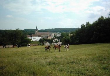
Itinéraire plaisant du nom d'un lieu-dit qu'il contourne. Partagé entre décors champêtres, les charmes de la forêt vosgienne et ceux de l'eau vive, il offre de beaux points de vue, ouverts sur le lointain à l'ouest et centrés sur le village enserré dans sa couronne forestière à l'est.

Elevation profile

Points of interest

Point of interest Xertigny -  - Photo
Emmanuel Remy
XERTIGNY 
Point of interest Xertigny -  - Photo
Emmanuel Remy
XERTIGNY 
Point of interest Xertigny -  - Photo
Emmanuel Remy
XERTIGNY 
Point of interest Xertigny -  - Photo
Emmanuel Remy
XERTIGNY 
Point of interest Hadol -  - Photo
Emmanuel Remy
HADOL 
Point of interest Hadol -  - Photo
Emmanuel Remy
HADOL 
Point of interest Xertigny -  - Photo
Emmanuel Remy
XERTIGNY 

Positioning

Country:
France
Region :
Grand Est
Department/Province :
Vosges
Municipality :
Xertigny
Location:
Unknown
Start:(UTM)
306036 ; 5324790 (32U) N.

Trails nearby

Trail Mountain bike Bellefontaine - Espace VTT FFC Chemins du Coeur des Vosges - circuit n°23 - Le Xaty - Photo
Mountain bike
tracegps

Mountain bike

Easy
(2)
Bellefontaine, Grand Est, Vosges, France
12.2 km | 14.7 km-effort
49min
Yes
Trail Walking Xertigny - l)Etapa 12 - Photo
Walking
RafaTuareg

Walking

Easy
Xertigny, Grand Est, Vosges, France
23 km | 30 km-effort
5h 2min
No
Trail Mountain bike Hadol - Q Xx - Photo
Mountain bike
Arnaud88

Mountain bike

Medium
Hadol, Grand Est, Vosges, France
23 km | 30 km-effort
2h 13min
Yes
Trail Walking Xertigny - Xertigny : circuit n'5 les granges Richard 10-05-19 - Photo
Walking
annefrance70

Walking

Easy
Xertigny, Grand Est, Vosges, France
9.4 km | 12.3 km-effort
2h 0min
Yes
Trail Walking Xertigny - Les Bois Beaudoin - Photo
Walking
jeanclaude12

Walking

Easy
Xertigny, Grand Est, Vosges, France
6.8 km | 9.2 km-effort
2h 43min
Yes
Trail Mountain bike La Chapelle-aux-Bois - Espace VTT FFC Chemins du Coeur des Vosges - circuit n°18 - Le Grand Bois - Photo
Mountain bike
tracegps

Mountain bike

Easy
La Chapelle-aux-Bois, Grand Est, Vosges, France
11.7 km | 14.5 km-effort
49min
Yes
Trail Mountain bike Xertigny - Espace VTT FFC Chemins du Coeur des Vosges - circuit n°22 - La Hutte - Photo
Mountain bike
tracegps

Mountain bike

Medium
Xertigny, Grand Est, Vosges, France
10.3 km | 14.3 km-effort
49min
Yes
Trail Mountain bike La Chapelle-aux-Bois - Espace VTT FFC Chemins du Coeur des Vosges - circuit n°19 - Le Rouge Moulin - Photo
Mountain bike
tracegps

Mountain bike

Difficult
La Chapelle-aux-Bois, Grand Est, Vosges, France
26 km | 33 km-effort
2h 19min
Yes
Trail Mountain bike Xertigny - Espace VTT FFC Chemins du Coeur des Vosges - circuit n°30 - Le Gué du Saut - Photo
Mountain bike
tracegps

Mountain bike

Difficult
Xertigny, Grand Est, Vosges, France
32 km | 40 km-effort
1h 45min
Yes


Close
My subscriptions