Trail Walking Plombières-les-Bains - Cirkwi-Etang_du_Moineau - Photo

Cirkwi-Etang_du_Moineau

© OpenStreetMap contributors
Length
Length
6.9 km
Max alt
Max alt
596 m
Uphill gradient
Uphill gradient
223 m
Km-Effort
Km-Effort  
9.9 km
Min alt
Min alt
429 m
Downhill gradient
Downhill gradient
222 m
Boucle
Boucle
Yes
Creation date :
2023-10-12 10:27:24.54
Updated on :
2023-10-12 10:36:50.599

(0 Reviews)

Walking
Walking
2h14
Difficulty : Medium

Scan this QR Code to open this trail in the SityTrail application

FREE GPS app for hiking

Logo SityTrail SityTrail

IGN / Geographical institutes

Download SityTrail from the App Store Download SityTrail from Google Play

Logo SityTrail SityTrail World

The world is yours!

Download SityTrail from the App Store Download SityTrail from Google Play Download SityTrail on Huawei AppGallery

About

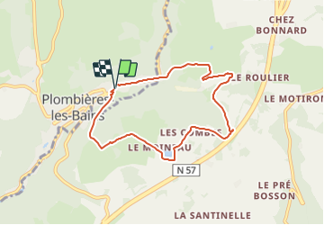
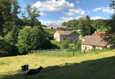
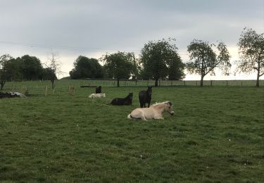
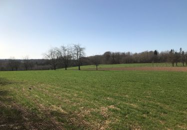
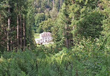
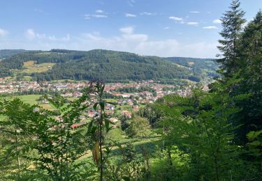
Trail Walking of 6.9 km to be discovered at Grand Est, Vosges, Plombières-les-Bains. This trail is proposed by Emmanuel Remy.

Description

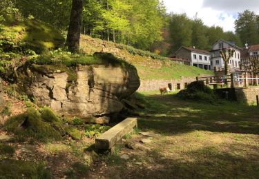
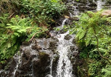
Autrefois, les aubergistes et les hôteliers de la station thermale profitaient de l'hiver pour faire des provisions de glace récoltée sur des étangs comme celui du Moineau. La glace était stockée dans des glacières souterraines jusqu'au début de l'été.

Elevation profile

Points of interest

Point of interest Plombières-les-Bains -  - Photo
Emmanuel Remy
PLOMBIÈRES-LES-BAINS 
Point of interest Le Val-d'Ajol -  - Photo
Emmanuel Remy
LE VAL-D'AJOL 
Point of interest Le Val-d'Ajol -  - Photo
Emmanuel Remy
LE VAL-D'AJOL 
Point of interest Le Val-d'Ajol -  - Photo
Emmanuel Remy
LE VAL-D'AJOL 
Point of interest Le Val-d'Ajol -  - Photo
Emmanuel Remy
LE VAL-D'AJOL 
Point of interest Le Val-d'Ajol -  - Photo
Emmanuel Remy
LE VAL-D'AJOL 
Point of interest Le Val-d'Ajol -  - Photo
Emmanuel Remy
LE VAL-D'AJOL 

Positioning

Country:
France
Region :
Grand Est
Department/Province :
Vosges
Municipality :
Plombières-les-Bains
Location:
Unknown
Start:(UTM)
310685 ; 5315687 (32T) N.

Trails nearby

Trail Walking Plombières-les-Bains - plombières et les Ruaux - Photo
Walking
Samuel88300

Walking

Easy
(1)
Plombières-les-Bains, Grand Est, Vosges, France
7.9 km | 10.2 km-effort
2h 28min
Yes
Trail Walking Le Val-d'Ajol - Cascade de Faymont - Photo
Walking
Galoche

Walking

Easy
Le Val-d'Ajol, Grand Est, Vosges, France
9.7 km | 13.7 km-effort
2h 44min
Yes
Trail Nordic walking Plombières-les-Bains - plombieres20221008 - Photo
Nordic walking
demange gerald

Nordic walking

Very easy
Plombières-les-Bains, Grand Est, Vosges, France
19.6 km | 25 km-effort
3h 18min
Yes
Trail Horseback riding Fougerolles-Saint-Valbert - Moulin taquere 7kms - Photo
Horseback riding
Bonetto

Horseback riding

Difficult
Fougerolles-Saint-Valbert, Bourgogne-Franche-Comté, Haute-Saône, France
7.6 km | 10.5 km-effort
1h 21min
Yes
Trail Walking Fougerolles-Saint-Valbert - Balade poney 6kms - Photo
Walking
Bonetto

Walking

Medium
Fougerolles-Saint-Valbert, Bourgogne-Franche-Comté, Haute-Saône, France
6.3 km | 8 km-effort
Unknown
Yes
Trail Horseback riding Fougerolles-Saint-Valbert - Balade 1h vers chez le poix - Photo
Horseback riding
Bonetto

Horseback riding

Difficult
Fougerolles-Saint-Valbert, Bourgogne-Franche-Comté, Haute-Saône, France
6.1 km | 7.8 km-effort
1h 12min
Yes
Trail Walking Le Val-d'Ajol - Faymont - Photo
Walking
jpblimond

Walking

Easy
Le Val-d'Ajol, Grand Est, Vosges, France
9.4 km | 13.1 km-effort
2h 51min
Yes
Trail Walking Plombières-les-Bains - 30-07-23 Plombières : circuit jaune n°9 - Photo
Walking
annefrance70

Walking

Medium
Plombières-les-Bains, Grand Est, Vosges, France
10.7 km | 15.5 km-effort
2h 32min
Yes
Trail Walking Le Val-d'Ajol - Val d’Ajol  - Photo
Walking
jpblimond

Walking

Difficult
Le Val-d'Ajol, Grand Est, Vosges, France
13.5 km | 18.4 km-effort
4h 11min
Yes


Close
My subscriptions