


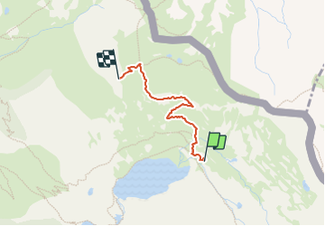

15.5 km | 30 km-effort


User GUIDE


FREE GPS app for hiking
 SityTrail
IGN / Geographical institutes
SityTrail World
The world is yours!
Trail Walking of 1.9 km to be discovered at Provence-Alpes-Côte d'Azur, Maritime Alps, Saint-Étienne-de-Tinée. This trail is proposed by nadd73.
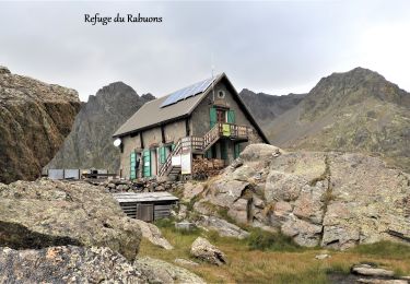
Petite montée avant le bivouac.
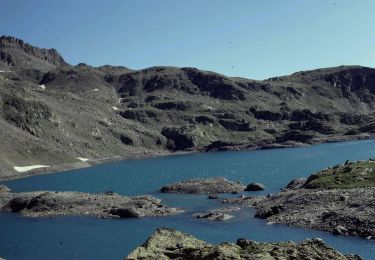
Magnifique !


Walking
Walking

Walking

Walking

On foot

On foot
On foot

Walking
Walking