![](/images/other/stat-length.png)
![Trail Walking Herstal - SGR 412 (2ème étape) - Photo](https://media.geolcdn.com/t/1900/400/3adf180f-69fd-4cf5-8b4b-02a6289b52be.jpg&format=pjpeg&maxdim=2)
SGR 412 (2ème étape)
© OpenStreetMap contributors
![Walking](https://static1.geolcdn.com/sitytour/trail-icons/101.png)
Walking
2h15
Difficulty : Easy
![Length](/images/other/stat-length.png)
Length
7.5 km
![Max alt](https://static1.geolcdn.com/siteimages/upload/files/1508320355ic_sort_altitude_max_24dp.png)
Max alt
165 m
![Uphill gradient](https://static1.geolcdn.com/siteimages/upload/files/1508320355ic_sort_den_pos_24dp.png)
Uphill gradient
252 m
![Km-Effort](/images/other/stat-length.png)
Km-Effort
10.6 km
![Min alt](https://static1.geolcdn.com/siteimages/upload/files/1508320355ic_sort_altitude_min_24dp.png)
Min alt
69 m
![Downhill gradient](https://static1.geolcdn.com/siteimages/upload/files/1508320355ic_sort_den_neg_24dp.png)
Downhill gradient
163 m
![Boucle](https://static1.geolcdn.com/siteimages/upload/files/16400158638029165_repeat_loop_refresh_sync_direction_icon.png)
Boucle
No
Creation date :
2023-10-08 12:31:31.272
Updated on :
2023-10-08 18:46:36.269
![Walking](https://static1.geolcdn.com/sitytour/trail-icons/101.png)
2h15
Difficulty : Easy
![Scan this QR Code to open this trail in the SityTrail application](https://capi.geolives.com/qq0zvz2zws4bq2lad0pu/sitytour/trails/3833818/qr.png?size=200)
FREE GPS app for hiking
About
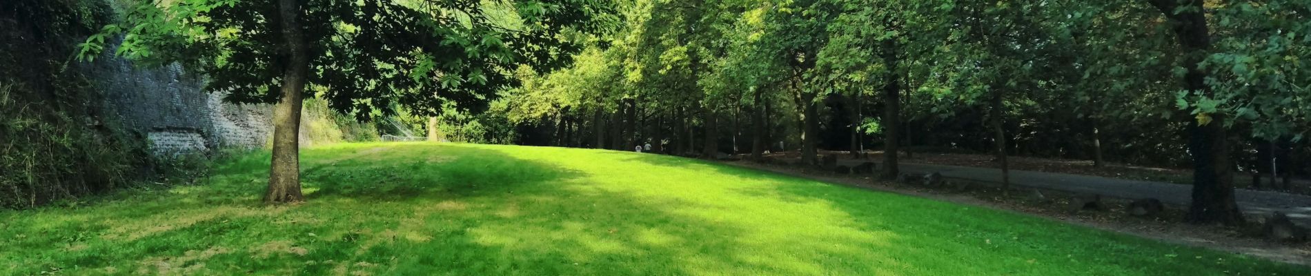
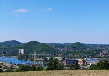
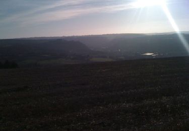
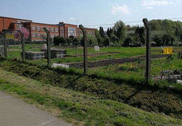
Trail Walking of 7.5 km to be discovered at Wallonia, Liège, Herstal. This trail is proposed by Godasses et Grosses Pattes.
Description
2éme étape du SGR 412 sentier des terrils dans le sens Blegny mine - Bernissart
1er partie de la boucles les coteaux (Herstal - citadelle de Liège - Herstal)
que j'ai scindé en deux Herstal - citadelle de Liège.
Positioning
Country:
Belgium
Region :
Wallonia
Department/Province :
Liège
Municipality :
Herstal
Location:
Unknown
Start:(Dec)
Start:(UTM)
685054 ; 5615148 (31U) N.
Comments
Trails nearby
![Trail Walking Liège - Nuit du scoutisme - Liège - Photo](https://media.geolcdn.com/t/375/260/9ee5fcc5-2ed6-4f9c-9105-1fa3b4422f73.jpg&format=jpg&maxdim=2)
![Walking Walking](https://static1.geolcdn.com/sitytour/trail-icons/101.png)
Nuit du scoutisme - Liège
Walking
Easy
(12)
Liège,
Wallonia,
Liège,
Belgium
![](/images/other/stat-length.png)
4.2 km | 6 km-effort
1h 19min
![](https://static1.geolcdn.com/siteimages/upload/files/16400158638029165_repeat_loop_refresh_sync_direction_icon.png)
Yes
![Trail Walking Liège - coteaux de la citadelle liège - Photo](https://media.geolcdn.com/t/375/260/ext.jpg?maxdim=2&url=https%3A%2F%2Fservices.sitytrail.com%2FGeolivesWS%2FDownloadMedia.ashx%3FTrailID%3D114030%26Media%3D89e4d7f6-fadf-43e4-96ab-3cccd7baadb9.jpg)
![Walking Walking](https://static1.geolcdn.com/sitytour/trail-icons/101.png)
coteaux de la citadelle liège
Walking
Medium
(6)
Liège,
Wallonia,
Liège,
Belgium
![](/images/other/stat-length.png)
14.3 km | 19.8 km-effort
7h 4min
![](https://static1.geolcdn.com/siteimages/upload/files/16400158638029165_repeat_loop_refresh_sync_direction_icon.png)
Yes
![Trail Walking Liège - liege st lambert versant gauche entre ville et nature - Photo](https://media.geolcdn.com/t/375/260/88c52680-ebe2-4244-8d59-4bcee560958c.jpg&format=jpg&maxdim=2)
![Walking Walking](https://static1.geolcdn.com/sitytour/trail-icons/101.png)
liege st lambert versant gauche entre ville et nature
Walking
Medium
(1)
Liège,
Wallonia,
Liège,
Belgium
![](/images/other/stat-length.png)
10.5 km | 14 km-effort
2h 31min
![](https://static1.geolcdn.com/siteimages/upload/files/16400158638029165_repeat_loop_refresh_sync_direction_icon.png)
Yes
![Trail Walking Liège - 2021-03-07_15h45m11_1615128300605_UnnMrtGYyrs - Photo](https://media.geolcdn.com/t/375/260/1db82134-c6f1-4cf9-9ec5-4781d8a78844.jpg&format=jpg&maxdim=2)
![Walking Walking](https://static1.geolcdn.com/sitytour/trail-icons/101.png)
2021-03-07_15h45m11_1615128300605_UnnMrtGYyrs
Walking
Easy
(1)
Liège,
Wallonia,
Liège,
Belgium
![](/images/other/stat-length.png)
3 km | 3.9 km-effort
53min
![](https://static1.geolcdn.com/siteimages/upload/files/16400158638029165_repeat_loop_refresh_sync_direction_icon.png)
Yes
![Trail Walking Fléron - F15 Fléron Fond du Pucet - Photo](https://media.geolcdn.com/t/375/260/52059866-a3d8-42bb-ace6-902ab69a25c9.jpg&format=jpg&maxdim=2)
![Walking Walking](https://static1.geolcdn.com/sitytour/trail-icons/101.png)
F15 Fléron Fond du Pucet
Walking
Easy
(2)
Fléron,
Wallonia,
Liège,
Belgium
![](/images/other/stat-length.png)
4.8 km | 6 km-effort
57min
![](https://static1.geolcdn.com/siteimages/upload/files/16400158638029165_repeat_loop_refresh_sync_direction_icon.png)
Yes
![Trail Electric bike Blegny - Par les Houlpais - Photo](https://media.geolcdn.com/t/375/260/91501caf-acdf-43bf-a952-638e9aed87aa.jpg&format=jpg&maxdim=2)
![Electric bike Electric bike](https://static1.geolcdn.com/sitytour/trail-icons/205.png)
Par les Houlpais
Electric bike
Difficult
(1)
Blegny,
Wallonia,
Liège,
Belgium
![](/images/other/stat-length.png)
37 km | 48 km-effort
2h 30min
![](https://static1.geolcdn.com/siteimages/upload/files/16400158638029165_repeat_loop_refresh_sync_direction_icon.png)
Yes
![Trail Walking Beyne-Heusay - Beyne-Heusay - Grivegnée par la Chapelle Sainte-Anne - Photo](https://media.geolcdn.com/t/375/260/ext.jpg?maxdim=2&url=https%3A%2F%2Fservices.sitytrail.com%2FGeolivesWS%2FDownloadMedia.ashx%3FTrailID%3D229568%26Media%3D20120115145851.jpg)
![Walking Walking](https://static1.geolcdn.com/sitytour/trail-icons/101.png)
Beyne-Heusay - Grivegnée par la Chapelle Sainte-Anne
Walking
Very easy
(1)
Beyne-Heusay,
Wallonia,
Liège,
Belgium
![](/images/other/stat-length.png)
5.1 km | 6 km-effort
45min
![](https://static1.geolcdn.com/siteimages/upload/files/16400158638029165_repeat_loop_refresh_sync_direction_icon.png)
No
![Trail Nordic walking Blegny - TESTS AVEC JACK - ALGO ANDY - Photo](https://media.geolcdn.com/t/375/260/09d1cea1-fab7-46f5-b4c0-91844c93e8cf.jpg&format=jpg&maxdim=2)
![Nordic walking Nordic walking](https://static1.geolcdn.com/sitytour/trail-icons/102.png)
TESTS AVEC JACK - ALGO ANDY
Nordic walking
Easy
(2)
Blegny,
Wallonia,
Liège,
Belgium
![](/images/other/stat-length.png)
1 km | 1.1 km-effort
20min
![](https://static1.geolcdn.com/siteimages/upload/files/16400158638029165_repeat_loop_refresh_sync_direction_icon.png)
Yes
![Trail Walking Blegny - Promenade du vendredi P10 - Photo](https://media.geolcdn.com/t/375/260/b561cb32-28a1-4403-b429-4d2aa3579b8b.jpg&format=jpg&maxdim=2)
![Walking Walking](https://static1.geolcdn.com/sitytour/trail-icons/101.png)
Promenade du vendredi P10
Walking
Very easy
(1)
Blegny,
Wallonia,
Liège,
Belgium
![](/images/other/stat-length.png)
1.7 km | 2 km-effort
34min
![](https://static1.geolcdn.com/siteimages/upload/files/16400158638029165_repeat_loop_refresh_sync_direction_icon.png)
Yes