![](/images/other/stat-length.png)
![Trail Walking Saint-Rimay - Saint-Rimay - Photo](https://media.geolcdn.com/t/1900/400/4102077f-f972-4a74-9982-90e370a0028d.jpg&format=pjpeg&maxdim=2)
Saint-Rimay
guydu41
User
![Length](/images/other/stat-length.png)
![Max alt](https://static1.geolcdn.com/siteimages/upload/files/1508320355ic_sort_altitude_max_24dp.png)
![Uphill gradient](https://static1.geolcdn.com/siteimages/upload/files/1508320355ic_sort_den_pos_24dp.png)
![Km-Effort](/images/other/stat-length.png)
![Min alt](https://static1.geolcdn.com/siteimages/upload/files/1508320355ic_sort_altitude_min_24dp.png)
![Downhill gradient](https://static1.geolcdn.com/siteimages/upload/files/1508320355ic_sort_den_neg_24dp.png)
![Boucle](https://static1.geolcdn.com/siteimages/upload/files/16400158638029165_repeat_loop_refresh_sync_direction_icon.png)
![Walking](https://static1.geolcdn.com/sitytour/trail-icons/101.png)
3h14
Difficulty : Medium
![Scan this QR Code to open this trail in the SityTrail application](https://capi.geolives.com/qq0zvz2zws4bq2lad0pu/sitytour/trails/3833487/qr.png?size=200)
FREE GPS app for hiking
About
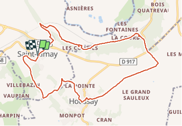
Trail Walking of 11.3 km to be discovered at Centre-Loire Valley, Loir-et-Cher, Saint-Rimay. This trail is proposed by guydu41.
Description
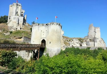
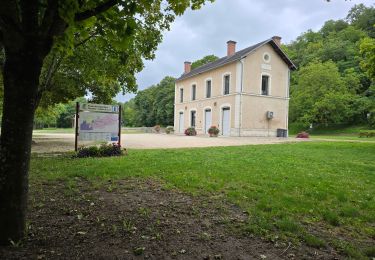
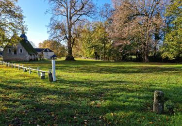
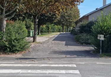
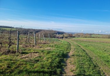
Ce circuit depuis le parking en face de la mairie de Saint-Rimay permet d'emprunter plusieurs petits sentiers boisés et tortueux à flancs de coteaux, de surplomber l'ancienne voie ferrée entrant dans un tunnel, de voir plusieurs blockhaus dont un très grand de la seconde guerre mondiale, d'admirer plusieurs points de vue sur des vallées, etc.
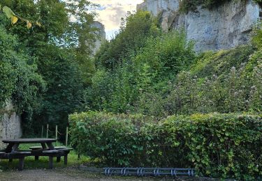
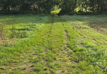
Positioning
Comments
Trails nearby
![Trail Walking - Lavardin - Vallée du Loir - 2015 08 22 - Photo](https://media.geolcdn.com/t/375/260/9217c5be-6f6a-4a6f-89e4-63f2df152ec7.jpg&format=jpg&maxdim=2)
![Walking Walking](https://static1.geolcdn.com/sitytour/trail-icons/101.png)
Walking
![](/images/other/stat-length.png)
![](https://static1.geolcdn.com/siteimages/upload/files/16400158638029165_repeat_loop_refresh_sync_direction_icon.png)
![Trail Walking - Lavardin - Chemin de la roue des Carriers - Photo](https://media.geolcdn.com/t/375/260/e44cda87-93d4-4d06-b6ec-b3c61a83f120.jpg&format=jpg&maxdim=2)
![Walking Walking](https://static1.geolcdn.com/sitytour/trail-icons/101.png)
Walking
![](/images/other/stat-length.png)
![](https://static1.geolcdn.com/siteimages/upload/files/16400158638029165_repeat_loop_refresh_sync_direction_icon.png)
![Trail Walking Villavard - Villavard - Bois et champs - Photo](https://media.geolcdn.com/t/375/260/4d475905-90ac-4961-b085-7edf726aaef9.jpg&format=jpg&maxdim=2)
![Walking Walking](https://static1.geolcdn.com/sitytour/trail-icons/101.png)
Walking
![](/images/other/stat-length.png)
![](https://static1.geolcdn.com/siteimages/upload/files/16400158638029165_repeat_loop_refresh_sync_direction_icon.png)
![Trail Walking Thoré-la-Rochette - Thoré-la-Rochette - Vallée et Coteaux du Loir - Photo](https://media.geolcdn.com/t/375/260/3f4c80d2-3437-4e69-84de-30a02f464543.jpg&format=jpg&maxdim=2)
![Walking Walking](https://static1.geolcdn.com/sitytour/trail-icons/101.png)
Walking
![](/images/other/stat-length.png)
![](https://static1.geolcdn.com/siteimages/upload/files/16400158638029165_repeat_loop_refresh_sync_direction_icon.png)
![Trail Walking Lunay - Château de la Mézière - Asnières - Photo](https://media.geolcdn.com/t/375/260/7020eb26-114b-4b8b-93d9-05c4bb72eb01.jpg&format=jpg&maxdim=2)
![Walking Walking](https://static1.geolcdn.com/sitytour/trail-icons/101.png)
Walking
![](/images/other/stat-length.png)
![](https://static1.geolcdn.com/siteimages/upload/files/16400158638029165_repeat_loop_refresh_sync_direction_icon.png)
![Trail Walking Houssay - Houssay - Photo](https://media.geolcdn.com/t/375/260/3bd1239e-bd99-41e7-b552-6fe8c8fd81df.jpg&format=jpg&maxdim=2)
![Walking Walking](https://static1.geolcdn.com/sitytour/trail-icons/101.png)
Walking
![](/images/other/stat-length.png)
![](https://static1.geolcdn.com/siteimages/upload/files/16400158638029165_repeat_loop_refresh_sync_direction_icon.png)
![Trail Walking Les Roches-l'Évêque - Les Roches-l'Evêque - Photo](https://media.geolcdn.com/t/375/260/dca20853-d794-4c8a-9c81-2319f41b2890.jpg&format=jpg&maxdim=2)
![Walking Walking](https://static1.geolcdn.com/sitytour/trail-icons/101.png)
Walking
![](/images/other/stat-length.png)
![](https://static1.geolcdn.com/siteimages/upload/files/16400158638029165_repeat_loop_refresh_sync_direction_icon.png)
![Trail Walking Thoré-la-Rochette - Thoré-la-Rochette - Vallée et Coteaux du Loir - Photo](https://media.geolcdn.com/t/375/260/344cfef8-5ffd-42a8-843d-f0a9586064a7.jpg&format=jpg&maxdim=2)
![Walking Walking](https://static1.geolcdn.com/sitytour/trail-icons/101.png)
Walking
![](/images/other/stat-length.png)
![](https://static1.geolcdn.com/siteimages/upload/files/16400158638029165_repeat_loop_refresh_sync_direction_icon.png)
![Trail Walking Houssay - Circuit Promenades et Randonnées (PR)](https://media.geolcdn.com/t/375/260/5ea570ff-f61f-453e-a15a-2af4ead43e67.jpg&format=jpg&maxdim=2)
![Walking Walking](https://static1.geolcdn.com/sitytour/trail-icons/101.png)
Walking
![](/images/other/stat-length.png)
![](https://static1.geolcdn.com/siteimages/upload/files/16400158638029165_repeat_loop_refresh_sync_direction_icon.png)