![](/images/other/stat-length.png)
![Trail Walking Clairefontaine-en-Yvelines - Clairefontaine - Photo](https://media.geolcdn.com/t/1900/400/f9ebf4ea-ca14-458b-9191-1e3f45b135cd.jpg&format=pjpeg&maxdim=2)
Clairefontaine
BMorin91470
User
![Length](/images/other/stat-length.png)
Length
12.1 km
![Max alt](https://static1.geolcdn.com/siteimages/upload/files/1508320355ic_sort_altitude_max_24dp.png)
Max alt
181 m
![Uphill gradient](https://static1.geolcdn.com/siteimages/upload/files/1508320355ic_sort_den_pos_24dp.png)
Uphill gradient
151 m
![Km-Effort](/images/other/stat-length.png)
Km-Effort
14.1 km
![Min alt](https://static1.geolcdn.com/siteimages/upload/files/1508320355ic_sort_altitude_min_24dp.png)
Min alt
126 m
![Downhill gradient](https://static1.geolcdn.com/siteimages/upload/files/1508320355ic_sort_den_neg_24dp.png)
Downhill gradient
151 m
![Boucle](https://static1.geolcdn.com/siteimages/upload/files/16400158638029165_repeat_loop_refresh_sync_direction_icon.png)
Boucle
Yes
Creation date :
2023-10-08 10:11:47.601
Updated on :
2024-10-09 07:35:02.61
![Walking](https://static1.geolcdn.com/sitytour/trail-icons/101.png)
3h11
Difficulty : Easy
![Scan this QR Code to open this trail in the SityTrail application](https://capi.geolives.com/qq0zvz2zws4bq2lad0pu/sitytour/trails/3832888/qr.png?size=200)
FREE GPS app for hiking
About
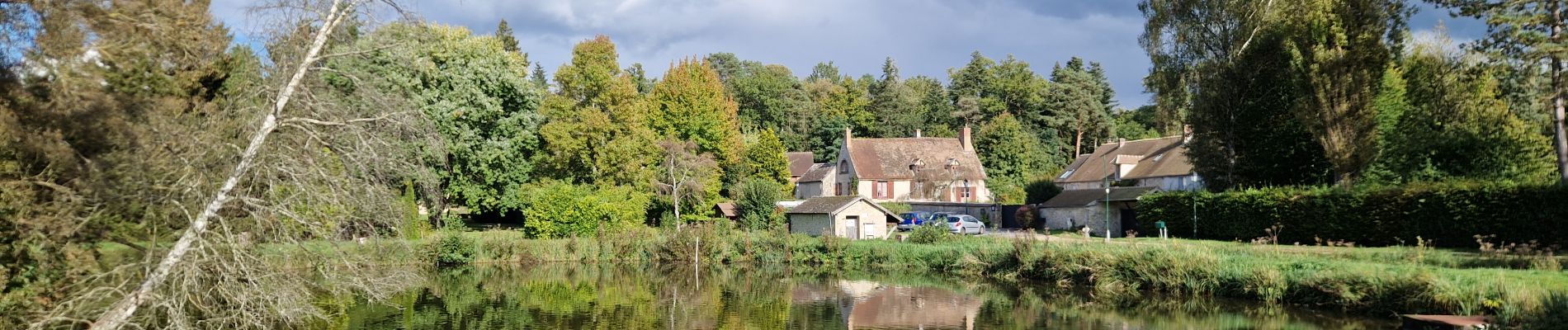
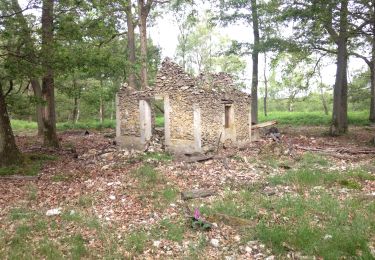
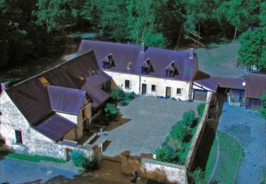
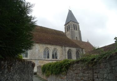
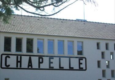
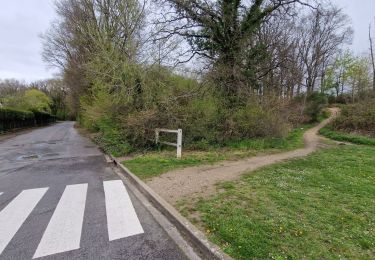
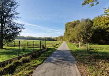
Trail Walking of 12.1 km to be discovered at Ile-de-France, Yvelines, Clairefontaine-en-Yvelines. This trail is proposed by BMorin91470.
Description
Randonnée facile et très agréable associant traversée de village, plaine et forêt, sur un circuit de 12 km autour de Clairefontaine (Yvelines) avec peu de dénivelé.
Rando réalisée le 28/09/2024
Positioning
Country:
France
Region :
Ile-de-France
Department/Province :
Yvelines
Municipality :
Clairefontaine-en-Yvelines
Location:
Unknown
Start:(Dec)
Start:(UTM)
419521 ; 5384990 (31U) N.
Comments
Trails nearby
![Trail Walking La Celle-les-Bordes - _Sensations originelles - Photo](https://media.geolcdn.com/t/375/260/ext.jpg?maxdim=2&url=https%3A%2F%2Fservices.sitytrail.com%2FGeolivesWS%2FDownloadMedia.ashx%3FTrailID%3D172073%26Media%3D62ffcccf-49cf-426b-af31-a3cdff83876e.JPG)
![Walking Walking](https://static1.geolcdn.com/sitytour/trail-icons/101.png)
_Sensations originelles
Walking
Medium
(8)
La Celle-les-Bordes,
Ile-de-France,
Yvelines,
France
![](/images/other/stat-length.png)
13.6 km | 16 km-effort
3h 30min
![](https://static1.geolcdn.com/siteimages/upload/files/16400158638029165_repeat_loop_refresh_sync_direction_icon.png)
Yes
![Trail Walking Clairefontaine-en-Yvelines - _Aux sources de la Rabette - Photo](https://media.geolcdn.com/t/375/260/ext.jpg?maxdim=2&url=https%3A%2F%2Fservices.sitytrail.com%2FGeolivesWS%2FDownloadMedia.ashx%3FTrailID%3D172067%26Media%3D8303e7f0-43e7-437e-9972-9962d4dcef0e.jpg)
![Walking Walking](https://static1.geolcdn.com/sitytour/trail-icons/101.png)
_Aux sources de la Rabette
Walking
Easy
(15)
Clairefontaine-en-Yvelines,
Ile-de-France,
Yvelines,
France
![](/images/other/stat-length.png)
7.2 km | 8.3 km-effort
1h 51min
![](https://static1.geolcdn.com/siteimages/upload/files/16400158638029165_repeat_loop_refresh_sync_direction_icon.png)
Yes
![Trail Walking La Celle-les-Bordes - _Animaux de la ferme et faune sauvage - Photo](https://media.geolcdn.com/t/375/260/ext.jpg?maxdim=2&url=https%3A%2F%2Fservices.sitytrail.com%2FGeolivesWS%2FDownloadMedia.ashx%3FTrailID%3D749987%26Media%3D2b4960e8-40f4-40d7-ba40-d1279ecfb88b.jpg)
![Walking Walking](https://static1.geolcdn.com/sitytour/trail-icons/101.png)
_Animaux de la ferme et faune sauvage
Walking
Medium
(1)
La Celle-les-Bordes,
Ile-de-France,
Yvelines,
France
![](/images/other/stat-length.png)
12.7 km | 13.5 km-effort
3h 0min
![](https://static1.geolcdn.com/siteimages/upload/files/16400158638029165_repeat_loop_refresh_sync_direction_icon.png)
Yes
![Trail Walking La Celle-les-Bordes - _Entre allées royales et pâtures - Photo](https://media.geolcdn.com/t/375/260/ext.jpg?maxdim=2&url=https%3A%2F%2Fservices.sitytrail.com%2FGeolivesWS%2FDownloadMedia.ashx%3FTrailID%3D751392%26Media%3D7991b926-f5be-4041-a4fe-180d615e51da.jpg)
![Walking Walking](https://static1.geolcdn.com/sitytour/trail-icons/101.png)
_Entre allées royales et pâtures
Walking
Easy
(2)
La Celle-les-Bordes,
Ile-de-France,
Yvelines,
France
![](/images/other/stat-length.png)
7.7 km | 9.5 km-effort
2h 0min
![](https://static1.geolcdn.com/siteimages/upload/files/16400158638029165_repeat_loop_refresh_sync_direction_icon.png)
Yes
![Trail Walking Sonchamp - _Sonchamp, entre ruelles, étang et forêt - Photo](https://media.geolcdn.com/t/375/260/ext.jpg?maxdim=2&url=https%3A%2F%2Fservices.sitytrail.com%2FGeolivesWS%2FDownloadMedia.ashx%3FTrailID%3D793359%26Media%3Da7fdaaed-ef91-44f6-b9b8-e931274307db.JPG)
![Walking Walking](https://static1.geolcdn.com/sitytour/trail-icons/101.png)
_Sonchamp, entre ruelles, étang et forêt
Walking
Medium
Sonchamp,
Ile-de-France,
Yvelines,
France
![](/images/other/stat-length.png)
8.9 km | 10.1 km-effort
2h 30min
![](https://static1.geolcdn.com/siteimages/upload/files/16400158638029165_repeat_loop_refresh_sync_direction_icon.png)
Yes
![Trail Walking Sonchamp - _La marlotterie - Photo](https://media.geolcdn.com/t/375/260/ext.jpg?maxdim=2&url=https%3A%2F%2Fservices.sitytrail.com%2FGeolivesWS%2FDownloadMedia.ashx%3FTrailID%3D780610%26Media%3D9a2ac7f9-d16a-44b5-b35a-b5d44d659c80.jpg)
![Walking Walking](https://static1.geolcdn.com/sitytour/trail-icons/101.png)
_La marlotterie
Walking
Easy
Sonchamp,
Ile-de-France,
Yvelines,
France
![](/images/other/stat-length.png)
5.9 km | 6.8 km-effort
1h 30min
![](https://static1.geolcdn.com/siteimages/upload/files/16400158638029165_repeat_loop_refresh_sync_direction_icon.png)
Yes
![Trail Walking Sonchamp - Sonchamps-Lorieux - Photo](https://media.geolcdn.com/t/375/260/ext.jpg?maxdim=2&url=https%3A%2F%2Fstatic1.geolcdn.com%2Fsiteimages%2Fupload%2Ffiles%2F1553511878bg_sport_marche.png)
![Walking Walking](https://static1.geolcdn.com/sitytour/trail-icons/101.png)
Sonchamps-Lorieux
Walking
Difficult
(1)
Sonchamp,
Ile-de-France,
Yvelines,
France
![](/images/other/stat-length.png)
11 km | 12.5 km-effort
2h 45min
![](https://static1.geolcdn.com/siteimages/upload/files/16400158638029165_repeat_loop_refresh_sync_direction_icon.png)
Yes
![Trail Walking Saint-Arnoult-en-Yvelines - Yvelines_Saint-Arnoult=>BoisDeRochefort=>Rochefort - Photo](https://media.geolcdn.com/t/375/260/4db7159e-1f12-446b-909c-36750ce5637d.jpg&format=jpg&maxdim=2)
![Walking Walking](https://static1.geolcdn.com/sitytour/trail-icons/101.png)
Yvelines_Saint-Arnoult=>BoisDeRochefort=>Rochefort
Walking
Easy
Saint-Arnoult-en-Yvelines,
Ile-de-France,
Yvelines,
France
![](/images/other/stat-length.png)
11.8 km | 14.2 km-effort
3h 13min
![](https://static1.geolcdn.com/siteimages/upload/files/16400158638029165_repeat_loop_refresh_sync_direction_icon.png)
Yes
![Trail Walking La Celle-les-Bordes - Yvelines_La-Celle-Les-Bordes=>Moutiers - Photo](https://media.geolcdn.com/t/375/260/00e30d76-b5ab-43c4-9465-175a5fa29736.jpg&format=jpg&maxdim=2)
![Walking Walking](https://static1.geolcdn.com/sitytour/trail-icons/101.png)
Yvelines_La-Celle-Les-Bordes=>Moutiers
Walking
Medium
La Celle-les-Bordes,
Ile-de-France,
Yvelines,
France
![](/images/other/stat-length.png)
12.4 km | 14.7 km-effort
3h 27min
![](https://static1.geolcdn.com/siteimages/upload/files/16400158638029165_repeat_loop_refresh_sync_direction_icon.png)
Yes